Country:
Region:
City:
Latitude and Longitude:
Time Zone:
Postal Code:
IP information under different IP Channel
ip-api
Country
Region
City
ASN
Time Zone
ISP
Blacklist
Proxy
Latitude
Longitude
Postal
Route
Luminati
Country
Region
lsu
City
saurimo
ASN
Time Zone
Africa/Luanda
ISP
UNITEL
Latitude
Longitude
Postal
IPinfo
Country
Region
City
ASN
Time Zone
ISP
Blacklist
Proxy
Latitude
Longitude
Postal
Route
db-ip
Country
Region
City
ASN
Time Zone
ISP
Blacklist
Proxy
Latitude
Longitude
Postal
Route
ipdata
Country
Region
City
ASN
Time Zone
ISP
Blacklist
Proxy
Latitude
Longitude
Postal
Route
Popular places and events near this IP address

Cuíto
Municipality in Bié Province, Angola
Distance: Approx. 5 meters
Latitude and longitude: -12.38333333,16.93333333
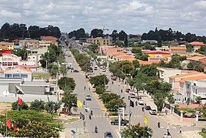
Cuíto, formerly known as Silva Porto, is a city and municipality in central Angola, capital of Bié Province. The municipality had a population of 450,881 in 2014. Projected to be the tenth fastest growing city on the African continent between 2020 and 2025, with a 5.56% growth.
Kunje
Commune and town in Bié, Angola
Distance: Approx. 4923 meters
Latitude and longitude: -12.34,16.9425
Kunje is a town and commune in the municipality of Kuito, province of Bié, Angola. It is the home town of UNITA President Isaías Samakuva. It is also home to a considerable amount of unexploded land mines.
Roman Catholic Diocese of Kwito-Bié
Roman Catholic diocese in Angola
Distance: Approx. 1180 meters
Latitude and longitude: -12.3843,16.9441
The Roman Catholic Diocese of Kwito-Bié (Latin: Dioecesis Kvitobiensis) is a diocese located in Bié Province in the ecclesiastical province of Huambo in Angola. The cathedral is located in the city of Cuito.
Joaquim Kapango Airport
Airport in Angola
Distance: Approx. 2858 meters
Latitude and longitude: -12.40416667,16.94861111
Joaquim Kapango Airport (Portuguese: Aeroporto Joaquim Kapango) (IATA: SVP, ICAO: FNKU), or Cuíto Airport, is an airport serving Cuíto (known as Silva Porto before 1975), a city in the Bié Province in Angola. The Joaquim Kapango non-directional beacon (Ident: KU) is located on the field.
Estádio dos Eucaliptos (Angola)
Football stadium in Cuíto, Angola
Distance: Approx. 1541 meters
Latitude and longitude: -12.396815,16.936354
Estádio dos Eucaliptos is a football stadium in Cuíto, Angola.
Weather in this IP's area
overcast clouds
18 Celsius
18 Celsius
18 Celsius
18 Celsius
1012 hPa
80 %
1012 hPa
831 hPa
10000 meters
2.59 m/s
4.43 m/s
351 degree
100 %
05:16:24
17:58:27