Country:
Region:
City:
Latitude and Longitude:
Time Zone:
Postal Code:
IP information under different IP Channel
ip-api
Country
Region
City
ASN
Time Zone
ISP
Blacklist
Proxy
Latitude
Longitude
Postal
Route
Luminati
Country
Region
uig
City
uige
ASN
Time Zone
Africa/Luanda
ISP
UNITEL
Latitude
Longitude
Postal
IPinfo
Country
Region
City
ASN
Time Zone
ISP
Blacklist
Proxy
Latitude
Longitude
Postal
Route
db-ip
Country
Region
City
ASN
Time Zone
ISP
Blacklist
Proxy
Latitude
Longitude
Postal
Route
ipdata
Country
Region
City
ASN
Time Zone
ISP
Blacklist
Proxy
Latitude
Longitude
Postal
Route
Popular places and events near this IP address

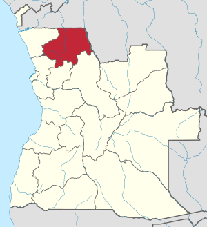
Uíge Province
Province of Angola
Distance: Approx. 1108 meters
Latitude and longitude: -7.61666667,15.05
Uíge (pronunciation: ; Kongo: Wizidi) is one of the eighteen Provinces of Angola, located in the northwestern part of the country. Its capital city is of the same name.
Uíge
Municipality and town in Uíge Province, Angola
Distance: Approx. 1108 meters
Latitude and longitude: -7.61666667,15.05
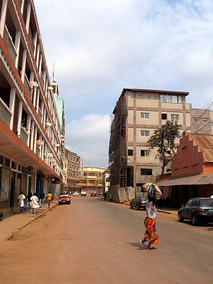
Uíge (Kongo: Wizidi), formerly Carmona, is a provincial capital city in northwestern Angola, with a population of 322,531 (2014 census), and a municipality, with a population of 519,196 (2014 census), located in the province of the same name. It grew from a small market centre in 1945 to become a city in 1956. It is serviced by the Uíge Airport with daily flights to Luanda.

Roman Catholic Diocese of Uíje
Roman Catholic diocese in Angola
Distance: Approx. 898 meters
Latitude and longitude: -7.6122,15.052
The Roman Catholic Diocese of Uíje (Latin: Dioecesis Uiiensis) is a diocese located in the ecclesiastical province of Malanje in Angola.
Quitexe
Municipality & Town in Uíge, Angola
Distance: Approx. 1108 meters
Latitude and longitude: -7.61666667,15.05
Quitexe is a town and municipality in Uíge Province in Angola. The municipality had a population of 34,297 in 2014.
Uíge Airport
Airport in Uíge, Angola
Distance: Approx. 3767 meters
Latitude and longitude: -7.60277778,15.02777778
Uíge/Carmona Airport (IATA: UGO, ICAO: FNUG) is a public use airport on the west side of Uíge, the capital of Uíge Province in Angola. The runway additionally has a 65 metres (213 ft) displaced threshold on each end. The Uíge non-directional beacon (Ident: UG) is located 2.2 nautical miles south of the runway.
Estádio 4 de Janeiro
Football stadium in Uíge, Angola
Distance: Approx. 13 meters
Latitude and longitude: -7.614432,15.059897
Estádio 4 de Janeiro is a football stadium in Uíge, Angola.
Weather in this IP's area
light rain
19 Celsius
20 Celsius
19 Celsius
19 Celsius
1011 hPa
99 %
1011 hPa
918 hPa
9680 meters
0.55 m/s
2.28 m/s
170 degree
100 %
05:30:46
17:59:04
