104.36.245.93 - IP Lookup: Free IP Address Lookup, Postal Code Lookup, IP Location Lookup, IP ASN, Public IP
Country:
Region:
City:
Location:
Time Zone:
Postal Code:
ISP:
ASN:
language:
User-Agent:
Proxy IP:
Blacklist:
IP information under different IP Channel
ip-api
Country
Region
City
ASN
Time Zone
ISP
Blacklist
Proxy
Latitude
Longitude
Postal
Route
db-ip
Country
Region
City
ASN
Time Zone
ISP
Blacklist
Proxy
Latitude
Longitude
Postal
Route
IPinfo
Country
Region
City
ASN
Time Zone
ISP
Blacklist
Proxy
Latitude
Longitude
Postal
Route
IP2Location
104.36.245.93Country
Region
washington
City
lynden
Time Zone
America/Los_Angeles
ISP
Language
User-Agent
Latitude
Longitude
Postal
ipdata
Country
Region
City
ASN
Time Zone
ISP
Blacklist
Proxy
Latitude
Longitude
Postal
Route
Popular places and events near this IP address

Everson, Washington
City in Washington, United States
Distance: Approx. 8394 meters
Latitude and longitude: 48.9175,-122.34888889
Everson is a city in Whatcom County, Washington, United States. The population was 2,888 at the time of the 2020 census. It is the fifth Largest city within the Bellingham Metropolitan Area.

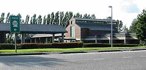
Lynden, Washington
City in Washington, United States
Distance: Approx. 670 meters
Latitude and longitude: 48.94666667,-122.45694444
Lynden is a city in Whatcom County, Washington, United States. It is located 15 miles (24 km) north of Bellingham, the county seat and principal city of the Bellingham Metropolitan Area. It is the second largest city in Whatcom County.

Northwest Washington Fair
Annual fair in Lynden, Washington, U.S.
Distance: Approx. 1436 meters
Latitude and longitude: 48.93718056,-122.47699167
The Northwest Washington Fair is an annual county fair in Whatcom County, Washington, United States. The six-day August event has been held in Lynden since 1909 and draws approximately 200,000 visitors. The fair includes animal exhibits, agricultural displays, a carnival, and food vendors.

Lynden Christian Schools
Private school in the United States
Distance: Approx. 1374 meters
Latitude and longitude: 48.94972222,-122.44527778
Lynden Christian School (abbreviated LCS), often referred to as Lynden Christian (LC), is a non-denominational private Christian school. The school educates 1,300 students in Lynden, Washington, United States.
Lynden High School
Public secondary school in Lynden, Washington, United States
Distance: Approx. 2511 meters
Latitude and longitude: 48.95194444,-122.42833333
Lynden High School (LHS) is a public high school in Lynden, Washington, United States. Lynden High School serves students in grades 9-12 for the Lynden School District.
National Processed Raspberry Council
U.S. agricultural organization
Distance: Approx. 1202 meters
Latitude and longitude: 48.939441,-122.474427
The National Processed Raspberry Council is a U.S. organization that promotes and researches processed raspberries. It is part of a commodity checkoff program overseen by the U.S. Department of Agriculture.

Lynden–Aldergrove Border Crossing
Border crossing between Canada and the United States
Distance: Approx. 7130 meters
Latitude and longitude: 49.00227,-122.484984
The Lynden–Aldergrove Border Crossing connects the town of Lynden, Washington and Aldergrove, British Columbia on the Canada–US border. Washington State Route 539 on the American side joins British Columbia Highway 13 on the Canadian side.

0 Avenue
Road in British Columbia, Canada
Distance: Approx. 7308 meters
Latitude and longitude: 49.002312,-122.492623
0 Avenue (Zero Avenue) is a road in the Lower Mainland, British Columbia, running beside the Canada–United States border from Surrey to Abbotsford. The road runs parallel to the physical border between the two countries. The road begins near the Peace Arch Border Crossing, and continues eastward for 28.9 kilometres (18.0 mi), with gaps around the Pacific Highway and Lynden–Aldergrove Border Crossings.
Bertrand Creek
Stream in British Columbia, Canada
Distance: Approx. 6439 meters
Latitude and longitude: 48.91222222,-122.53472222
Bertrand Creek is a stream in the U.S. state of Washington and the Canadian province of British Columbia. Bertrand Creek is 9.8 miles long and drains into the Nooksack River 3 miles south of Lynden. This cross-border stream is the largest lowland tributary of the Nooksack River.
Greenwood, Washington
Unincorporated community in Washington, US
Distance: Approx. 3210 meters
Latitude and longitude: 48.91388889,-122.44194444
Greenwood is an unincorporated community in Whatcom County, in the U.S. state of Washington.
Wiser Lake
Lake in Whatcom County, Washington
Distance: Approx. 4451 meters
Latitude and longitude: 48.9036957,-122.481156
Wiser Lake is a lake in the U.S. state of Washington. It is split in two halves by State Route 539 (the Guide Meridian). Wiser Lake bears the name of Jack Wiser, a pioneer who settled there.

Berthusen Barn and Privy
United States historic place
Distance: Approx. 4283 meters
Latitude and longitude: 48.96194444,-122.50694444
Berthusen Barn and Privy, also called simply Berthusen Barn, is a historical structure located at the 236 acre Berthusen Park in Lynden, Washington. It was built using wood from the area by Hans Christian Berthusen, who was a pioneer resident of Whatcom County, and Jack Jensen. It was completed in 1901.
Weather in this IP's area
snow
-1 Celsius
-6 Celsius
-2 Celsius
1 Celsius
1019 hPa
60 %
1019 hPa
1011 hPa
10000 meters
4.63 m/s
30 degree
75 %