Country:
Region:
City:
Latitude and Longitude:
Time Zone:
Postal Code:
IP information under different IP Channel
ip-api
Country
Region
City
ASN
Time Zone
ISP
Blacklist
Proxy
Latitude
Longitude
Postal
Route
Luminati
Country
ASN
Time Zone
America/Chicago
ISP
AMAZON-AES
Latitude
Longitude
Postal
IPinfo
Country
Region
City
ASN
Time Zone
ISP
Blacklist
Proxy
Latitude
Longitude
Postal
Route
db-ip
Country
Region
City
ASN
Time Zone
ISP
Blacklist
Proxy
Latitude
Longitude
Postal
Route
ipdata
Country
Region
City
ASN
Time Zone
ISP
Blacklist
Proxy
Latitude
Longitude
Postal
Route
Popular places and events near this IP address

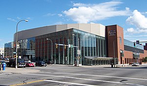
Blue Cross Arena
Multi-purpose indoor arena in Rochester, New York, U.S.
Distance: Approx. 157 meters
Latitude and longitude: 43.15369444,-77.61077778
Blue Cross Arena, also known as the War Memorial, is a multi-purpose indoor arena located in Rochester, New York. For hockey and lacrosse, its seating capacity is 10,662. The arena opened on October 18, 1955, as the Rochester Community War Memorial.

First Federal Plaza
Office, Revolving restaurant (before 1990) in Rochester, NY
Distance: Approx. 176 meters
Latitude and longitude: 43.1565,-77.6116
First Federal Plaza is a high-rise building located in Rochester, New York. It is the fifth tallest building in Rochester, standing at 309 feet (94 meters) with 21 floors. It was completed in 1976.

Times Square Building (Rochester)
Office, Citizens Bank in NY, USA
Distance: Approx. 165 meters
Latitude and longitude: 43.15465,-77.61253
The Times Square Building is an Art Deco skyscraper designed by Ralph Thomas Walker of the firm Voorhees, Gmelin, and Walker located in Rochester, New York, United States. At 260 feet (79 m), it is the eighth-tallest building in Rochester, with 14 floors. The former Genesee Valley Trust Building is a streamlined twelve-story building supporting four aluminum wings 42 feet (13 m) high, known as the "Wings of Progress", each weighing 12,000 pounds (5,400 kg).

Main Street Bridge (Rochester, New York)
United States historic place
Distance: Approx. 114 meters
Latitude and longitude: 43.15611111,-77.61083333
Main Street Bridge is a historic stone arch bridge located at Rochester in Monroe County, New York. It was constructed in 1857 and spans the Genesee River. It has five segmental arches with spans of 30 to 42 feet (9.1 to 12.8 m) and rises of 8–11.5 feet (2.4–3.5 m).

Broad Street Bridge (Rochester, New York)
United States historic place
Distance: Approx. 83 meters
Latitude and longitude: 43.15472222,-77.60972222
Erie Canal: Second Genesee Aqueduct, also known as the Broad Street Aqueduct or Broad Street Bridge, is a historic stone aqueduct located at Rochester in Monroe County, New York. It was constructed in 1836–1842 and originally carried the Erie Canal over the Genesee River. The overall length of the aqueduct including the wings and abutments is 800 feet (240 m).

Wilder Building
Historic commercial building in New York, United States
Distance: Approx. 133 meters
Latitude and longitude: 43.15527778,-77.61222222
Wilder Building is a historic office building located in Rochester, New York. It is an eleven-story steel or iron framed brick clad structure built between 1887 and 1888 in a modified Romanesque style. It is considered Rochester's first modern skyscraper, and is considered to be among the oldest of the early skyscrapers.

Reynolds Arcade
Historic commercial building in New York, United States
Distance: Approx. 155 meters
Latitude and longitude: 43.15583333,-77.61222222
Reynolds Arcade is an office building located in Rochester in Monroe County, New York.

Talman Building
Historic building in Rochester, NY
Distance: Approx. 126 meters
Latitude and longitude: 43.1558798,-77.6117288
The Talman Building is a historic site at 25 E. Main Street, Rochester, New York, used as an office by Frederick Douglass in editing and publishing the abolitionist journal, The North Star from 1847 to 1863. It was also a stop on the Underground Railroad, and Douglass gave asylum to many traveling fugitives, of which at least one party was led by Harriet Tubman. It is named the Talman Building (also listed as the Talman Hall) after John T. Talman purchased the plot in 1839.
Elwood Building
Building in New York, US
Distance: Approx. 185 meters
Latitude and longitude: 43.156025,-77.612497
The Elwood Building was built in 1879 for a Rochester lawyer Frank W. Elwood, whose family owned the property. The Elwood Building was the first building to have a mail chute, which was installed in 1884 by James Goold Cutler, the inventor of the mail chute.

City Hall station (Rochester)
Distance: Approx. 171 meters
Latitude and longitude: 43.15444444,-77.6125
City Hall is a former Rochester Industrial and Rapid Transit Railway station located in Rochester, New York. It was closed in 1956 along with the rest of the line. The station was in the former Erie Canal tunnel under West Broad Street in front of City Hall and the Times Square Building.

Central Trust Bank Building
Historic commercial building in New York, United States
Distance: Approx. 87 meters
Latitude and longitude: 43.155,-77.61166667
Central Trust Bank Building is a historic bank building located in downtown Rochester, Monroe County, New York. It was built in 1959, and is a five-story, International Style building with a flat roof. It features a continuous metal and glass curtain wall on the south facade.

Reynolds Arcade (1829–1932)
Commercial building in Rochester, New York, 1829–1932
Distance: Approx. 180 meters
Latitude and longitude: 43.15625,-77.61216
The Reynolds Arcade (1829–1932) was a commercial building constructed by Abelard Reynolds in 1829 on Buffalo Street (now Main Street) in Rochester, New York. According to Joseph W. Barnes, a Rochester City Historian, it was, "the center of Rochester downtown life for more than a century." After it was demolished, an office building with the same name was constructed on the same site. Built of brick, it was four-and-a-half stories tall and almost 100 feet wide.
Weather in this IP's area
overcast clouds
7 Celsius
5 Celsius
6 Celsius
8 Celsius
1017 hPa
61 %
1017 hPa
998 hPa
10000 meters
4.63 m/s
150 degree
100 %
07:02:41
16:47:27