104.36.120.211 - IP Lookup: Free IP Address Lookup, Postal Code Lookup, IP Location Lookup, IP ASN, Public IP
Country:
Region:
City:
Location:
Time Zone:
Postal Code:
IP information under different IP Channel
ip-api
Country
Region
City
ASN
Time Zone
ISP
Blacklist
Proxy
Latitude
Longitude
Postal
Route
Luminati
Country
Region
tx
City
libertyhill
ASN
Time Zone
America/Chicago
ISP
HURRICANE
Latitude
Longitude
Postal
IPinfo
Country
Region
City
ASN
Time Zone
ISP
Blacklist
Proxy
Latitude
Longitude
Postal
Route
IP2Location
104.36.120.211Country
Region
texas
City
pflugerville
Time Zone
America/Chicago
ISP
Language
User-Agent
Latitude
Longitude
Postal
db-ip
Country
Region
City
ASN
Time Zone
ISP
Blacklist
Proxy
Latitude
Longitude
Postal
Route
ipdata
Country
Region
City
ASN
Time Zone
ISP
Blacklist
Proxy
Latitude
Longitude
Postal
Route
Popular places and events near this IP address
Wells Branch, Texas
CDP in Texas, United States
Distance: Approx. 5621 meters
Latitude and longitude: 30.44388889,-97.67833333
Wells Branch is a census-designated place (CDP) in Travis County, Texas, United States. The population was 14,000 at the 2020 census.

Windemere, Texas
Former CDP in Texas, United States
Distance: Approx. 4411 meters
Latitude and longitude: 30.45805556,-97.66055556
Windermere is a former census-designated place (CDP) in Travis County, Texas, United States. The population was 1,037 at the 2010 census. It has since largely been annexed by the city of Pflugerville.

Pflugerville, Texas
City in Texas, United States
Distance: Approx. 2783 meters
Latitude and longitude: 30.4575,-97.64
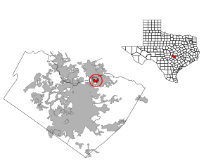
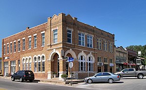
Pflugerville ( FLOO-gər-vil) is a city in Travis County, Texas, United States, with a small portion in Williamson County. The population was 65,191 at the 2020 census. Pflugerville is a suburb of Austin and part of the Austin–Round Rock– Metropolitan Statistical Area.
Cedar Ridge High School (Texas)
Public high school in Round Rock, Texas, United States
Distance: Approx. 6223 meters
Latitude and longitude: 30.4925,-97.64027778
Cedar Ridge High School is a public secondary school in Round Rock, Texas, United States. The school opened for the 2010-2011 school year with grades nine and ten. Grade eleven was added in 2011-2012, and grade twelve in 2012-2013.
Hendrickson High School
School in Pflugerville, Travis, Texas, United States
Distance: Approx. 4160 meters
Latitude and longitude: 30.4647,-97.5881
Hendrickson High School is a high school in the city of Pflugerville, Travis County, Texas, United States. It is operated by the Pflugerville Independent School District and is named after Pflugerville educator and civil servant Robert E. Hendrickson.

Pflugerville High School
Public high school in Pflugerville, Texas, United States
Distance: Approx. 1322 meters
Latitude and longitude: 30.4443,-97.63255
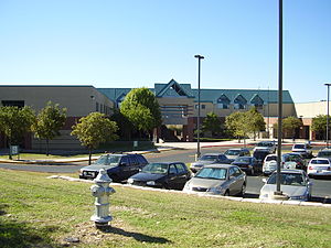
Pflugerville High School is a public high school located in Pflugerville, Texas. In 2017, the school was a Top-10 Finalist in Reader's Digest Nicest Places in America contest.
Cook-Walden Capital Parks Cemetery
Cemetery in Travis County, Texas
Distance: Approx. 4423 meters
Latitude and longitude: 30.437,-97.666
Cook-Walden Capital Parks Cemetery (also known as Capital Memorial Park and Capital Memorial Park Cemetery) is a cemetery located in Pflugerville, Texas, United States a suburb of Austin, Texas.
John B. Connally High School
Public high school in Austin, Texas, United States
Distance: Approx. 5879 meters
Latitude and longitude: 30.4188,-97.6764
John B. Connally High School is a public secondary school in Austin, Texas, United States. The school, which opened in 1996, serves 9-12 and is part of the Pflugerville Independent School District.

Lake Pflugerville
Reservoir in Pflugerville, Texas
Distance: Approx. 4687 meters
Latitude and longitude: 30.439,-97.57116667
Lake Pflugerville is a reservoir in Pflugerville, Texas in the United States. Construction of the 180-acre reservoir began in 2005 and was completed in 2006. Pumps are used to flow water through a 16-mile pipeline to the reservoir from the lower Colorado River.

Austin Executive Airport
Airport in Travis County, Texas, United States of America
Distance: Approx. 6266 meters
Latitude and longitude: 30.3999,-97.5735
Austin Executive Airport (ICAO: KEDC, FAA LID: EDC) is a public-use airport in Travis County, 14 miles northeast of Austin, immediately southeast of Pflugerville and north of Manor. It was known as Bird's Nest Airport (FAA: 6R4) until 2011. Many U.S. airports use the same three-letter location identifier for the FAA and IATA, but this facility is EDC to the FAA and has no IATA code.
Dessau, Texas
Unincorporated community in Texas, United States
Distance: Approx. 4355 meters
Latitude and longitude: 30.40361111,-97.63833333
Dessau is an unincorporated community in Travis County, in the U.S. state of Texas. It is located within the Greater Austin metropolitan area.
Three Points, Texas
Unincorporated community in Texas, United States
Distance: Approx. 4276 meters
Latitude and longitude: 30.45166667,-97.66222222
Three Points is an unincorporated community in Travis County, in the U.S. state of Texas. It is located within the Greater Austin metropolitan area.
Weather in this IP's area
clear sky
14 Celsius
13 Celsius
13 Celsius
16 Celsius
1026 hPa
55 %
1026 hPa
1002 hPa
10000 meters
0.45 m/s
1.34 m/s
190 degree
