104.255.174.94 - IP Lookup: Free IP Address Lookup, Postal Code Lookup, IP Location Lookup, IP ASN, Public IP
Country:
Region:
City:
Location:
Time Zone:
Postal Code:
IP information under different IP Channel
ip-api
Country
Region
City
ASN
Time Zone
ISP
Blacklist
Proxy
Latitude
Longitude
Postal
Route
Luminati
Country
Region
or
City
bend
ASN
Time Zone
America/Los_Angeles
ISP
H4Y-TECHNOLOGIES
Latitude
Longitude
Postal
IPinfo
Country
Region
City
ASN
Time Zone
ISP
Blacklist
Proxy
Latitude
Longitude
Postal
Route
IP2Location
104.255.174.94Country
Region
florida
City
melbourne
Time Zone
America/New_York
ISP
Language
User-Agent
Latitude
Longitude
Postal
db-ip
Country
Region
City
ASN
Time Zone
ISP
Blacklist
Proxy
Latitude
Longitude
Postal
Route
ipdata
Country
Region
City
ASN
Time Zone
ISP
Blacklist
Proxy
Latitude
Longitude
Postal
Route
Popular places and events near this IP address

Indian Harbour Beach, Florida
City in Florida
Distance: Approx. 2368 meters
Latitude and longitude: 28.15194444,-80.595
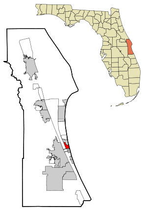
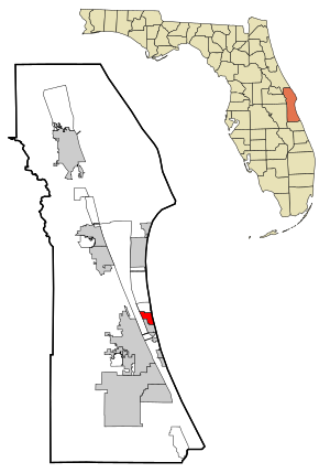
Indian Harbour Beach is a coastal city in Brevard County, Florida, United States. It is part of the Palm Bay–Melbourne–Titusville, Florida Metropolitan Statistical Area. The population was 9,019 at the 2020 census, up from 8,225 at the 2010 census.

Satellite Beach, Florida
City in Florida, U.S.
Distance: Approx. 174 meters
Latitude and longitude: 28.17333333,-80.59666667
Satellite Beach is a coastal city in Brevard County, Florida, U.S. The population was 11,226 at the 2020 United States Census, up from 10,109 at the 2010 census, and it is located with the Atlantic Ocean to the east and the Banana River to the west. Satellite Beach is part of the Palm Bay–Melbourne–Titusville, Florida Metropolitan Statistical Area.

South Patrick Shores, Florida
CDP in Florida, United States
Distance: Approx. 3328 meters
Latitude and longitude: 28.2025,-80.60388889
South Patrick Shores is a census-designated place (CDP) in Brevard County, Florida, United States. The population was 6,496 at the 2020 census, up from 5,875 at the 2010 census. It is part of the Palm Bay–Melbourne–Titusville, Florida Metropolitan Statistical Area.

Eau Gallie Causeway
Bridge in Florida, United States of America
Distance: Approx. 4875 meters
Latitude and longitude: 28.13277778,-80.61805556
The Eau Gallie Causeway connects Eau Gallie, Florida (which merged with Melbourne in 1969), with SR A1A near Indian Harbour Beach, across the Indian River Lagoon. Located entirely within the Melbourne city limits, the causeway consists of a main bridge crossing over the Intracoastal Waterway and a relief bridge. The bridge is a key link in SR 518, Eau Gallie Boulevard, of which the causeway is a part.

Mathers Bridge
Bridge in Florida, United States of America
Distance: Approx. 2759 meters
Latitude and longitude: 28.14916667,-80.60611111
Mathers Bridge is a 700-foot-long (210 m) low-level swing bridge located on the southern tip of Merritt Island, Florida, crossing the Banana River at the end of County Road 3.
Merritt Island Dragon
Distance: Approx. 3467 meters
Latitude and longitude: 28.14221389,-80.60377778
The Merritt Island Dragon or Merrit Island River Dragon was a dragon-shaped green concrete structure that stood at the southern tip of Merritt Island, Florida, known as Dragon Point, where the Indian River Lagoon splits to form the Banana River Lagoon. The dragon was built in 1971 by Florida artist Lewis VanDercar and property owner Aynn Christal. In 1981, the statue was expanded for new property owner Warren McFadden, with the addition of a tail, an extended neck, two cavepeople a caveman named Fred and a cavewoman named Wilma and four hatchling dragons named Joy, Sunshine, Charity, and Freedom.
Holy Apostles Episcopal Church (Satellite Beach, Florida)
Church
Distance: Approx. 1072 meters
Latitude and longitude: 28.18143,-80.603682
Holy Apostles Episcopal Church, is an historic Carpenter Gothic church building now located at 505 Grant Avenue in Satellite Beach, Florida in the United States. It was built in 1902 some 100 kilometers to the south in Fort Pierce to serve St. Andrew's Episcopal Church, which it did until March 25, 1959, when St.
Holy Name of Jesus Catholic Church (Indialantic, Florida)
Church in Florida, United States
Distance: Approx. 4634 meters
Latitude and longitude: 28.13416667,-80.58138889
Holy Name of Jesus Catholic Church is a Roman Catholic parish located in Indialantic, Florida. It is under the jurisdiction of the Diocese of Orlando. Its name is often shortened to "Holy Name" in conversation and "HNJ" in informal writing.

Eau Gallie Yacht Club
Distance: Approx. 3170 meters
Latitude and longitude: 28.14462222,-80.6011
The Eau Gallie Yacht Club is a U.S. boating organization, located in Indian Harbour Beach, Florida with access to the Indian River. The original clubhouse is also a historic building. The club has 1,200 members.
Satellite High School
Public high school in Satellite Beach, Florida, United States
Distance: Approx. 1437 meters
Latitude and longitude: 28.1858453,-80.5969964
Satellite High School is a public high school (grades 9 - 12) located in Satellite Beach, Florida in Florida's Space Coast, Brevard County. It was founded in 1962, and has been rated an 'A' school in the state of Florida since 2003 . The mascot is the Scorpion.
Innovative Routines International
American software company
Distance: Approx. 3779 meters
Latitude and longitude: 28.1422,-80.5822
Innovative Routines International (IRI), Inc. is an American software company first known for bringing mainframe sort merge functionality into open systems. IRI was the first vendor to develop a commercial replacement for the Unix sort command, and combine data transformation and reporting in Unix batch processing environments.
South Beaches
Distance: Approx. 4044 meters
Latitude and longitude: 28.1374,-80.5902
South Beaches is an unofficial area in Brevard County, Florida, United States. It includes cities, towns and unincorporated area on the barrier island south of Patrick Space Force Base. The cities and towns include: South Patrick Shores, Satellite Beach, Indian Harbour Beach, Indialantic and Melbourne Beach, and the city of Melbourne.
Weather in this IP's area
clear sky
18 Celsius
17 Celsius
16 Celsius
19 Celsius
1019 hPa
48 %
1019 hPa
1019 hPa
10000 meters
3.09 m/s
10 degree