104.252.160.17 - IP Lookup: Free IP Address Lookup, Postal Code Lookup, IP Location Lookup, IP ASN, Public IP
Country:
Region:
City:
Location:
Time Zone:
Postal Code:
ISP:
ASN:
language:
User-Agent:
Proxy IP:
Blacklist:
IP information under different IP Channel
ip-api
Country
Region
City
ASN
Time Zone
ISP
Blacklist
Proxy
Latitude
Longitude
Postal
Route
db-ip
Country
Region
City
ASN
Time Zone
ISP
Blacklist
Proxy
Latitude
Longitude
Postal
Route
IPinfo
Country
Region
City
ASN
Time Zone
ISP
Blacklist
Proxy
Latitude
Longitude
Postal
Route
IP2Location
104.252.160.17Country
Region
california
City
san gabriel
Time Zone
America/Los_Angeles
ISP
Language
User-Agent
Latitude
Longitude
Postal
ipdata
Country
Region
City
ASN
Time Zone
ISP
Blacklist
Proxy
Latitude
Longitude
Postal
Route
Popular places and events near this IP address
Mission San Gabriel Arcángel
18th-century Spanish mission in California
Distance: Approx. 102 meters
Latitude and longitude: 34.09666667,-118.10666667
Mission San Gabriel Arcángel (Spanish: Misión de San Gabriel Arcángel) is a Californian mission and historic landmark in San Gabriel, California. It was founded by the Spanish Empire on "The Feast of the Birth of Mary," September 8, 1771, as the fourth of what would become twenty-one Spanish missions in California. San Gabriel Arcángel was named after the Archangel Gabriel and often referred to as the "Godmother of the Pueblo of Los Angeles." The mission was designed by Antonio Cruzado, who gave the building its capped buttresses and the tall narrow windows, which are unique among the missions of the California chain.

San Gabriel, California
City in California, United States
Distance: Approx. 936 meters
Latitude and longitude: 34.10281667,-118.09969167
San Gabriel (Spanish for "St. Gabriel") is a city located in the San Gabriel Valley of Los Angeles County, California. At the 2010 census, the population was 39,718.
San Gabriel High School
Public high school in San Gabriel, California, United States
Distance: Approx. 521 meters
Latitude and longitude: 34.0927,-118.10968
San Gabriel High School (SGHS) is a public high school located in Los Angeles County, California and operated by the Alhambra Unified School District. It is almost entirely in the city limits of Alhambra, with a small portion and the school's address in the city limits of San Gabriel. It traditionally served students residing in San Gabriel although the balance was shifted in 1994 when San Gabriel Unified School District separated itself from Alhambra Unified.
San Gabriel Unified School District
School district in California
Distance: Approx. 186 meters
Latitude and longitude: 34.0976,-118.1049
San Gabriel Unified School District, also known as SGUSD, is a public school district that serves the community of San Gabriel, California. It is located in the San Gabriel Valley area. SGUSD separated itself from the Alhambra Unified School District.
San Gabriel Mission High School
Private school in San Gabriel, , California, United States
Distance: Approx. 344 meters
Latitude and longitude: 34.09899167,-118.10713056
San Gabriel Mission High School is an all-girls Catholic College Preparatory high school located on the grounds of the fourth mission of California, which was founded in 1771 by Franciscan priests and often used by Junipero Serra as his headquarters. It is located in the Roman Catholic Archdiocese of Los Angeles.
Shevaanga
Former settlement in California, United States
Distance: Approx. 221 meters
Latitude and longitude: 34.09722222,-118.10777778
Shevaanga or Sibagna (or Sibanga) is a former Tongva village located at the area of what would become San Gabriel, California. It was closely situated to the village of Toviscanga. It lay at an elevation of 430 feet (131 m).

Toviscanga
Former Tongva village located at Mission San Gabriel
Distance: Approx. 201 meters
Latitude and longitude: 34.0977,-118.1068
Toviscanga was a former Tongva village now located at Mission San Gabriel Arcángel in San Gabriel, California. Alternative spellings for the village include Tobiscanga. The name of Tuvasak was the Payómkawichum name for the village.
AHMC Healthcare
Hospital corporation in California
Distance: Approx. 1491 meters
Latitude and longitude: 34.0974,-118.1219
AHMC Healthcare Inc. is a for-profit privately held hospital corporation based in the Greater San Gabriel Valley of California. Dr.

San Gabriel Mission Playhouse
Theater and movie theater in San Gabriel, California, United States
Distance: Approx. 341 meters
Latitude and longitude: 34.09837,-118.10829
The San Gabriel Mission Playhouse is a historic performing arts venue located in the Mission District of the city of San Gabriel, California, United States.

Vincent Lugo Park
United States historic place
Distance: Approx. 1396 meters
Latitude and longitude: 34.08361111,-118.10444444
Vincent Lugo Park is the largest park in the city of San Gabriel, California, United States. Park grounds include lighted youth baseball diamond, youth multi-purpose athletic field, Laguna de San Gabriel Nautical (Dinosaur) Playground, picnic tables, barbecues, restrooms and the Girl Scout House.
Ortega-Vigare Adobe
California historic landmark
Distance: Approx. 264 meters
Latitude and longitude: 34.09442,-118.107825
The Ortega-Vigare Adobe is second oldest adobe in the San Gabriel Valley, built in 1792. The Ortega-Vigare Adobe was designated a California Historic Landmark (No.632) on Nov. 2, 1949.

San Gabriel Cemetery
Cemetery in Los Angeles County, California
Distance: Approx. 1712 meters
Latitude and longitude: 34.1113,-118.10863
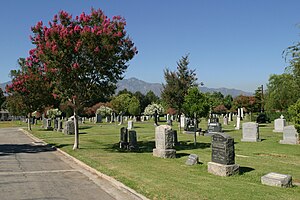
San Gabriel Cemetery is a historic cemetery in San Gabriel, California, United States. Founded in 1872, it contains over 19,000 burials in its approximately 15 acres (6 ha), including many of the founding leaders of San Gabriel and Los Angeles.
Weather in this IP's area
clear sky
18 Celsius
17 Celsius
16 Celsius
19 Celsius
1019 hPa
42 %
1019 hPa
982 hPa
10000 meters
0.89 m/s
4.02 m/s
215 degree
