104.244.190.205 - IP Lookup: Free IP Address Lookup, Postal Code Lookup, IP Location Lookup, IP ASN, Public IP
Country:
Region:
City:
Location:
Time Zone:
Postal Code:
ISP:
ASN:
language:
User-Agent:
Proxy IP:
Blacklist:
IP information under different IP Channel
ip-api
Country
Region
City
ASN
Time Zone
ISP
Blacklist
Proxy
Latitude
Longitude
Postal
Route
db-ip
Country
Region
City
ASN
Time Zone
ISP
Blacklist
Proxy
Latitude
Longitude
Postal
Route
IPinfo
Country
Region
City
ASN
Time Zone
ISP
Blacklist
Proxy
Latitude
Longitude
Postal
Route
IP2Location
104.244.190.205Country
Region
british columbia
City
vancouver
Time Zone
America/Vancouver
ISP
Language
User-Agent
Latitude
Longitude
Postal
ipdata
Country
Region
City
ASN
Time Zone
ISP
Blacklist
Proxy
Latitude
Longitude
Postal
Route
Popular places and events near this IP address

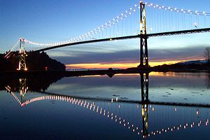
Lions Gate Bridge
Suspension bridge in Vancouver, Canada
Distance: Approx. 1613 meters
Latitude and longitude: 49.31527778,-123.13833333
The Lions Gate Bridge, opened in 1938 and officially known as the First Narrows Bridge, is a suspension bridge that crosses the first narrows of Burrard Inlet and connects the City of Vancouver, British Columbia, to the North Shore municipalities of the District of North Vancouver, the City of North Vancouver, and West Vancouver. The term "Lions Gate" refers to the Lions, a pair of mountain peaks north of Vancouver. Northbound traffic on the bridge heads in their general direction.

Capilano River
River in British Columbia, Canada
Distance: Approx. 1098 meters
Latitude and longitude: 49.32111111,-123.13944444
The Capilano River flows from north to south through the Coast Mountains on the North Shore of the Burrard Inlet between British Columbia's district municipalities of West Vancouver and North Vancouver and empties into Burrard Inlet, opposite Stanley Park. The river is one of three primary sources of drinking water for residents of Greater Vancouver, and flows through the Capilano watershed. The Cleveland Dam, built in 1954, impounds a reservoir for this purpose.

Capilano Suspension Bridge
Suspension bridge in Capilano, British Columbia, Canada
Distance: Approx. 2020 meters
Latitude and longitude: 49.34277778,-123.11222222
The Capilano Suspension Bridge is a simple suspension bridge crossing the Capilano River in Upper Capilano, British Columbia, Canada, in the District of North Vancouver. The current bridge is 140 metres (460 ft) long and 70 metres (230 ft) above the river. It is part of a private facility with an admission fee and draws over 1.2 million visitors per year.

Park Royal Shopping Centre
Shopping mall in British Columbia, Canada
Distance: Approx. 610 meters
Latitude and longitude: 49.326,-123.137
Park Royal Shopping Centre, also known as simply Park Royal, opened in 1950, is a shopping mall located in West Vancouver and X̱wemelch'stn, British Columbia, Canada. Park Royal was Canada's first covered shopping mall. Park Royal has seen multiple redeveloped projects within the last decade.

Seawall (Vancouver)
Stone wall constructed around Stanley Park
Distance: Approx. 2054 meters
Latitude and longitude: 49.313398,-123.145634
The seawall in Vancouver, British Columbia, Canada, is a stone wall that was constructed around the perimeter of Stanley Park to prevent erosion of the park's foreshore and is the world's longest uninterrupted waterfront path. Colloquially, the term also denotes the pedestrian, bicycle, and rollerblading pathway on the seawall, one which has been extended far outside the boundaries of Stanley Park and which has become one of the most-used features of the park by both locals and tourists. While the whole path is not built upon the seawall, the total distance from CRAB park, around Stanley Park and False Creek to Spanish Banks is about 30 kilometres (19 mi).
X̱wemelch'stn
Distance: Approx. 1356 meters
Latitude and longitude: 49.31666667,-123.13333333
X̱wemelch'stn [χʷəməltʃʼstn], usually anglicized as Homulchesan, is a large community within the Squamish Nation of the Squamish people, who are a part of the Coast Salish ethnic and linguistic group. The name X̱wemelch'stn, translates to "Fast Moving Water of Fish", relating to the Capilano River. The village is one of the oldest and major villages of the Squamish and continues to be so, being the Squamish Nation's most populated reserve.

Ambleside, West Vancouver
Distance: Approx. 1968 meters
Latitude and longitude: 49.328298,-123.156729
Ambleside is a neighbourhood in West Vancouver that occupies the southeastern corner of the community, with only Park Royal being farther east. The neighborhood is bordered by the neighbourhoods of Dundarave, Park Royal, and the British Properties. Ambleside covers the area from 19th Street to 13th Street, and from Fulton Avenue down to the waterfront.
North Vancouver station
Railway station in British Columbia, Canada
Distance: Approx. 1822 meters
Latitude and longitude: 49.31555556,-123.11444444
North Vancouver station is a railway station located in the city of North Vancouver, British Columbia, Canada and is serviced by the Rocky Mountaineer tour company. The station is used on the Rainforest to Gold Rush route that goes to Jasper (via Whistler and Quesnel). It was formerly the southern terminus of the Whistler Sea to Sky Climb.

The Attic (restaurant)
Former West Vancouver restaurant
Distance: Approx. 348 meters
Latitude and longitude: 49.32777778,-123.13423056
The Attic was a popular 1,200 seat Smörgåsbord restaurant in West Vancouver, British Columbia that was open from 1968 to 1981. The owners were former Vancouver alderman Frank Baker (1922–1989) and his wife Dorothy.

Prospect Point (British Columbia)
Distance: Approx. 1820 meters
Latitude and longitude: 49.31416667,-123.14138889
Prospect Point is a point at the northern tip of Stanley Park in Vancouver, British Columbia, Canada, located on the south side of the First Narrows of Burrard Inlet. The point, which as its name suggests, is a viewpoint, landmark and tourist attraction in Stanley Park and has a restaurant and other facilities, is just west of the Lions Gate Bridge. The location of the point is known in the Skwxwu7mesh (Squamish) language as Chay-thoos, meaning "high bank".

Park Royal Exchange
Distance: Approx. 804 meters
Latitude and longitude: 49.32666667,-123.14027778
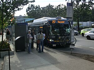
Park Royal Exchange is an on-street transit exchange in West Vancouver, British Columbia, Canada. Opened on October 16, 1959, it lies on Marine Drive at the Park Royal Shopping Centre and has connections to the Horseshoe Bay Ferry Terminal, the City and District of North Vancouver (including Capilano University), and Vancouver.

First Narrows (Vancouver)
Distance: Approx. 1548 meters
Latitude and longitude: 49.31666667,-123.14055556
First Narrows is the official name for the entrance to Burrard Inlet, the mouth of Vancouver, British Columbia's inner harbour.
Weather in this IP's area
overcast clouds
5 Celsius
3 Celsius
4 Celsius
6 Celsius
1038 hPa
70 %
1038 hPa
1014 hPa
10000 meters
3.13 m/s
4.02 m/s
292 degree
100 %