104.244.190.181 - IP Lookup: Free IP Address Lookup, Postal Code Lookup, IP Location Lookup, IP ASN, Public IP
Country:
Region:
City:
Location:
Time Zone:
Postal Code:
ISP:
ASN:
language:
User-Agent:
Proxy IP:
Blacklist:
IP information under different IP Channel
ip-api
Country
Region
City
ASN
Time Zone
ISP
Blacklist
Proxy
Latitude
Longitude
Postal
Route
db-ip
Country
Region
City
ASN
Time Zone
ISP
Blacklist
Proxy
Latitude
Longitude
Postal
Route
IPinfo
Country
Region
City
ASN
Time Zone
ISP
Blacklist
Proxy
Latitude
Longitude
Postal
Route
IP2Location
104.244.190.181Country
Region
british columbia
City
langley
Time Zone
America/Vancouver
ISP
Language
User-Agent
Latitude
Longitude
Postal
ipdata
Country
Region
City
ASN
Time Zone
ISP
Blacklist
Proxy
Latitude
Longitude
Postal
Route
Popular places and events near this IP address

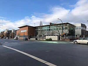
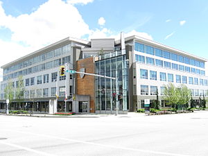
Langley, British Columbia (city)
City in British Columbia, Canada
Distance: Approx. 2079 meters
Latitude and longitude: 49.1041,-122.65758
The City of Langley, commonly referred to as Langley City, or just Langley, is a municipality in the Metro Vancouver Regional District in British Columbia, Canada. It lies directly east of Surrey, adjacent to the Cloverdale area, and is surrounded elsewhere by the Township of Langley, bordered by its neighbourhoods of Willowbrook to the north, Murrayville to the east, and Brookswood and Fern Ridge to the south.
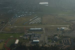
Langley Regional Airport
Airport in Langley, British Columbia
Distance: Approx. 3241 meters
Latitude and longitude: 49.10083333,-122.63083333
Langley Regional Airport (IATA: YLY, ICAO: CYNJ) is located in Langley Township, British Columbia, Canada. It serves mostly general aviation, and also provided scheduled passenger service to the Victoria Airport Water Aerodrome via Harbour Air Seaplanes before service was ended on May 20, 2011. Helicopter operations are a major part of Langley Airport's traffic; the airport has three helipads.

Clayton Heights Secondary School
High school in Surrey, British Columbia, Canada
Distance: Approx. 3211 meters
Latitude and longitude: 49.12894,-122.70323
Clayton Heights Secondary is a public high school in Surrey, British Columbia and is a part of School District 36 Surrey.

Langley Secondary School
High school in Langley, British Columbia, Canada
Distance: Approx. 2918 meters
Latitude and longitude: 49.10529,-122.63027
Langley Secondary is a public high school in Langley, British Columbia part of School District 35 Langley. It is the oldest secondary school in the Langley School District, having been opened in 1949. Langley Secondary offers programs for students in Grade 9 to 12 and has strong traditions in academics, fine arts and athletics.

R. E. Mountain Secondary School
High school in Langley, British Columbia, Canada
Distance: Approx. 2364 meters
Latitude and longitude: 49.1439,-122.6621
R.E. Mountain Secondary is a public high school in northern Langley, British Columbia and is a part of School District 35 Langley. It originally opened in 1977 and was relocated to a new facility in 2019. As of 2014, the school no longer offers Grade 8 as Yorkson Creek Middle School took the position.

Willowbrook Shopping Centre
Shopping mall in Metro Vancouver, Canada
Distance: Approx. 1411 meters
Latitude and longitude: 49.11451,-122.67498
Willowbrook Shopping Centre (sometimes referred to as Willowbrook Mall) is a shopping centre in the Fraser Valley area of Metro Vancouver, Canada. Situated on Fraser Highway at Highway 10 (Langley By-Pass), Willowbrook is located half in the City of Langley and half in the Township of Langley in British Columbia. The mall is 40 minutes southeast of Vancouver.

Vancouver British Columbia Temple
Latter-day Saint temple in British Columbia, Canada
Distance: Approx. 3115 meters
Latitude and longitude: 49.150676,-122.659225
The Vancouver British Columbia Temple is a temple of the Church of Jesus Christ of Latter-day Saints. The intent to build the temple was announced on May 25, 2006, by the First Presidency in letters to local church leadership. It is the seventh in Canada and the first in British Columbia.

Langley Centre
Public transit exchange in Langley, British Columbia, Canada
Distance: Approx. 1864 meters
Latitude and longitude: 49.10638889,-122.65444444
Langley Centre is an on-street bus exchange located in downtown Langley City, British Columbia, Canada. As part of the TransLink system, it serves the municipalities of Langley City and Langley Township with routes to Surrey, Maple Ridge, and White Rock, that provide connections to SkyTrain and the West Coast Express rail services for travel towards Vancouver.

Willoughby, Langley
Distance: Approx. 3105 meters
Latitude and longitude: 49.149,-122.646
Willoughby, British Columbia is a community located within the Township of Langley. It is also home to the Township of Langley's municipal hall.

Langley Events Centre
Multipurpose venue in Langley, British Columbia
Distance: Approx. 2611 meters
Latitude and longitude: 49.14583333,-122.66611111
The Langley Events Centre is a 322,312-square-foot (29,943.8 m2) multipurpose facility in the Township of Langley, British Columbia, Canada. The LEC debuted in April 2009, hosting the 2009 BC Gymnastics Championships. It boasts an arena bowl with a 5,276 capacity for sports, including 24 individual suites.

Langley Education Centre
High school in Langley, British Columbia, Canada
Distance: Approx. 3082 meters
Latitude and longitude: 49.104,-122.629
Langley Education Centre (LEC) is a public high school in Langley, British Columbia, part of School District 35 Langley. LEC offers secondary school (Gr. 10–12) options for teens and adults to continue and complete a secondary education or upgrade their courses.

Willoughby Community Park (stadium)
Soccer stadium in the Township of Langley, British Columbia, Canada
Distance: Approx. 2388 meters
Latitude and longitude: 49.143849,-122.665662
Willoughby Community Park is a soccer stadium located in the Township of Langley, British Columbia, near the Langley Events Centre. In 2023, spectator stands were constructed around the existing turf field for the newly founded club named Vancouver FC. It is one of four sports fields in Willoughby Park. The stadium hosted its first match on May 7, 2023, as Vancouver FC drew 1–1 against Calgary's Cavalry FC with an announced crowd of 6,177.
Weather in this IP's area
overcast clouds
1 Celsius
1 Celsius
-0 Celsius
3 Celsius
1037 hPa
82 %
1037 hPa
1032 hPa
10000 meters
100 %
