Country:
 USA
USARegion:
City:
Latitude and Longitude:
Time Zone:
Postal Code:
IP information under different IP Channel
ip-api
Country
Region
City
ASN
Time Zone
ISP
Blacklist
Proxy
Latitude
Longitude
Postal
Route
IPinfo
Country
Region
City
ASN
Time Zone
ISP
Blacklist
Proxy
Latitude
Longitude
Postal
Route
MaxMind
Country
Region
City
ASN
Time Zone
ISP
Blacklist
Proxy
Latitude
Longitude
Postal
Route
Luminati
Country
USASN
Time Zone
America/Chicago
ISP
FRONTIER-FRTR
Latitude
Longitude
Postal
db-ip
Country
Region
City
ASN
Time Zone
ISP
Blacklist
Proxy
Latitude
Longitude
Postal
Route
ipdata
Country
Region
City
ASN
Time Zone
ISP
Blacklist
Proxy
Latitude
Longitude
Postal
Route
Popular places and events near this IP address

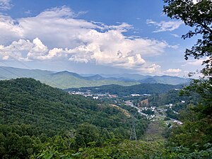
Jackson County, North Carolina
County in North Carolina, United States
Distance: Approx. 6331 meters
Latitude and longitude: 35.29,-83.12
Jackson County is a county located in the western part of the U.S. state of North Carolina. As of the 2020 census, the population was 43,109. Since 1913, its county seat has been Sylva, which replaced Webster.
Cullowhee, North Carolina
Census-designated place in North Carolina, United States
Distance: Approx. 8682 meters
Latitude and longitude: 35.30972222,-83.18166667
Cullowhee () is a census-designated place (CDP) in Jackson County, North Carolina, United States. It is located on the Tuckasegee River, and the permanent population was 7,682 at the 2020 census up from 6,228 at the 2010 census. The community is the home of Western Carolina University, part of the University of North Carolina System.
Forest Hills, North Carolina
Village in North Carolina, United States
Distance: Approx. 7911 meters
Latitude and longitude: 35.29583333,-83.19555556
Forest Hills is a village in Jackson County, North Carolina, United States. The population was 365 at the 2010 census. Formerly a neighborhood within nearby unincorporated Cullowhee, it became incorporated in 1997.
Glenville, North Carolina
Census-designated place in North Carolina, United States
Distance: Approx. 7477 meters
Latitude and longitude: 35.17194444,-83.12722222
Glenville is an unincorporated community and census-designated place (CDP) in Jackson County, North Carolina, United States. It is now a popular lakeside vacation community with many second homes that sometimes are rented around Lake Glenville, which flooded and destroyed the original town. As of the 2010 census, the year-round population was 110.
Bob Waters Field at E. J. Whitmire Stadium
Football stadium in Cullowhee, North Carolina
Distance: Approx. 8198 meters
Latitude and longitude: 35.30472222,-83.1825
Bob Waters Field at E. J. Whitmire Stadium is a 13,742-seat football stadium in Cullowhee, North Carolina. It opened in 1974 and is home to the Western Carolina University Catamounts football team. The field itself is named Bob Waters Field.

Ramsey Center
Distance: Approx. 8087 meters
Latitude and longitude: 35.3037,-83.1823
The Liston B. Ramsey Regional Activity Center is a 7,826-seat multi-purpose arena in Cullowhee, in the U.S. state of North Carolina, and is home to the Western Carolina University Catamounts basketball and volleyball teams. It is also named "The Lair". It is a state owned facility (by the University) and offers the largest seating capacity inside the Charlotte–Atlanta–Knoxville triangle.
Lake Glenville
Reservoir in North Carolina, United States
Distance: Approx. 4627 meters
Latitude and longitude: 35.19611111,-83.15305556
Lake Glenville is a reservoir located eight miles from Cashiers, North Carolina to the dam and public beach. The headwaters, at Hurricane Creek, are less than two miles. It was formed by the damming of the west fork of the Tuckasegee River in 1941.
Hennon Stadium
Distance: Approx. 7780 meters
Latitude and longitude: 35.301108,-83.181127
Ronnie G. Childress Field at Hennon Stadium is the home of the Western Carolina Catamounts baseball team in Cullowhee, North Carolina.
Tuckasegee, North Carolina
Unincorporated community in North Carolina, United States
Distance: Approx. 4244 meters
Latitude and longitude: 35.27027778,-83.12277778
Tuckasegee (Cherokee: ᏛᎧᏏᎩ, romanized: Dvkasigi), named after the historic Cherokee town of that name located near here, is an unincorporated community in Jackson County, North Carolina, United States. It followed the earlier Cherokee town as developing on the upper Tuckaseegee River, at the confluence of its East and West forks. Today North Carolina Highway 107 and North Carolina Highway 281 intersect at this community, southeast of Forest Hills.

Joyner Building
United States historic place
Distance: Approx. 8703 meters
Latitude and longitude: 35.31111111,-83.17777778
The Joyner Building was a historic classroom/administration building located on the campus of Western Carolina University in Cullowhee, Jackson County, North Carolina. brick Colonial It was built in 1913–1914, and was a two-story on a raised basement, T-shaped red brick building with a cross-gab1e-on-hip roof. The main block was 11 bays wide and six bays deep.

Judaculla Rock
United States historic place
Distance: Approx. 7794 meters
Latitude and longitude: 35.30055556,-83.10944444
Judaculla Rock is a curvilinear-shaped outcrop of soapstone known for its ancient carvings and petroglyphs. The archaeological site is located on a 0.85-acre rectangular-shaped property, now owned by Jackson County. It is approximately 60 meters east of Caney Fork Creek, a major branch of the northwestward-trending Tuckasegee River in the mountains of Western North Carolina.
Johns Creek (Jackson County, North Carolina)
Stream in North Carolina, USA
Distance: Approx. 7253 meters
Latitude and longitude: 35.29166667,-83.10222222
Johns Creek is a stream in Jackson County, in the U.S. state of North Carolina. The stream derives its name from Chief John, a Native American.
Weather in this IP's area
scattered clouds
19 Celsius
19 Celsius
18 Celsius
19 Celsius
1015 hPa
92 %
1015 hPa
917 hPa
10000 meters
40 %
07:18:43
19:33:47