104.238.194.59 - IP Lookup: Free IP Address Lookup, Postal Code Lookup, IP Location Lookup, IP ASN, Public IP
Country:
Region:
City:
Location:
Time Zone:
Postal Code:
IP information under different IP Channel
ip-api
Country
Region
City
ASN
Time Zone
ISP
Blacklist
Proxy
Latitude
Longitude
Postal
Route
Luminati
Country
ASN
Time Zone
America/Puerto_Rico
ISP
FIBERX
Latitude
Longitude
Postal
IPinfo
Country
Region
City
ASN
Time Zone
ISP
Blacklist
Proxy
Latitude
Longitude
Postal
Route
IP2Location
104.238.194.59Country
Region
guaynabo
City
guaynabo
Time Zone
America/Puerto_Rico
ISP
Language
User-Agent
Latitude
Longitude
Postal
db-ip
Country
Region
City
ASN
Time Zone
ISP
Blacklist
Proxy
Latitude
Longitude
Postal
Route
ipdata
Country
Region
City
ASN
Time Zone
ISP
Blacklist
Proxy
Latitude
Longitude
Postal
Route
Popular places and events near this IP address
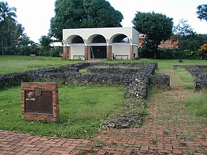
Guaynabo, Puerto Rico
City and municipality in Puerto Rico
Distance: Approx. 1538 meters
Latitude and longitude: 18.36666667,-66.1
Guaynabo (Spanish pronunciation: [ɡwajˈnaβo], locally [wajˈnaβo]) is a city and municipality on the northeastern coastal plain of Puerto Rico. Located west of the capital San Juan, east of Bayamón, south of Cataño and San Juan Bay, and north of Aguas Buenas, Guaynabo is spread over 9 barrios and the downtown area and administrative center of Guaynabo Pueblo. With a land area of 27.13 square miles (70.3 km2) and a population of 89,780 as of the 2020 census, it is part of the San Juan metropolitan area.

Atlantic University College
Digital arts school in Guaynabo, Puerto Rico
Distance: Approx. 97 meters
Latitude and longitude: 18.357395,-66.111714
Atlantic University (AU) is a private college in Guaynabo, Puerto Rico. It was founded in 1981 by Colonel Ramón M. Barquín. It is one of the few colleges or universities in the Caribbean specializing in digital arts education in all of its forms.
Mario Morales Coliseum
Indoor sports arena located in Guaynabo, Puerto Rico
Distance: Approx. 486 meters
Latitude and longitude: 18.359871,-66.114587
Mario Morales Coliseum (Spanish: Coliseo Mario Morales) is an indoor sporting arena that is located in Guaynabo, Puerto Rico. It used mainly for basketball, but it can also be used for table tennis or volleyball. The coliseum's seating capacity is 5,500 seats.
Estadio José "Pepito" Bonano
Sports facility located in Guaynabo, Puerto Rico
Distance: Approx. 1909 meters
Latitude and longitude: 18.374484,-66.112368
The Parque José “Pepito” Bonano is located in Guaynabo, Puerto Rico and is a sports facility used mainly for baseball, and soccer. It is used by Puerto Rico Soccer League's Guaynabo Fluminense FC for its soccer games.
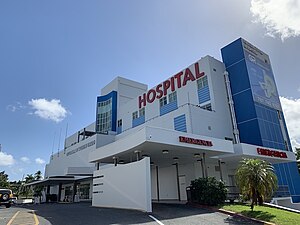
Professional Hospital Guaynabo
Hospital in Guaynabo, Puerto Rico
Distance: Approx. 1488 meters
Latitude and longitude: 18.3625,-66.09777778
Professional Hospital Guaynabo is a private general hospital in Guaynabo, Puerto Rico. It encompasses the Vascular Institute of Puerto Rico—site where the first vascular stent in Puerto Rico was placed. The institution has been treating vascular conditions in Puerto Rico since 1988.
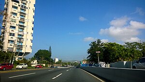
Frailes, Guaynabo, Puerto Rico
Barrio of Puerto Rico
Distance: Approx. 1533 meters
Latitude and longitude: 18.371062,-66.108992
Frailes is a barrio in the municipality of Guaynabo, Puerto Rico. Its population in 2010 was 32,050.
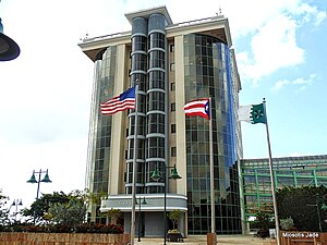
Guaynabo barrio-pueblo
Historical and administrative center (seat) of Guaynabo, Puerto Rico
Distance: Approx. 368 meters
Latitude and longitude: 18.360163,-66.112718
Guaynabo barrio-pueblo is a barrio and the administrative center (seat) of Guaynabo, a municipality of Puerto Rico. Its population in 2010 was 4,008. As was customary in Spain, in Puerto Rico, the municipality has a barrio called pueblo which contains a central plaza, the municipal buildings (city hall), and a Catholic church.
Santa Rosa, Guaynabo, Puerto Rico
Barrio of Puerto Rico
Distance: Approx. 1849 meters
Latitude and longitude: 18.351081,-66.126981
Santa Rosa is a barrio in the municipality of Guaynabo, Puerto Rico. Its population in 2010 was 16,904.
Colegio Sagrados Corazones (Guaynabo, Puerto Rico)
Catholic school, private school in Guaynabo, Puerto Rico
Distance: Approx. 1845 meters
Latitude and longitude: 18.371416,-66.101472
Colegio Sagrados Corazones (Sacred Hearts School) was a Catholic day school in the municipality of Guaynabo in the metropolitan area of Puerto Rico. It offered PK-12 with a traditional educational approach and offered courses in the Spanish language. SSCC (as commonly abbreviated) was aimed at the Catholic denomination and offered a level of preschool and elementary in their academic program.
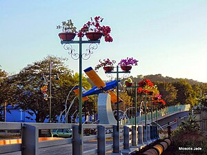
Museum of Transportation of Puerto Rico
Former transport museum in Guaynabo, Puerto Rico
Distance: Approx. 532 meters
Latitude and longitude: 18.358642,-66.115658
The Museum Of Transportation (MOT) of Puerto Rico is a museum located in the town of Guaynabo, Puerto Rico which documents the history of transportation in Puerto Rico, from the canoes used by the natives, to the actual subway system located in the metro area known as the "Tren Urbano" (Urban Train). Founded in 2013, the museum began as an initiative by a group of local automotive enthusiasts. Consisting of an architecturally rich design inspired by other great and renowned museums from around the globe.

Iglesia Parroquial de San Pedro Mártir de Guaynabo
Puerto Rican historic place
Distance: Approx. 101 meters
Latitude and longitude: 18.35777778,-66.11166667
The San Pedro Mártir Parish Church of Guaynabo (Spanish: Iglesia Parroquial de San Pedro Mártir de Guaynabo) is a historic parish church of the Roman Catholic Archdiocese of San Juan de Puerto Rico, located in Guaynabo Pueblo (downtown Guaynabo) in the Puerto Rican municipality of the same name. The church was added to the United States National Register of Historic Places on September 8, 1976, and to the Puerto Rico Register of Historic Sites and Zones in 2000. The church is the oldest building in Guaynabo, and it was established as a parish in 1775.

Oficina de Telégrafo y Teléfono
Puerto Rican historic place
Distance: Approx. 168 meters
Latitude and longitude: 18.35888889,-66.11055556
The Telephone and Telegraph Station of Guaynabo (Spanish: Oficina de Telégrafo y Teléfono de Guaynabo) is a one-story flat roof building located in the downtown (pueblo) area of Guaynabo, Puerto Rico. It was designed in the Art Deco style and constructed entirely of reinforced concrete with glass blocks and ornamental ironwork. It is one of the few (private or public) buildings in the island built entirely in this architectural style.
Weather in this IP's area
broken clouds
23 Celsius
24 Celsius
22 Celsius
24 Celsius
1015 hPa
90 %
1015 hPa
1010 hPa
10000 meters
1.61 m/s
2.37 m/s
92 degree
80 %
