104.234.83.23 - IP Lookup: Free IP Address Lookup, Postal Code Lookup, IP Location Lookup, IP ASN, Public IP
Country:
Region:
City:
Location:
Time Zone:
Postal Code:
ISP:
ASN:
language:
User-Agent:
Proxy IP:
Blacklist:
IP information under different IP Channel
ip-api
Country
Region
City
ASN
Time Zone
ISP
Blacklist
Proxy
Latitude
Longitude
Postal
Route
db-ip
Country
Region
City
ASN
Time Zone
ISP
Blacklist
Proxy
Latitude
Longitude
Postal
Route
IPinfo
Country
Region
City
ASN
Time Zone
ISP
Blacklist
Proxy
Latitude
Longitude
Postal
Route
IP2Location
104.234.83.23Country
Region
new york
City
adams center
Time Zone
America/New_York
ISP
Language
User-Agent
Latitude
Longitude
Postal
ipdata
Country
Region
City
ASN
Time Zone
ISP
Blacklist
Proxy
Latitude
Longitude
Postal
Route
Popular places and events near this IP address

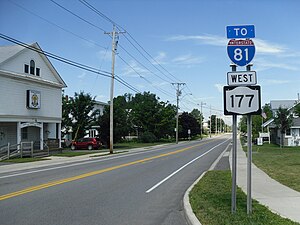
Adams Center, New York
Census-designated place in New York, United States
Distance: Approx. 263 meters
Latitude and longitude: 43.86222222,-76.00694444
Adams Center (formerly called Adams Five Corners) is a hamlet and census-designated place (CDP) in the town of Adams in Jefferson County, New York, United States. The population was 1,492 during the 2020 decennial census.
Rodman, New York
Town in New York, United States
Distance: Approx. 5286 meters
Latitude and longitude: 43.85111111,-75.94083333
Rodman is a town in Jefferson County, New York, United States. The population was 1,176 at the 2010 census. The name is derived from a public official, Daniel Rodman.
Adams (village), New York
Village in New York, United States
Distance: Approx. 5859 meters
Latitude and longitude: 43.80916667,-76.02388889
Adams is a village in the town of Adams in Jefferson County, New York, United States. The population was 1,775 at the 2010 census. The village is named after President John Adams.

Adams, New York
Town in New York, United States
Distance: Approx. 5769 meters
Latitude and longitude: 43.81,-76.02388889
Adams is a town in Jefferson County, New York, United States. Named after President John Adams, the town had a population of 5,143 at the 2010 census. The town contains a village also named Adams.
WEFX
Radio station in Henderson, New York
Distance: Approx. 8189 meters
Latitude and longitude: 43.82,-76.091
WEFX (100.7 FM, "100.7 The Eagle") is a commercial radio station licensed to Henderson, New York. It is owned by Community Broadcasters, LLC, and airs a country music radio format. The radio studios and offices are on Wealtha Avenue in Watertown, New York.

Adams Commercial Historic District
Historic commercial building in New York, United States
Distance: Approx. 5900 meters
Latitude and longitude: 43.80888889,-76.02444444
Adams Commercial Historic District is a historic district located at Adams in Jefferson County, New York. The district was listed on the National Register of Historic Places in 2006. It includes 21 contributing buildings and one contributing structure, encompassing the historic commercial core of the village of Adams.

Smith-Ripley House
Historic house in New York, United States
Distance: Approx. 5596 meters
Latitude and longitude: 43.81111111,-76.02111111
Smith-Ripley House, also known as Ripley House Museum, is a historic home located at Adams in Jefferson County, New York. It was built in 1854 and is a two-story Italianate style house with an 1883 two-story addition in the southeast corner and a 1967 one story addition in the rear. Sitting on a stone foundation, the main block is three bays wide and three bays deep.
District School No. 19
United States historic place
Distance: Approx. 7488 meters
Latitude and longitude: 43.92472222,-76.03138889
District School No. 19 is a historic one-room school building located at Hounsfield in Jefferson County, New York. It is a one-story, rectangular one room structure built about 1837 of rubble Chaumont limestone.
Star Grange No. 9
United States historic place
Distance: Approx. 7683 meters
Latitude and longitude: 43.92722222,-76.02777778
Star Grange No. 9 is a historic grange hall located at Hounsfield in Jefferson County, New York. It was built in 1931 and is a two-story, three by five bay light wood-frame building on a foundation of concrete block.
Sulphur Springs Cemetery
Historic cemetery in New York, United States
Distance: Approx. 7434 meters
Latitude and longitude: 43.92416667,-76.03166667
Sulphur Springs Cemetery is a historic rural cemetery located at Hounsfield in Jefferson County, New York. It is a cemetery that includes both the original burial ground dating to about 1800 and the much larger "romantic landscape" expansion dating to about 1879. The earliest extant stones date from 1812.
John Losee House
Historic house in New York, United States
Distance: Approx. 8775 meters
Latitude and longitude: 43.91694444,-75.92972222
John Losee House is a historic home located at Watertown, Jefferson County, New York. The house was built about 1828, and is a two-story, five-bay, Federal style limestone dwelling. It has a two-story rear frame ell.
Rodman (CDP), New York
Census-designated place in New York, United States
Distance: Approx. 5314 meters
Latitude and longitude: 43.85083333,-75.94055556
Rodman is a hamlet and census-designated place (CDP) in the town of Rodman, Jefferson County, New York, United States. As of the 2010 census, the CDP population was 153, out of 1,176 in the entire town of Rodman.
Weather in this IP's area
clear sky
-10 Celsius
-14 Celsius
-11 Celsius
-9 Celsius
1030 hPa
72 %
1030 hPa
1003 hPa
10000 meters
1.54 m/s
270 degree