Country:
 USA
USARegion:
City:
Latitude and Longitude:
Time Zone:
Postal Code:
IP information under different IP Channel
ip-api
Country
Region
City
ASN
Time Zone
ISP
Blacklist
Proxy
Latitude
Longitude
Postal
Route
IPinfo
Country
Region
City
ASN
Time Zone
ISP
Blacklist
Proxy
Latitude
Longitude
Postal
Route
MaxMind
Country
Region
City
ASN
Time Zone
ISP
Blacklist
Proxy
Latitude
Longitude
Postal
Route
Luminati
Country
USASN
Time Zone
America/Chicago
ISP
NETACTUATE
Latitude
Longitude
Postal
db-ip
Country
Region
City
ASN
Time Zone
ISP
Blacklist
Proxy
Latitude
Longitude
Postal
Route
ipdata
Country
Region
City
ASN
Time Zone
ISP
Blacklist
Proxy
Latitude
Longitude
Postal
Route
Popular places and events near this IP address
NUMMI
Former American automaker based in Fremont, California
Distance: Approx. 3350 meters
Latitude and longitude: 37.49472222,-121.94472222
New United Motor Manufacturing, Inc. (NUMMI) was an American automobile manufacturing company in Fremont, California, jointly owned by General Motors and Toyota that opened in 1984 and closed in April 2010. The plant is located in the East Industrial area of Fremont next to the Mud Slough between Interstate 880 and Interstate 680, the plant's peak production year was 2006, when it manufactured 428,633 vehicles.

Milpitas High School
Public school in Milpitas, California, United States
Distance: Approx. 2818 meters
Latitude and longitude: 37.451,-121.902
Milpitas High School (MHS) is a public four-year comprehensive high school in Milpitas, California, a suburban community north of San Jose. It is the main high school serving the boundaries of the Milpitas Unified School District. As of 2013, Milpitas High School had an API score of 830 and had an API ranking of 8 out of 10.
San Francisco Bay University
Private university in Fremont, California, United States
Distance: Approx. 838 meters
Latitude and longitude: 37.4778,-121.9259
San Francisco Bay University, formerly Northwestern Polytechnic University, is a private university in Fremont, California. Founded in 1984, the university awards bachelor's and master's degrees in computer science, engineering, technology and management programs. It was founded by Ramsey Carter and Barbara Brown in 1984.

Fremont Assembly
Former GM automobile assembly plant in Fremont, California
Distance: Approx. 3356 meters
Latitude and longitude: 37.49475556,-121.94476667
Fremont Assembly was a General Motors automobile factory in Fremont, California, in the San Francisco area, replacing the older Oakland Assembly. Groundbreaking for the plant occurred in September 1961, and the plant produced its first vehicle on May 1, 1963. Production continued through March 1, 1982, when the plant was closed after production problems.

Rancho Rincón de los Esteros
Mexican land grant
Distance: Approx. 3659 meters
Latitude and longitude: 37.44,-121.93
Rancho Rincón de los Esteros was a 6,353-acre (25.71 km2) Mexican land grant in present-day Santa Clara County, California. It was given by Governor Juan Bautista Alvarado in 1838 to Ignacio Alviso. The name means Estuaries Corner or Estuaries Bend, in reference to the local estuaries.
Curtner, Fremont, California
Distance: Approx. 401 meters
Latitude and longitude: 37.46972222,-121.92361111
Curtner is a neighborhood of Fremont in Alameda County, California. It lies at an elevation of 30 feet (9.1 m). It was formerly an unincorporated community.
Rancho Los Tularcitos
Mexican land grant in California, United States
Distance: Approx. 2209 meters
Latitude and longitude: 37.46,-121.9
Rancho Los Tularcitos was a 4,394-acre (17.78 km2) Spanish land concession in present day Santa Clara County, California given in 1821 to José Loreto Higuera by the last Spanish governor of Alta California, Pablo Vicente de Solá. The land grant was confirmed by Mexican Governor Juan Alvarado in 1839. The name means "place of the little Tule thickets".
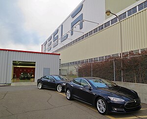
Tesla Fremont Factory
Tesla, Inc. factory
Distance: Approx. 3356 meters
Latitude and longitude: 37.49475556,-121.94476667
The Tesla Fremont Factory is an automobile manufacturing plant in Fremont, California, United States, operated by Tesla, Inc. The factory originally opened as General Motors' Fremont Assembly in 1962, and then was operated by New United Motor Manufacturing, Inc. (NUMMI), a joint venture of GM and Toyota from 1984.

Warm Springs/South Fremont station
Rapid transit station in San Francisco Bay Area
Distance: Approx. 3887 meters
Latitude and longitude: 37.503,-121.94
Warm Springs/South Fremont station is a Bay Area Rapid Transit (BART) station located in the Warm Springs district of Fremont, California. The station is served by the Orange and Green lines. It was the southern terminus of both lines from its opening on March 25, 2017 until June 13, 2020, when Milpitas and Berryessa/North San José stations opened as part of the Silicon Valley BART extension.

Leland Stanford Winery
Historic site in Fremont, California
Distance: Approx. 3573 meters
Latitude and longitude: 37.503411,-121.912311
Leland Stanford Winery was a winery located in the Santa Clara Valley AVA, in Fremont, California, United States. The winery was founded by Leland Stanford in 1869. The vineyard was planted by Stanford's brother, Josiah Stanford.

Oorja Fuel Cells
US fuel cell manufacturer
Distance: Approx. 3361 meters
Latitude and longitude: 37.4995,-121.93541667
Oorja Fuel Cells (Oorja Protonics Inc) is an energy company that designs, manufactures, and commercializes direct methanol fuel cells for use in the logistics, automotive, distributed generation (micro-grid), and telecommunication industries. Oorja develops direct methanol fuel cells ranging in power from 0.5 to 100 kilowatts.
Newby Island landfill
Distance: Approx. 2569 meters
Latitude and longitude: 37.458916,-121.944038
The Newby Island Landfill (NISL) is one of the largest active landfills on the shores of the San Francisco Bay. It is located in Santa Clara County, California in the United States. The site is located within the city limits of San Jose, California at the western terminus of Dixon Landing Road.
Weather in this IP's area
clear sky
16 Celsius
16 Celsius
14 Celsius
19 Celsius
1011 hPa
84 %
1011 hPa
1010 hPa
10000 meters
2.57 m/s
330 degree
06:44:29
19:26:10