104.224.6.13 - IP Lookup: Free IP Address Lookup, Postal Code Lookup, IP Location Lookup, IP ASN, Public IP
Country:
 USA
USARegion:
City:
Location:
Time Zone:
Postal Code:
ISP:
ASN:
language:
User-Agent:
Proxy IP:
Blacklist:
IP information under different IP Channel
ip-api
Country
Region
City
ASN
Time Zone
ISP
Blacklist
Proxy
Latitude
Longitude
Postal
Route
db-ip
Country
Region
City
ASN
Time Zone
ISP
Blacklist
Proxy
Latitude
Longitude
Postal
Route
IPinfo
Country
Region
City
ASN
Time Zone
ISP
Blacklist
Proxy
Latitude
Longitude
Postal
Route
IP2Location
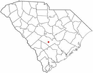
104.224.6.13Country
usRegion
south carolina
City
rowesville
Time Zone
America/New_York
ISP
Language
User-Agent
Latitude
Longitude
Postal
ipdata
Country
Region
City
ASN
Time Zone
ISP
Blacklist
Proxy
Latitude
Longitude
Postal
Route
Popular places and events near this IP address
Orangeburg County, South Carolina
County in South Carolina, United States
Distance: Approx. 8159 meters
Latitude and longitude: 33.44,-80.8
Orangeburg County is a county located in the U.S. state of South Carolina. As of the 2020 census, the population was 84,223. Its county seat is Orangeburg.
Rowesville, South Carolina
Town in South Carolina, United States
Distance: Approx. 4 meters
Latitude and longitude: 33.37333333,-80.83638889
Rowesville is a town in Orangeburg County, South Carolina, United States. The population was 304 at the 2010 census.

WQKI-FM
Radio station in Orangeburg, South Carolina
Distance: Approx. 8306 meters
Latitude and longitude: 33.44284,-80.80401
WQKI-FM (95.7 MHz) is a commercial radio station licensed to Orangeburg, South Carolina. It airs a classic hip hop radio format and is owned by Community Broadcasters, LLC. WQKI-FM has a construction permit issued by the Federal Communications Commission to move its frequency to 95.7 MHz and slightly increase its effective radiated power (ERP) to 4,000 watts from the current output of 3,100 watts.

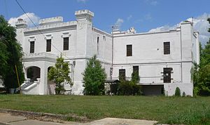
Orangeburg Municipal Airport
Airport
Distance: Approx. 9554 meters
Latitude and longitude: 33.45694444,-80.85944444
Orangeburg Municipal Airport (IATA: OGB, ICAO: KOGB, FAA LID: OGB) is a city-owned, public-use airport located two nautical miles (4 km) south of the central business district of Orangeburg, a city in Orangeburg County, South Carolina, United States. It is included in the National Plan of Integrated Airport Systems for 2011–2015, which categorized it as a general aviation facility. The airport does not have scheduled commercial airline service.
Sixty Six, South Carolina
Unincorporated community in South Carolina, United States
Distance: Approx. 7571 meters
Latitude and longitude: 33.30583333,-80.82611111
Sixty Six is an unincorporated community in Orangeburg County, South Carolina, United States. Sixty Six is located along U.S. Route 21, north of Branchville.
Cattle Creek Campground
United States historic place
Distance: Approx. 9675 meters
Latitude and longitude: 33.32222222,-80.75222222
Cattle Creek Campground, also known as Cattle Creek United Methodist Church and Campground, is a historic camp meeting ground that is now a national historic district located near Rowesville, Orangeburg County, South Carolina. The 2 acre tract was deeded to the trustees of the Methodist Episcopal Church by George Summers Sr and his wife May in July, 1833. The district encompasses 37 contributing buildings and 1 contributing site.
Weather in this IP's area
scattered clouds
17 Celsius
16 Celsius
16 Celsius
18 Celsius
1023 hPa
62 %
1023 hPa
1017 hPa
10000 meters
3.09 m/s
40 %