104.219.88.125 - IP Lookup: Free IP Address Lookup, Postal Code Lookup, IP Location Lookup, IP ASN, Public IP
Country:
Region:
City:
Location:
Time Zone:
Postal Code:
ISP:
ASN:
language:
User-Agent:
Proxy IP:
Blacklist:
IP information under different IP Channel
ip-api
Country
Region
City
ASN
Time Zone
ISP
Blacklist
Proxy
Latitude
Longitude
Postal
Route
db-ip
Country
Region
City
ASN
Time Zone
ISP
Blacklist
Proxy
Latitude
Longitude
Postal
Route
IPinfo
Country
Region
City
ASN
Time Zone
ISP
Blacklist
Proxy
Latitude
Longitude
Postal
Route
IP2Location
104.219.88.125Country
Region
tennessee
City
lebanon
Time Zone
America/Chicago
ISP
Language
User-Agent
Latitude
Longitude
Postal
ipdata
Country
Region
City
ASN
Time Zone
ISP
Blacklist
Proxy
Latitude
Longitude
Postal
Route
Popular places and events near this IP address
Cumberland University
Priviate university in Lebanon, Tennessee, US
Distance: Approx. 838 meters
Latitude and longitude: 36.204,-86.299
Cumberland University is a private university in Lebanon, Tennessee, United States. It was founded in 1842. The oldest campus buildings were constructed between 1892 and 1896.
WCOR
Radio station in Lebanon, Tennessee
Distance: Approx. 2122 meters
Latitude and longitude: 36.20722222,-86.2675
WCOR is an AM radio station broadcasting in the eastern portion of the Nashville, Tennessee, market with a power of 1,000 watts. In its early years, WCOR functioned as a community-oriented station aimed primarily at residents of Wilson County, Tennessee. (It is licensed to the county seat of Wilson County, Lebanon).

Castle Heights Military Academy
Private school in Lebanon, Tennessee, US (1902–1986)
Distance: Approx. 1461 meters
Latitude and longitude: 36.21305556,-86.30611111
Castle Heights Military Academy was a private military academy in Lebanon, Tennessee, United States. It opened in 1902 and became a military school in 1918. The school closed in 1986.
Cedar Grove Cemetery (Lebanon, Tennessee)
Historic cemetery in Wilson County, Tennessee
Distance: Approx. 1726 meters
Latitude and longitude: 36.1933811,-86.2974861
Cedar Grove Cemetery is a historic cemetery located in Lebanon, Tennessee, and owned by the city government. The land was purchased by the City of Lebanon in 1846. However, the first mention of a city cemetery was in the year 1823.

Lebanon station (Tennessee)
Distance: Approx. 719 meters
Latitude and longitude: 36.21211,-86.29728
Lebanon station is a train station in Lebanon, Tennessee, serving Nashville's commuter rail line, the WeGo Star. Service began September 18, 2006.
Lebanon Commercial Historic District (Lebanon, Tennessee)
Historic district in Tennessee, United States
Distance: Approx. 25 meters
Latitude and longitude: 36.20805556,-86.29083333
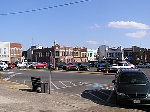
The Lebanon Commercial Historic District in Lebanon, Tennessee is a 10-acre (4.0 ha) historic district centered on the city's public square. It was listed on the National Register of Historic Places in 1999. In 1999 it included 43 contributing buildings and one other contributing structure.

I.W.P. Buchanan House
Historic house in Tennessee, United States
Distance: Approx. 852 meters
Latitude and longitude: 36.20861111,-86.30055556
The I.W.P. Buchanan House is a historic house in Lebanon, Tennessee, United States. It was built circa 1894 for Isaac William Pleasant Buchanan, whose father, Dr. Andrew H. Buchanan, was the chair of the Department of Mathematics at Cumberland University.

Fite-Fessenden House
Historic house in Tennessee, United States
Distance: Approx. 352 meters
Latitude and longitude: 36.20833333,-86.295
The Fite-Fessenden House is a historic house in Lebanon, Tennessee, U.S.. It is now home to the Wilson County Museum.

Mitchell House (Lebanon, Tennessee)
United States national historic place
Distance: Approx. 1562 meters
Latitude and longitude: 36.21111111,-86.30805556
The Mitchell House is a Neo-Classical Revival Style building in Lebanon, Tennessee, that was built as a home by Dr. David Mitchell and his wife, Elizabeth. It was designed by architects Thompson, Gibel & Asmus.
Wilson County Schools
School district in Tennessee
Distance: Approx. 951 meters
Latitude and longitude: 36.2025,-86.283
Wilson County Schools (WCS) is a K–12 school district in Wilson County, Tennessee, United States. The district enrolls nearly 20,000 students and over 1,100 teachers at ten elementary schools, three K-8 schools, four middle schools, and five high schools. Students who live within the K–8 Lebanon Special School District (LSSD) automatically transition to Lebanon High School in Wilson County Schools after completing their eighth-grade year.

Rest Hill Cemetery
Historic cemetery in Lebanon, Wilson County, Tennessee, US
Distance: Approx. 1887 meters
Latitude and longitude: 36.21027778,-86.27027778
Rest Hill Cemetery is an African-American cemetery in Lebanon, Tennessee. The cemetery was established with the help of the Freedmen's Bureau in 1867–1869, during the Reconstruction Era. It was expanded in 1880.

Lebanon Woolen Mills
United States historic place
Distance: Approx. 260 meters
Latitude and longitude: 36.20916667,-86.29361111
The Lebanon Woolen Mills are historic industrial buildings in Lebanon, Tennessee, U.S. They were built in 1909 by Dr Howard K. Edgerton. The facility was inherited by John Edgerton, who served as its president from 1914 to 1938. Edgerton was vehemently opposed to labor unions, and strongly in favor of open shops.
Weather in this IP's area
clear sky
-1 Celsius
-4 Celsius
-1 Celsius
-0 Celsius
1020 hPa
66 %
1020 hPa
997 hPa
10000 meters
2.75 m/s
4.99 m/s
216 degree
