Country:
Region:
City:
Latitude and Longitude:
Time Zone:
Postal Code:
IP information under different IP Channel
ip-api
Country
Region
City
ASN
Time Zone
ISP
Blacklist
Proxy
Latitude
Longitude
Postal
Route
Luminati
Country
ASN
Time Zone
America/Chicago
ISP
AMR
Latitude
Longitude
Postal
IPinfo
Country
Region
City
ASN
Time Zone
ISP
Blacklist
Proxy
Latitude
Longitude
Postal
Route
db-ip
Country
Region
City
ASN
Time Zone
ISP
Blacklist
Proxy
Latitude
Longitude
Postal
Route
ipdata
Country
Region
City
ASN
Time Zone
ISP
Blacklist
Proxy
Latitude
Longitude
Postal
Route
Popular places and events near this IP address

Coors Field
Baseball stadium in Denver, Colorado
Distance: Approx. 445 meters
Latitude and longitude: 39.75611111,-104.99416667
Coors Field is a baseball stadium in downtown Denver, Colorado. It is the ballpark of Major League Baseball's Colorado Rockies. Opened in 1995, the park is located in Denver's Lower Downtown neighborhood, two blocks from Union Station.

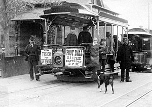
Denver Tramway
Streetcar system in Denver, Colorado, US
Distance: Approx. 909 meters
Latitude and longitude: 39.751,-104.9942
The Denver Tramway, operating in Denver, Colorado, was a streetcar system incorporated in 1886. The tramway was unusual for a number of reasons: the term "tramway" is generally not used in the United States, and it is not known why the company was named as such. The track was 3 ft 6 in (1,067 mm) narrow gauge, an unusual gauge in the United States (although streetcars in Los Angeles also used this gauge), but in general use by railways in Japan, southern Africa, New Zealand, and Queensland, Australia.
Sakura Square
Distance: Approx. 790 meters
Latitude and longitude: 39.7519,-104.9934
Sakura Square (Japanese: サクラ・スクエア, Sakura Sukuea) is a small plaza located on the north/east side of the intersection of 19th Street and Larimer Street in Denver, Colorado. The square contains busts of Ralph L. Carr, Governor of Colorado from 1939 to 1943, Minoru Yasui, a Japanese-American lawyer, and Yoshitaka Tamai (1900–1983), a Buddhist priest who lived in Denver. Sakura Square also has a small Japanese garden, and it serves as the entrance to the 20-story Tamai Tower apartment building that occupies most of the block.
The Real World: Denver
Season of television series
Distance: Approx. 719 meters
Latitude and longitude: 39.75277778,-104.99388889
The Real World: Denver is the eighteenth season of MTV's reality television series The Real World, which focuses on a group of diverse strangers living together for several months in a different city each season, as cameras follow their lives and interpersonal relationships. It is the second season to be filmed in the Mountain States region of the United States, specifically in Colorado. The season featured seven people who lived in a two-story building in the Lower Downtown area of Denver, Colorado, which production started from late May to September 2006.
Union Station, Denver
Neighborhood in Denver, Colorado
Distance: Approx. 629 meters
Latitude and longitude: 39.75708,-104.99712
Union Station is a downtown neighborhood of Denver, Colorado. In 2020, the population of the neighborhood was roughly 5,878. The neighborhood is named for Union Station, Denver's main railroad terminal.
Kopper's Hotel and Saloon
United States historic place
Distance: Approx. 648 meters
Latitude and longitude: 39.75277778,-104.99138889
Kopper's Hotel and Saloon, also known as the Airedale Building, is a National Register of Historic Places listed building in Denver, Colorado. It was designed by Frederick C. Eberley. The Hotel and Saloon was constructed in 1889.

Chinatown, Denver
Neighborhood of Denver in Colorado, United States
Distance: Approx. 616 meters
Latitude and longitude: 39.75395,-104.9941
Chinatown in Denver, Colorado, was a residential and business district of Chinese Americans in what is now the LoDo section of the city. It was also referred to as "Hop Alley", based upon a slang word for opium. The first Chinese resident of Denver, Hong Lee, arrived in 1869 and lived in a shanty at Wazee and F Streets and ran a washing and ironing laundry business.

Union Station North
Neighborhoods in Denver in Colorado, United States
Distance: Approx. 600 meters
Latitude and longitude: 39.7598,-104.9968
Union Station North, formerly known as Prospect, is a neighborhood within the city limits of Denver, Colorado. Previously dominated by industrial buildings, waste, railroad tracks and considered an area of the city to be avoided, today it has been rehabilitated into multi-story residential buildings, restaurants, amenities, easy access to downtown Denver, and is a short walk to the South Platte River Trail, which runs along its northern boundary.
John Elsner House
United States historic place
Distance: Approx. 788 meters
Latitude and longitude: 39.75916667,-104.98083333
The John Elsner House is an Italianate-style house located at 2810 Arapahoe Street in Denver, Colorado. It was added to the National Register of Historic Places on December 17, 1979. The house was commissioned in 1872 by Denver physician John Elsner.
Beckon
Restaurant in Denver, Colorado, U.S.
Distance: Approx. 719 meters
Latitude and longitude: 39.76113889,-104.98233333
Beckon is a Michelin-starred restaurant in Denver, Colorado. In 2024, Beckon was a semifinalist in the Outstanding Restaurant category of the James Beard Foundation Awards.
Brutø
Restaurant in Denver, Colorado, U.S.
Distance: Approx. 871 meters
Latitude and longitude: 39.75277778,-104.99694444
Brutø is a Michelin-starred restaurant in Denver, Colorado.
La Diabla Pozole y Mezcal
Restaurant in Denver, Colorado, U.S.
Distance: Approx. 341 meters
Latitude and longitude: 39.75544444,-104.98972222
La Diabla Pozole y Mezcal is a Mexican restaurant in Denver, Colorado. Established in July 2021, the business was included in The New York Times's 2023 list of the 50 best restaurants in the United States.
Weather in this IP's area
overcast clouds
5 Celsius
-1 Celsius
4 Celsius
7 Celsius
1005 hPa
53 %
1005 hPa
831 hPa
10000 meters
11.83 m/s
14.92 m/s
10 degree
100 %
06:33:46
16:53:22


