104.201.75.59 - IP Lookup: Free IP Address Lookup, Postal Code Lookup, IP Location Lookup, IP ASN, Public IP
Country:
Region:
City:
Location:
Time Zone:
Postal Code:
ISP:
ASN:
language:
User-Agent:
Proxy IP:
Blacklist:
IP information under different IP Channel
ip-api
Country
Region
City
ASN
Time Zone
ISP
Blacklist
Proxy
Latitude
Longitude
Postal
Route
db-ip
Country
Region
City
ASN
Time Zone
ISP
Blacklist
Proxy
Latitude
Longitude
Postal
Route
IPinfo
Country
Region
City
ASN
Time Zone
ISP
Blacklist
Proxy
Latitude
Longitude
Postal
Route
IP2Location
104.201.75.59Country
Region
minnesota
City
plymouth
Time Zone
America/Chicago
ISP
Language
User-Agent
Latitude
Longitude
Postal
ipdata
Country
Region
City
ASN
Time Zone
ISP
Blacklist
Proxy
Latitude
Longitude
Postal
Route
Popular places and events near this IP address

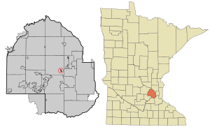
Hennepin County, Minnesota
County in Minnesota, United States
Distance: Approx. 3355 meters
Latitude and longitude: 45.03333333,-93.48333333
Hennepin County ( HEN-ə-pin) is a county in the U.S. state of Minnesota. Its county seat is Minneapolis, the state's most populous city. The county is named for the 17th-century explorer Louis Hennepin.

Medicine Lake, Minnesota
City in Minnesota, United States
Distance: Approx. 2849 meters
Latitude and longitude: 45.00194444,-93.42138889
Medicine Lake is an independent municipality in Hennepin County, Minnesota, United States located on a peninsula that juts into a lake of the same name. The population was 371 at the 2010 census.

Plymouth, Minnesota
City in Minnesota, United States
Distance: Approx. 8 meters
Latitude and longitude: 45.01055556,-93.45555556
Plymouth is a city in Hennepin County in the U.S. state of Minnesota. A suburb in the Minneapolis–Saint Paul metropolitan area, the city is about 10 miles (16 km) west of downtown Minneapolis. The population was 81,026 at the 2020 census, making it Minnesota's 7th-largest city.

Free Lutheran Bible College and Seminary
Distance: Approx. 3006 meters
Latitude and longitude: 45.01541667,-93.41794444
Free Lutheran Bible College and Seminary (FLBCS) is one institution of higher education consisting of two programs, the undergraduate Free Lutheran Bible College (FLBC) and the four-year pastoral training program Free Lutheran Seminary (FLS). FLBCS is accredited through the Transnational Association of Christian Colleges and Schools (TRACS), a member of the Evangelical Council for Financial Accountability (ECFA), and an associate member of the Association for Biblical Higher Education (ABHE). FLBCS is located in Plymouth, Minnesota, near the national offices of the Association of Free Lutheran Congregations (AFLC).
Robbinsdale Armstrong High School
Public secondary school in Minnesota, US
Distance: Approx. 3190 meters
Latitude and longitude: 45.0201,-93.4173
Robbinsdale Armstrong High School (AHS; full name Robbinsdale Neil A. Armstrong Senior High School) is located in Plymouth, Minnesota, just outside Minneapolis. The school serves students from the cities of Robbinsdale, Crystal, New Hope, Plymouth and Golden Valley. The school offers core subjects as well as technology education, physical education, and the fine arts.
Providence Academy (Plymouth, Minnesota)
Catholic K-12 school in Plymouth, MN
Distance: Approx. 4097 meters
Latitude and longitude: 45.0455,-93.4716
Providence Academy is a private, co-ed, Catholic college-preparatory PreK–12 school in Plymouth, Minnesota founded in 2001. It is located in and affiliated with the Roman Catholic Archdiocese of Saint Paul and Minneapolis.
Lost Lake (Minnesota)
Lake in the state of Minnesota, United States
Distance: Approx. 3854 meters
Latitude and longitude: 45.0305693,-93.415597
Lost Lake is located entirely within the city limits of Mound, Minnesota. It is part of Lake Minnetonka and considered by the city of Mound to be important to its re-development plans with the hope being that boat users will increase its downtown business traffic. In the past, lake steamers used Lost Lake's channel or canal to bring tourists into the downtown area, when Lake Minnetonka was a resort area.
Central Baptist Theological Seminary of Minneapolis
Distance: Approx. 3353 meters
Latitude and longitude: 44.98833333,-93.42666667
Central Baptist Theological Seminary of Minneapolis is an Independent Baptist seminary in Plymouth, Minnesota. The seminary moved from Minneapolis to its present location in 1996.
West Lutheran High School
Private secondary school in Plymouth, Minnesota, United States
Distance: Approx. 992 meters
Latitude and longitude: 45.01777778,-93.46277778
West Lutheran High School is a private Lutheran co-educational secondary school located in Plymouth, a suburb of the Twin Cities, in Minnesota, in the United States. It is operated by 20 Lutheran congregations belonging to the Wisconsin Evangelical Lutheran Synod and the Evangelical Lutheran Synod. It is accredited by the Minnesota Nonpublic School Accrediting Association (MNSAA).
Fourth Baptist Christian School
Private school in the United States
Distance: Approx. 3377 meters
Latitude and longitude: 44.988,-93.42672
Fourth Baptist Christian School, a ministry of Fourth Baptist Church, is a private Christian school located in Plymouth, Minnesota.
Four Seasons Mall
Shopping mall in Minnesota, US
Distance: Approx. 4738 meters
Latitude and longitude: 45.03158333,-93.40319444
Four Seasons Mall was an enclosed shopping mall in Plymouth, Minnesota, a suburb of the Twin Cities. Four Seasons Mall once comprised 117,000 square feet (11,000 m2) of retail space with approximately 26 storefronts. The mall opened in 1978 and the last tenant, Marcello's Pizza, closed on February 29, 2012.

Medicine Lake (Minnesota)
Distance: Approx. 2739 meters
Latitude and longitude: 45.00833333,-93.42083333
Medicine Lake is an inland lake located approximately 8 miles northwest of downtown Minneapolis, Minnesota. The lake lies within Hennepin County and is surrounded by two municipalities. At 902 acres, it is Hennepin County's second largest lake behind Lake Minnetonka and is popular among boaters, sailors, and fishers.
Weather in this IP's area
overcast clouds
2 Celsius
-2 Celsius
2 Celsius
2 Celsius
999 hPa
77 %
999 hPa
965 hPa
10000 meters
5.82 m/s
14.1 m/s
292 degree
100 %