Country:
 USA
USARegion:
City:
Latitude and Longitude:
Time Zone:
Postal Code:
IP information under different IP Channel
ip-api
Country
Region
City
ASN
Time Zone
ISP
Blacklist
Proxy
Latitude
Longitude
Postal
Route
IPinfo
Country
Region
City
ASN
Time Zone
ISP
Blacklist
Proxy
Latitude
Longitude
Postal
Route
MaxMind
Country
Region
City
ASN
Time Zone
ISP
Blacklist
Proxy
Latitude
Longitude
Postal
Route
Luminati
Country
USRegion
ia
City
councilbluffs
ASN
Time Zone
America/Chicago
ISP
GOOGLE-CLOUD-PLATFORM
Latitude
Longitude
Postal
db-ip
Country
Region
City
ASN
Time Zone
ISP
Blacklist
Proxy
Latitude
Longitude
Postal
Route
ipdata
Country
Region
City
ASN
Time Zone
ISP
Blacklist
Proxy
Latitude
Longitude
Postal
Route
Popular places and events near this IP address

Council Bluffs Public Library
Library in Iowa, United States
Distance: Approx. 884 meters
Latitude and longitude: 41.25816667,-95.85147222
The Council Bluffs Public Library serves the residents of Council Bluffs, Iowa, United States, along with unincorporated and rural areas of Pottawattamie County. Several cities also contract with the library to provide services. It dates back to 1866.
B'nai Israel Synagogue (Council Bluffs, Iowa)
Synagogue in Council Bluffs, IA
Distance: Approx. 750 meters
Latitude and longitude: 41.26444444,-95.8525
B'nai Israel Synagogue is a synagogue in Council Bluffs, Iowa, United States. It is listed on the National Register of Historic Places by its original name Chevra B'nai Yisroel Synagogue in 2007.

Bennett Building (Council Bluffs, Iowa)
United States historic place
Distance: Approx. 996 meters
Latitude and longitude: 41.26055556,-95.84902778
The Bennett Building, also known as the Ervin Building, is a historic building located in downtown Council Bluffs, Iowa, United States. The previous building to occupy this property was a Woolworth's that was destroyed in a fire in 1922. The Bennett Building Corporation was formed in 1923 to build an office building that was designed to attract medical professionals.

Reverend Little's Young Ladies Seminary
United States historic place
Distance: Approx. 965 meters
Latitude and longitude: 41.25611111,-95.85222222
Reverend Little's Young Ladies Seminary is a historic seminary building at 541 6th Avenue in Council Bluffs, Iowa. The Italianate style building was constructed in 1867 as a school for women, which was founded by a Presbyterian minister, George Little. Unfortunately, "[a]lthough the Rev.

Chieftain Hotel
United States historic place
Distance: Approx. 855 meters
Latitude and longitude: 41.25988889,-95.85094444
The Chieftain Hotel is a historic former hotel building at 38 Pearl Street in Council Bluffs, Iowa, United States. It opened in 1927, the result of a partnership between the Eppley Hotel Company and local patrons, and was built on the site of the Grand Hotel, which had opened in 1891 and was destroyed by a fire in 1925. The hotel was eight stories tall, and featured 153 guest rooms.

Thomas Jefferis House
Historic house in Iowa, United States
Distance: Approx. 993 meters
Latitude and longitude: 41.25588889,-95.85202778
The Thomas Jefferis House is a historic building located in Council Bluffs, Iowa, United States. Jefferis was a Delaware native who was a homeopathic physician. He made and lost fortunes through his involvement in speculative ventures, including real estate and a silver mine in Utah.
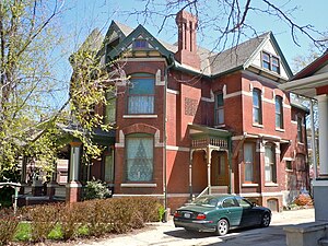
John J. and Agnes Shea House
Historic house in Iowa, United States
Distance: Approx. 608 meters
Latitude and longitude: 41.25805556,-95.85563889
The John J. and Agnes Shea House is a historic building located in Council Bluffs, Iowa, United States. This is the only brick Queen Anne house in the city with a corner tower topped by a witch's cap. The 2½-story structure features an asymmetrical plan, complex roofline, corbelled chimneys, gables, bays, and porches.

O.P. Wickham House
Historic house in Iowa, United States
Distance: Approx. 865 meters
Latitude and longitude: 41.25544444,-95.85505556
The O.P. Wickham House is a historic building located in Council Bluffs, Iowa, United States. Brothers Owen and James Wickham were born in Ireland, and settled in Council Bluffs in the 1860s. They were brick and stonemasons by trade, and they established a contracting firm with another partner in 1863.
State Savings Bank (Council Bluffs, Iowa)
United States historic place
Distance: Approx. 865 meters
Latitude and longitude: 41.26083333,-95.85055556
State Savings Bank, also known as the Old Savings Bank, is a historic building located in Council Bluffs, Iowa, United States. the bank was established in 1889, and was originally located across the street. Planning for this building began in 1941 with the organization of the State Investment Company, which would build and own the building.

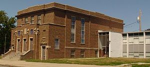
YMCA Building (Council Bluffs, Iowa)
United States historic place
Distance: Approx. 617 meters
Latitude and longitude: 41.26041667,-95.85369444
The YMCA Building is a historic building located in Council Bluffs, Iowa, United States. Construction of the building was partially funded by railroad magnet Grenville M. Dodge. The front section, designed by local architect Frederic E. Cox, was completed in 1909.

Haymarket Commercial Historic District
Historic district in Iowa, United States
Distance: Approx. 1043 meters
Latitude and longitude: 41.25611111,-95.851
The Haymarket Commercial Historic District is a nationally recognized historic district located in Council Bluffs, Iowa, United States. It was listed on the National Register of Historic Places in 1985. At the time of its nomination the district consisted of 28 resources, including 19 contributing buildings, and nine non-contributing buildings.
Shepard and Emma Farnsworth House
Historic house in Iowa, United States
Distance: Approx. 555 meters
Latitude and longitude: 41.25872222,-95.85569444
The Shepard and Emma Farnsworth House is a historic building located in Council Bluffs, Iowa, United States. Built by Vincent Battin in 1886, the two-story frame structure is an example of an asymmetrical Queen Anne style residence. It was designed by local architect Stiles Maxon, who was also responsible for numerous other houses in the city and three county courthouses in the state of Iowa.
Weather in this IP's area
clear sky
16 Celsius
15 Celsius
15 Celsius
17 Celsius
1021 hPa
67 %
1021 hPa
986 hPa
10000 meters
2.57 m/s
130 degree
06:56:32
19:46:24