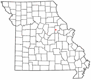
104.192.98.36 - IP Lookup: Free IP Address Lookup, Postal Code Lookup, IP Location Lookup, IP ASN, Public IP
Country:
Region:
City:
Location:
Time Zone:
Postal Code:
IP information under different IP Channel
ip-api
Country
Region
City
ASN
Time Zone
ISP
Blacklist
Proxy
Latitude
Longitude
Postal
Route
Luminati
Country
Region
mo
City
montgomerycity
ASN
Time Zone
America/Chicago
ISP
MISSOURICOM
Latitude
Longitude
Postal
IPinfo
Country
Region
City
ASN
Time Zone
ISP
Blacklist
Proxy
Latitude
Longitude
Postal
Route
IP2Location
104.192.98.36Country
Region
missouri
City
new florence
Time Zone
America/Chicago
ISP
Language
User-Agent
Latitude
Longitude
Postal
db-ip
Country
Region
City
ASN
Time Zone
ISP
Blacklist
Proxy
Latitude
Longitude
Postal
Route
ipdata
Country
Region
City
ASN
Time Zone
ISP
Blacklist
Proxy
Latitude
Longitude
Postal
Route
Popular places and events near this IP address

Montgomery County, Missouri
County in Missouri, United States
Distance: Approx. 6486 meters
Latitude and longitude: 38.94,-91.47
Montgomery County is a county in the east central part of the U.S. state of Missouri. As of the 2020 census, the population was 11,322. Its county seat is Montgomery City.
New Florence, Missouri
City in Missouri, United States
Distance: Approx. 5786 meters
Latitude and longitude: 38.90944444,-91.45305556
New Florence is a city in Montgomery County, Missouri, United States. The population was 641 at the 2020 census, down from 769 in 2010.

Mineola, Missouri
Unincorporated community in the American state of Missouri
Distance: Approx. 4785 meters
Latitude and longitude: 38.88805556,-91.57166667
Mineola is an unincorporated community in western Montgomery County, Missouri, United States. The community is located on Missouri Supplemental Route J and is about one mile south from Interstate 70. Montgomery City is approximately six miles north of the community.

Graham Cave
United States historic place
Distance: Approx. 4989 meters
Latitude and longitude: 38.90527778,-91.57305556
Graham Cave is a Native American archeological site near Mineola, Missouri in Montgomery County in the hills above the Loutre River. It is located in the 356 acre Graham Cave State Park. The entrance of the sandstone cave forms a broad arch 120 feet (37 m) wide and 16 feet (5 m) high.

Graham Cave State Park
State park in Missouri, United States
Distance: Approx. 5376 meters
Latitude and longitude: 38.90666667,-91.57722222
Graham Cave State Park is a state park in the U.S. state of Missouri consisting of 369 acres (149 ha) located in Montgomery County. The park's namesake, Graham Cave, is a cave in St. Peter sandstone with an entrance 120 feet (37 m) wide and 60 feet (18 m) high and an extent of about 100 feet (30 m) into the hillside.
Calhoun Hollow
Valley in Missouri, United States
Distance: Approx. 3051 meters
Latitude and longitude: 38.8747644,-91.4929411
Calhoun Hollow is a valley in Montgomery County in the U.S. state of Missouri. Calhoun Hollow has the name of John Calhoun, original owner of the site.
Danville, Missouri
Census-designated place in Missouri, United States
Distance: Approx. 2389 meters
Latitude and longitude: 38.9125,-91.5325
Danville is an unincorporated community and census-designated place in Montgomery County, in the U.S. state of Missouri. As of the 2020 census, it had a population of 28.
Sallee Branch
Stream in the American state of Missouri
Distance: Approx. 5097 meters
Latitude and longitude: 38.886153,-91.574888
Sallee Branch is a stream in Montgomery County in the U.S. state of Missouri. It is a tributary of the Loutre River. Sallee Branch has the name of Van Sallee, a pioneer citizen.
Simpson Branch (Loutre River tributary)
Stream in the American state of Missouri
Distance: Approx. 6380 meters
Latitude and longitude: 38.873375,-91.585444
Simpson Branch is a stream in Montgomery County in the U.S. state of Missouri. It is a tributary of Loutre River. Simpson Branch has the name of a pioneer citizen.
Smith Branch (Clear Fork tributary)
Stream in the American state of Missouri
Distance: Approx. 6407 meters
Latitude and longitude: 38.94333333,-91.55666667
Smith Branch is a stream in Montgomery County in the U.S. state of Missouri. It is a tributary of Clear Fork of the Loutre River. The stream headwaters arise at 38°52′45″N 91°26′06″W and it flows northwest passing under I-70 just south of New Florence.
Danville Township, Montgomery County, Missouri
Township in Montgomery County, Missouri, U.S.
Distance: Approx. 3085 meters
Latitude and longitude: 38.8783,-91.5458
Danville Township is an inactive township in Montgomery County, in the U.S. state of Missouri. Danville Township takes its name from the community of Danville, Missouri.
Sylvester Marion and Frances Anne Stephens Baker House
Historic house in Missouri, United States
Distance: Approx. 1741 meters
Latitude and longitude: 38.90833333,-91.52694444
Sylvester Marion and Frances Anne Stephens Baker House is a historic home located near Montgomery City, Montgomery County, Missouri. It was built in 1854, and is two-story, Greek Revival style brick I-house. It features a one-story portico, formal entryway with open staircase, and an elaborate door surround.: 5 It was listed on the National Register of Historic Places in 1999.
Weather in this IP's area
overcast clouds
6 Celsius
5 Celsius
6 Celsius
7 Celsius
1020 hPa
100 %
1020 hPa
991 hPa
10000 meters
2.15 m/s
5.41 m/s
134 degree
100 %

