104.192.211.230 - IP Lookup: Free IP Address Lookup, Postal Code Lookup, IP Location Lookup, IP ASN, Public IP
Country:
Region:
City:
Location:
Time Zone:
Postal Code:
ISP:
ASN:
language:
User-Agent:
Proxy IP:
Blacklist:
IP information under different IP Channel
ip-api
Country
Region
City
ASN
Time Zone
ISP
Blacklist
Proxy
Latitude
Longitude
Postal
Route
db-ip
Country
Region
City
ASN
Time Zone
ISP
Blacklist
Proxy
Latitude
Longitude
Postal
Route
IPinfo
Country
Region
City
ASN
Time Zone
ISP
Blacklist
Proxy
Latitude
Longitude
Postal
Route
IP2Location
104.192.211.230Country
Region
quebec
City
montreal
Time Zone
America/Montreal
ISP
Language
User-Agent
Latitude
Longitude
Postal
ipdata
Country
Region
City
ASN
Time Zone
ISP
Blacklist
Proxy
Latitude
Longitude
Postal
Route
Popular places and events near this IP address

Papineau (electoral district)
Federal electoral district in Quebec, Canada
Distance: Approx. 801 meters
Latitude and longitude: 45.55,-73.61666667
Papineau (formerly Papineau—Saint-Denis and Papineau—Saint-Michel) is a federal electoral district in Montreal, Quebec, Canada, that has been represented in the House of Commons of Canada since 1948. Its population in 2016 was 110,750. Justin Trudeau, the Prime Minister of Canada and Leader of the Liberal Party, has represented the riding since the 2008 federal election.

Crémazie station
Montreal Metro station
Distance: Approx. 1024 meters
Latitude and longitude: 45.54611111,-73.63833333
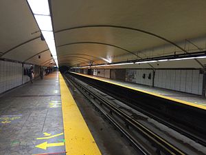
Crémazie station (French pronunciation: [kʁemazi]) is a Montreal Metro station in Montreal, Quebec, Canada. It is operated by the Société de transport de Montréal (STM) and serves the Orange Line. It is located on the border between the boroughs of Ahuntsic-Cartierville and Villeray–Saint-Michel–Parc-Extension The station opened October 14, 1966, as part of the original Metro network.

Jean-Talon station (Montreal Metro)
Montreal Metro station
Distance: Approx. 1169 meters
Latitude and longitude: 45.53888889,-73.61416667
Jean-Talon (French pronunciation: [ʒɑ̃ talɔ̃]) is a station of the Montreal Metro rapid transit system, operated by the Société de transport de Montréal (STM). It is located in the Little Italy district on the border between the boroughs of Rosemont—La Petite-Patrie and Villeray–Saint-Michel–Parc-Extension in Montreal, Quebec, Canada. It is a transfer station between the Orange Line and Blue Line.

Jarry station
Montreal Metro station
Distance: Approx. 399 meters
Latitude and longitude: 45.54333333,-73.62861111
Jarry station is a Montreal Metro station in the borough of Villeray–Saint-Michel–Parc-Extension in Montreal, Quebec, Canada. It is operated by the Société de transport de Montréal (STM) and serves the Orange Line. The station opened on October 14, 1966, as part of the original network of the Metro.

Villeray–Saint-Michel–Parc-Extension
Borough of Montreal in Quebec, Canada
Distance: Approx. 964 meters
Latitude and longitude: 45.549152,-73.61368
Villeray–Saint-Michel–Parc-Extension (French pronunciation: [vilʁɛ sɛ̃ miʃɛl paʁk ɛkstɑ̃sjɔ̃]) is a borough (arrondissement) in the city of Montreal, Quebec. It had a population of 143,853 according to the 2016 Census and a land area of 16.5 square kilometres (6.4 sq mi). The borough of Villeray–Saint-Michel–Parc-Extension was created on January 1, 2002, following the municipal reorganization of Montreal.
Villeray, Montreal
Neighbourhood in Montreal, Quebec, Canada
Distance: Approx. 685 meters
Latitude and longitude: 45.540143,-73.627882
Villeray (French pronunciation: [vilʁɛ]) is a neighbourhood in Montreal, Quebec, Canada. It is part of the Villeray–Saint-Michel–Parc-Extension borough and is situated in the north-central part of the Island of Montreal.
Académie de Roberval
High school in Montreal, Quebec, Canada
Distance: Approx. 1145 meters
Latitude and longitude: 45.546364,-73.610522
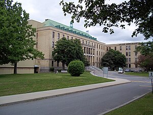
Académie de Roberval is a small French high school located in Montreal, Quebec containing approximately 600 students. It is a part of the Centre de services scolaire de Montréal (CSSDM).
Dorion (provincial electoral district)
Provincial electoral district in Quebec, Canada
Distance: Approx. 685 meters
Latitude and longitude: 45.540143,-73.627882
Dorion (French pronunciation: [dɔʁjɔ̃]) was a provincial electoral district in the province of Quebec, Canada. It corresponded to the Villeray neighbourhood in Montreal. It was created for the 1966 election from parts of Montréal-Outremont, Montréal–Jeanne-Mance and Montréal-Laurier electoral districts.
Christophe Colomb Avenue
Distance: Approx. 721 meters
Latitude and longitude: 45.5453,-73.616
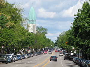
Christophe Colomb Avenue (officially in French: avenue Christophe-Colomb) is a major north–south street in Montreal, Quebec, Canada. It has a length of 8.5 kilometres (5.3 miles), and crosses the boroughs of Le Plateau-Mont-Royal, Rosemont-La Petite-Patrie, Villeray-Saint-Michel-Parc-Extension and Ahuntsic-Cartierville. The street is predominantly residential south of Villeray Street and is a large urban boulevard to the north.

St. George Antiochian Orthodox Church (Montreal)
Church in Canada, Canada
Distance: Approx. 1108 meters
Latitude and longitude: 45.53972222,-73.61416667
St. George Antiochian Orthodox Church (French: Église Saint-George Antiochian Orthodox) is a brick Antiochian Orthodox church in the Villeray neighbourhood of Montreal, Quebec, Canada. Designed by architect Joseph-Raoul Gariépy, the church was constructed in 1939–40 to serve the Syrian Orthodox community in Montreal.

Collège André-Grasset
Private college in Montreal, Canada
Distance: Approx. 779 meters
Latitude and longitude: 45.55055556,-73.63277778
Collège André-Grasset is a private college in Montreal, Quebec, Canada. It is located near the Quebec Autoroute 40 and the Crémazie metro station. The college was founded in 1927 by the priests of Saint-Sulpice Seminary (Montreal) and named after priest and martyr André Grasset.The school was built at the request of the Archbishop of Montreal.

Centre justice et foi
Distance: Approx. 980 meters
Latitude and longitude: 45.538636,-73.632097
Centre justice et foi (English: Centre for Justice and Faith), abbreviated to CJF, is a centre for social analysis in Montreal. It was founded by the Society of Jesus in 1983 and publishes the magazine Relation (French: Revue Relations). It is situated on the corner of Saint Laurent Boulevard and Jarry Street opposite Jarry Park.
Weather in this IP's area
broken clouds
-14 Celsius
-18 Celsius
-14 Celsius
-14 Celsius
1015 hPa
92 %
1015 hPa
1011 hPa
10000 meters
1.74 m/s
3.89 m/s
277 degree
73 %

