104.192.154.107 - IP Lookup: Free IP Address Lookup, Postal Code Lookup, IP Location Lookup, IP ASN, Public IP
Country:
Region:
City:
Location:
Time Zone:
Postal Code:
ISP:
ASN:
language:
User-Agent:
Proxy IP:
Blacklist:
IP information under different IP Channel
ip-api
Country
Region
City
ASN
Time Zone
ISP
Blacklist
Proxy
Latitude
Longitude
Postal
Route
db-ip
Country
Region
City
ASN
Time Zone
ISP
Blacklist
Proxy
Latitude
Longitude
Postal
Route
IPinfo
Country
Region
City
ASN
Time Zone
ISP
Blacklist
Proxy
Latitude
Longitude
Postal
Route
IP2Location
104.192.154.107Country
Region
alberta
City
spruce grove
Time Zone
America/Edmonton
ISP
Language
User-Agent
Latitude
Longitude
Postal
ipdata
Country
Region
City
ASN
Time Zone
ISP
Blacklist
Proxy
Latitude
Longitude
Postal
Route
Popular places and events near this IP address

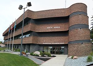
Spruce Grove
City in Alberta, Canada
Distance: Approx. 1752 meters
Latitude and longitude: 53.545,-113.9008
Spruce Grove is a city that is 11 km (6.8 mi) west of Edmonton, Alberta, in Canada. The city is adjacent to the Town of Stony Plain and is surrounded by Parkland County. With a 2021 population of 37,645, Spruce Grove is the ninth-largest city in Alberta.

Stony Plain, Alberta
Town in Alberta, Canada
Distance: Approx. 5891 meters
Latitude and longitude: 53.52638889,-114.00694444
Stony Plain is a town in the Edmonton Metropolitan Region of Alberta, Canada that is surrounded by Parkland County. It is west of Edmonton adjacent to the City of Spruce Grove and sits on Treaty 6 land. Stony Plain is known for its many painted murals representing various periods, events and people throughout the town's history.

Parkland County
Municipal district in Alberta, Canada
Distance: Approx. 5814 meters
Latitude and longitude: 53.53,-114.00638889
Parkland County is a municipal district in central Alberta, Canada. Located west of Edmonton in Census Division No. 11, its municipal office, Parkland County Centre, is located 0.25 km (0.16 mi) north of the Town of Stony Plain on Highway 779.
Memorial Composite High School
Public high school in Stony Plain, Alberta, Canada
Distance: Approx. 5427 meters
Latitude and longitude: 53.50552,-113.98596
Memorial Composite High School is located in Stony Plain, Alberta and is part of the Parkland School Division (Parkland School District no. 70). Serving grades 10-12, the student body consists of approximately 1300 students.

Spruce Grove Grain Elevator Museum
Farm history, farmers market, museum. in Alberta, Canada
Distance: Approx. 1270 meters
Latitude and longitude: 53.54019,-113.90328
The Spruce Grove Grain Elevator Museum is a former Alberta Wheat Pool grain elevator that has been preserved as a working museum run by the volunteers of the Spruce Grove and District Agricultural Society. The elevator stands within the city of Spruce Grove, Alberta, next to the Canadian National Railway and is the last elevator remaining heading west on the Yellowhead Highway and along the CN line.
Garden Grove Estates, Alberta
Designated place in Alberta, Canada
Distance: Approx. 5206 meters
Latitude and longitude: 53.49,-113.948
Garden Grove Estates is an unincorporated community in Alberta, Canada within Parkland County that is recognized as a designated place by Statistics Canada. It is located on the east side of Range Road 275, 2.4 km (1.5 mi) south of Highway 628. It is adjacent to the designated places of Green Acre Estates to the north and Peterburn Estates to the northwest.
Green Acre Estates, Alberta
Designated place in Alberta, Canada
Distance: Approx. 4290 meters
Latitude and longitude: 53.497,-113.94
Green Acre Estates is an unincorporated community in Alberta, Canada within Parkland County that is recognized as a designated place by Statistics Canada. It is located on the west side of Range Road 274, 1.6 km (0.99 mi) south of Highway 628. It is adjacent to the Town of Stony Plain to the northwest and the designated place of Garden Grove Estates to the south.
Peterburn Estates, Alberta
Designated place in Alberta, Canada
Distance: Approx. 5721 meters
Latitude and longitude: 53.49,-113.965
Peterburn Estates is an unincorporated community in Alberta, Canada within Parkland County that is recognized as a designated place by Statistics Canada. It is located on the west side of Range Road 275, 1.6 km (0.99 mi) south of Highway 628. It is adjacent to the Town of Stony Plain to the northwest and the designated place of Garden Grove Estates to the southeast.
Parkland Village
Locality in Alberta, Canada
Distance: Approx. 5459 meters
Latitude and longitude: 53.58,-113.893
Parkland Village is an unincorporated community in Alberta, Canada within Parkland County. It was previously recognized as a designated place by Statistics Canada in the 2001 Census of Canada. It is located on Range Road 272, 0.8 km (0.50 mi) north of Highway 16 (Yellowhead Highway) and the City of Spruce Grove.
CKSS-FM
Radio station in Stony Plain, Alberta, Canada
Distance: Approx. 5941 meters
Latitude and longitude: 53.5336,-114.0085
CKSS-FM is an FM radio station in Stony Plain, Alberta, Canada. Owned by Blackgold Broadcasting, it broadcasts a country format branded as 88.1 The One. Programming team consists of Shane Michaels on One Mornings, John Tesh on the One at Work and Seanna Collins on the Drive Home Show.
WestView Health Centre
Hospital in Stony Plain, Alberta, Canada
Distance: Approx. 3878 meters
Latitude and longitude: 53.537,-113.977
WestView Health Centre is a medical facility with a 24-hour emergency department located in Stony Plain, Alberta that is operated by Alberta Health Services. It is a 68-bed facility and features hospice care within its continuing care unit.
Myshak Metro Ballpark
Baseball stadium
Distance: Approx. 3867 meters
Latitude and longitude: 53.5423,-113.8622
Myshak Metro Ballpark is under construction in Spruce Grove, Alberta, Canada. The baseball park is the future home of the Edmonton Prospects, a Western Canadian Baseball League team playing in the West Division. The park's opening date is uncertain and will seat 3,470 people.
Weather in this IP's area
clear sky
3 Celsius
-2 Celsius
2 Celsius
3 Celsius
1017 hPa
48 %
1017 hPa
931 hPa
10000 meters
6.17 m/s
10.29 m/s
280 degree