104.171.208.1 - IP Lookup: Free IP Address Lookup, Postal Code Lookup, IP Location Lookup, IP ASN, Public IP
Country:
Region:
City:
Location:
Time Zone:
Postal Code:
IP information under different IP Channel
ip-api
Country
Region
City
ASN
Time Zone
ISP
Blacklist
Proxy
Latitude
Longitude
Postal
Route
Luminati
Country
Region
tn
City
fayetteville
ASN
Time Zone
America/Chicago
ISP
FAYETTEVILLEPUBLICUTILITIES-TN
Latitude
Longitude
Postal
IPinfo
Country
Region
City
ASN
Time Zone
ISP
Blacklist
Proxy
Latitude
Longitude
Postal
Route
IP2Location
104.171.208.1Country
Region
tennessee
City
shelbyville
Time Zone
America/Chicago
ISP
Language
User-Agent
Latitude
Longitude
Postal
db-ip
Country
Region
City
ASN
Time Zone
ISP
Blacklist
Proxy
Latitude
Longitude
Postal
Route
ipdata
Country
Region
City
ASN
Time Zone
ISP
Blacklist
Proxy
Latitude
Longitude
Postal
Route
Popular places and events near this IP address

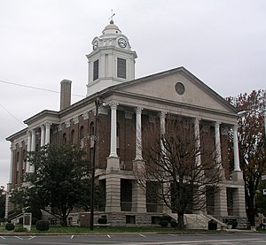
Bedford County, Tennessee
County in Tennessee, United States
Distance: Approx. 2961 meters
Latitude and longitude: 35.51,-86.46
Bedford County is a county located in the U.S. state of Tennessee. As of the 2020 census, the population was 50,237. Its county seat is Shelbyville.
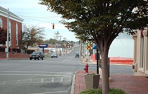
Shelbyville, Tennessee
City in Tennessee, United States
Distance: Approx. 954 meters
Latitude and longitude: 35.48888889,-86.45222222
Shelbyville is a city in and the county seat of Bedford County, Tennessee. The town was laid out in 1810 and incorporated in 1819. Shelbyville had a population of 20,335 residents at the 2010 census.
Tennessee College of Applied Technology - Shelbyville
Distance: Approx. 3572 meters
Latitude and longitude: 35.4857,-86.421
The Tennessee College of Applied Technology - Shelbyville is one of 27 colleges of applied technology in the Tennessee Board of Regents System, one of the largest systems of higher education in the nation. This system comprises thirteen community colleges and twenty-seven colleges of applied technology. More than 60 percent of all Tennessee students attending public institutions are enrolled in a Tennessee Board of Regents institution.
WZNG
Radio station in Tennessee, United States
Distance: Approx. 1681 meters
Latitude and longitude: 35.47396111,-86.44582778
WZNG (1400 AM "The Zinger 100.9") is a radio station broadcasting a classic rock format. Licensed to Shelbyville, Tennessee, United States, the station is owned by David Hopkins, Lori Schuler, and Paul Hopkins, through licensee Hopkins Farms Broadcasting Inc.
First Presbyterian Church (Shelbyville, Tennessee)
Historic church in Tennessee, United States
Distance: Approx. 364 meters
Latitude and longitude: 35.48611111,-86.45805556
First Presbyterian Church is a historic church at 600 N. Brittain Street in Shelbyville, Tennessee. The First Presbyterian congregation was established in 1815. It is affiliated with the Presbyterian Church (USA).
Old Bedford County Jail
United States historic place
Distance: Approx. 119 meters
Latitude and longitude: 35.48444444,-86.46055556
The Old Bedford County Jail, sometimes known as the Rock House Jail, is a 19th-century jail building located near the public square in Shelbyville, Tennessee. The old jail is a two-story building built in 1866-7 from solid hand-hewn limestone. Goodspeed's 1887 History of Tennessee described it as "one of the handsomest and most conspicuous buildings in Shelbyville".
Fly Manufacturing Company Building
United States historic place
Distance: Approx. 256 meters
Latitude and longitude: 35.48138889,-86.46166667
The Fly Manufacturing Company Building is a historic industrial building in Shelbyville, Tennessee, that now houses the Fly Arts Center, a cultural facility. It is listed on the National Register of Historic Places.
Calsonic Arena
Arena in Shelbyville, Tennessee, US
Distance: Approx. 954 meters
Latitude and longitude: 35.48888889,-86.45222222
Calsonic Arena is an arena in Shelbyville, Tennessee. It is best known as the home of the Tennessee Walking Horse National Celebration, but it hosts a variety of events throughout the year, including motocross competitions, 4-H events, dog shows, rodeos and circuses.
Gov. Prentice Cooper House
Historic house in Tennessee, United States
Distance: Approx. 656 meters
Latitude and longitude: 35.485,-86.45333333
The Gov. Prentice Cooper House is a historic house in Shelbyville, Tennessee, United States.
Winston Evans House
Historic house in Tennessee, United States
Distance: Approx. 428 meters
Latitude and longitude: 35.48555556,-86.45638889
Winston Evans House is a historic house in Shelbyville, Tennessee, U.S.. The two-story house was built in 1900 for Winston Evans and his wife Carrie Frierson, whose family owned the land and built the Frierson-Coble House nearby. It was designed in the Classical Revival architectural style.
Frierson-Coble House
Historic house in Tennessee, United States
Distance: Approx. 310 meters
Latitude and longitude: 35.485,-86.4575
The Frierson-Coble House is a historic house in Shelbyville, Tennessee, U.S.. It was built in 1835 for Erwin J. Frierson, who was trained as a lawyer by James K. Polk, who went on to serve as the 11th President of the United States from 1845 to 1849. Frierson served as a member of the Tennessee House of Representatives in 1845.
Bedford County Schools
School district in Tennessee, United States
Distance: Approx. 797 meters
Latitude and longitude: 35.488001,-86.453559
Bedford County School District (BCSD) or Bedford County Schools is a school district headquartered in Shelbyville, Tennessee, United States.
Weather in this IP's area
overcast clouds
12 Celsius
12 Celsius
11 Celsius
13 Celsius
1012 hPa
92 %
1012 hPa
984 hPa
10000 meters
4.07 m/s
10.41 m/s
231 degree
97 %


