Country:
Region:
City:
Latitude and Longitude:
Time Zone:
Postal Code:
IP information under different IP Channel
ip-api
Country
Region
City
ASN
Time Zone
ISP
Blacklist
Proxy
Latitude
Longitude
Postal
Route
Luminati
Country
Region
az
City
kingman
ASN
Time Zone
America/Phoenix
ISP
WECOM-INC
Latitude
Longitude
Postal
IPinfo
Country
Region
City
ASN
Time Zone
ISP
Blacklist
Proxy
Latitude
Longitude
Postal
Route
db-ip
Country
Region
City
ASN
Time Zone
ISP
Blacklist
Proxy
Latitude
Longitude
Postal
Route
ipdata
Country
Region
City
ASN
Time Zone
ISP
Blacklist
Proxy
Latitude
Longitude
Postal
Route
Popular places and events near this IP address

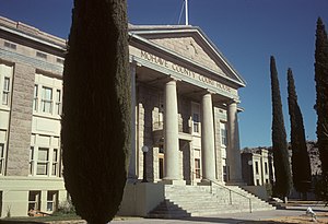
Kingman, Arizona
City in Arizona, United States
Distance: Approx. 6960 meters
Latitude and longitude: 35.20833333,-114.02583333
Kingman is a city in and the county seat of Mohave County, Arizona, United States. It is named after Lewis Kingman, an engineer for the Atlantic and Pacific Railroad. It is located 105 miles (169 km) southeast of Las Vegas, Nevada, and 180 miles (290 km) northwest of Arizona's state capital, Phoenix.

New Kingman-Butler, Arizona
CDP in Mohave County, Arizona
Distance: Approx. 1769 meters
Latitude and longitude: 35.255,-114.02055556
New Kingman-Butler is an unincorporated community and census-designated place (CDP) in Mohave County, Arizona, United States, directly north of and bordering the city of Kingman. The population was 12,907 as of the 2020 census.

Kingman Airport (Arizona)
Airfield in Mohave County, Arizona
Distance: Approx. 7788 meters
Latitude and longitude: 35.25944444,-113.93805556
Kingman Airport (IATA: IGM, ICAO: KIGM, FAA LID: IGM) is a city-owned, public-use airport located 9 miles (7.8 nmi; 14 km) northeast of the central business district of Kingman, a city in Mohave County, Arizona, United States. Kingman Municipal Airport, also known as Kingman Army Airfield, was founded at the start of World War II and was one of the nation's largest aerial training bases. After the war, Kingman Airfield served as one of the nation's top reclamation sites for outdated military aircraft.
Kingman High School (Kingman, Arizona)
Public high school in Kingman, Arizona, United States
Distance: Approx. 3140 meters
Latitude and longitude: 35.2447,-114.0095
Kingman High School is a public high school in Kingman, Arizona. It is a part of the Kingman Unified School District. The mascot of Kingman High School is an English bulldog.

W. P. Mahoney House
United States historic place in Kingman, Arizona
Distance: Approx. 8996 meters
Latitude and longitude: 35.19444444,-114.055
W. P. Mahoney House is in Kingman, Arizona. The house was built in 1919–23. It is a Bungalow/Craftsman style house.

House at 809 Grand View
United States historic place in Kingman, Arizona
Distance: Approx. 9012 meters
Latitude and longitude: 35.19611111,-114.06083333
The house at 809 Grand View Avenue is a Mission/Spanish Revival style house located in Kingman, Arizona. It is listed on the National Register of Historic Places. It was evaluated for National Register listing as part of a 1985 study of 63 historic resources in Kingman that led to this and many others being listed.

Kingman Grammar School
United States historic place
Distance: Approx. 9046 meters
Latitude and longitude: 35.1929,-114.0509
Kingman Grammar School (now named Palo Christi Elementary School) is an elementary school building located in Kingman, Arizona, that was listed on the National Register of Historic Places in 1986.

Kingman Air Force Station
Former USAF General Surveillance Radar station
Distance: Approx. 8337 meters
Latitude and longitude: 35.1975,-114.04138889
Kingman Air Force Station (ADC ID: M-128) is a closed United States Air Force General Surveillance Radar station. It is located 1 mile (1.6 km) southwest of Kingman, Arizona. It was closed in 1958.
Kingman Academy of Learning
Public charter school in Mohave County, Arizona
Distance: Approx. 5366 meters
Latitude and longitude: 35.222849,-114.028583
Kingman Academy of Learning (often shortened to Kingman Academy or KAOL) is a public charter school in Kingman, Arizona for preschool grades through high school. It consists of four campuses with a total enrollment of approximately 1,500 students. It is a member of the Arizona Interscholastic Association.
Kingman explosion
1973 propane tanker explosion in Arizona
Distance: Approx. 6248 meters
Latitude and longitude: 35.21502778,-114.03026389
The Kingman explosion, also known as the Doxol disaster or Kingman BLEVE, was a catastrophic boiling liquid expanding vapor explosion (BLEVE) that occurred on July 5, 1973, in Kingman, Arizona, United States.

Kingman Army Air Forces Flexible Gunnery School Radio Tower
United States historic place
Distance: Approx. 7282 meters
Latitude and longitude: 35.25861111,-113.94388889
The Kingman Army Air Forces Flexible Gunnery School Radio Tower, at 7000 Flightline Dr. in Kingman, Arizona is a historic structure built by the U.S. Army Corps of Engineers in 1943. It is a steel radio tower that has also been known as Kingman Army Air Field Radio Tower and as Storage Depot #41 Radio Tower.
Clacks Canyon, Arizona
CDP in Mohave County, Arizona
Distance: Approx. 7210 meters
Latitude and longitude: 35.22027778,-114.07222222
Clacks Canyon is a census-designated place (CDP) in Mohave County, Arizona, United States. The population was 167 at the 2020 census.
Weather in this IP's area
clear sky
10 Celsius
10 Celsius
9 Celsius
11 Celsius
1011 hPa
46 %
1011 hPa
893 hPa
10000 meters
1.34 m/s
1.79 m/s
246 degree
07:12:49
17:29:25