104.153.19.121 - IP Lookup: Free IP Address Lookup, Postal Code Lookup, IP Location Lookup, IP ASN, Public IP
Country:
Region:
City:
Location:
Time Zone:
Postal Code:
IP information under different IP Channel
ip-api
Country
Region
City
ASN
Time Zone
ISP
Blacklist
Proxy
Latitude
Longitude
Postal
Route
Luminati
Country
Region
il
City
geff
ASN
Time Zone
America/Chicago
ISP
WIN
Latitude
Longitude
Postal
IPinfo
Country
Region
City
ASN
Time Zone
ISP
Blacklist
Proxy
Latitude
Longitude
Postal
Route
IP2Location
104.153.19.121Country
Region
illinois
City
mattoon
Time Zone
America/Chicago
ISP
Language
User-Agent
Latitude
Longitude
Postal
db-ip
Country
Region
City
ASN
Time Zone
ISP
Blacklist
Proxy
Latitude
Longitude
Postal
Route
ipdata
Country
Region
City
ASN
Time Zone
ISP
Blacklist
Proxy
Latitude
Longitude
Postal
Route
Popular places and events near this IP address

Mattoon, Illinois
City in Illinois, United States
Distance: Approx. 1108 meters
Latitude and longitude: 39.4775,-88.36222222
Mattoon ( MAT-toon) is a city in Coles County, Illinois, United States. The population was 16,870 as of the 2020 census. The city is home to Lake Land College and has close ties with its neighbor, Charleston.

Burger King (Mattoon, Illinois)
Independent restaurant
Distance: Approx. 157 meters
Latitude and longitude: 39.4818,-88.3726
Burger King is a restaurant founded by the Hoots family and operated by Burger King LLC of Illinois in Mattoon, Illinois, United States; it is not related to the fast food chain Burger King. The restaurant's founders claim that it is the "original" Burger King and predates the fast food chain. A 1968 court case between this restaurant and the larger Burger King chain is a notable case in United States trademark law regarding the Lanham Act.

Mattoon station
Amtrak intercity train station in Mattoon, Illinois
Distance: Approx. 277 meters
Latitude and longitude: 39.4829,-88.376
Mattoon station is an Amtrak intercity train station in Mattoon, Illinois, United States. The station is a flag stop on the City of New Orleans route, served only when passengers have tickets to and from the station. It is a regular stop for the Illini and Saluki.

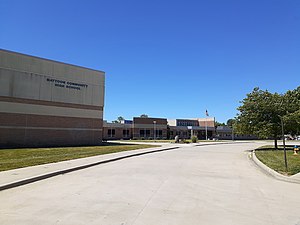
Mattoon High School
Public school in Mattoon, Coles, Illinois, United States
Distance: Approx. 1532 meters
Latitude and longitude: 39.4746,-88.38672
Mattoon High School is located in Coles County, Mattoon, Illinois, United States.

United States Post Office (Mattoon, Illinois)
United States historic place
Distance: Approx. 311 meters
Latitude and longitude: 39.48138889,-88.37555556
The United States Post Office, located at 1701 Charleston Ave., is the former main post office of Mattoon, Illinois. The post office was constructed in 1913 by Mangnus Yeager & Son, a building company from Danville, Illinois. The building was designed in the Classical Revival style and features Renaissance Revival influences; James K. Taylor was the Supervising Architect for the building.
Mattoon Jewish Community Center
Reform synagogue in Charleston, Illinois, United States
Distance: Approx. 756 meters
Latitude and longitude: 39.483106,-88.381603
The Mattoon Jewish Community Center is a Reform Jewish congregation and synagogue located in Mattoon.It was notable as North America's smallest Reform congregation, when it had four households. In 2022, the congregation expanded to seven households. The congregation's services are held in the Wesley United Methodist Church, at 2206 4th Street in Charleston.

Fifteenth Street and Oklahoma Avenue Brick Street
United States historic place
Distance: Approx. 913 meters
Latitude and longitude: 39.475,-88.3725
The Fifteenth Street and Oklahoma Avenue Brick Street is a 4.3-mile (6.9 km) section of brick pavement on Fifteenth Street and Oklahoma Avenue in Mattoon, Illinois. The section of pavement covers eight blocks of Fifteenth Street and one block of Oklahoma Avenue at the south end of the Fifteenth Street section. The H. W. Clark Company paved the streets in 1924.

Starr Hotel
United States historic place
Distance: Approx. 523 meters
Latitude and longitude: 39.48305556,-88.37888889
The Starr Hotel is a historic hotel building located at 1913-1923 Western Avenue in Mattoon, Illinois. Businessman George M. Custer built the hotel in 1888. The hotel primarily housed workers on Mattoon's three railroads: the Illinois Central, the Cleveland, Cincinnati, Chicago and St.

Unity Church (Mattoon, Illinois)
Historic church in Illinois, United States
Distance: Approx. 786 meters
Latitude and longitude: 39.48333333,-88.38194444
Unity Church, now known as Trinity Episcopal Church, is a historic church located at 2200 Western Avenue in Mattoon, Illinois. Mattoon's Unitarian congregation built the church in 1872. The church was built with red brick with stone decorations and a wooden cornice.

Railway Express Agency Building
United States historic place
Distance: Approx. 333 meters
Latitude and longitude: 39.48305556,-88.37666667
The Railway Express Agency Building was a historic building located at 1804 Western Avenue in Mattoon, Illinois. The building was constructed in 1918 to serve as the Mattoon office of the Railway Express Agency. The Railway Express Agency provided rail express shipping services to Mattoon's citizens, allowing them to ship money and packages along Mattoon's two major railways, the Illinois Central Railroad and Cleveland, Cincinnati, Chicago and St.

Lumpkin Heights and Elm Ridge Subdivision Historic District
Historic district in Illinois, United States
Distance: Approx. 1470 meters
Latitude and longitude: 39.48027778,-88.35611111
The Lumpkin Heights and Elm Ridge Subdivision Historic District is a residential historic district in Mattoon, Illinois. The district encompasses the Lumpkin Heights and Elm Ridge Subdivision neighborhoods in eastern Mattoon. Lumpkin Heights was originally developed as Lafayette Heights in the late nineteenth and early twentieth centuries, and it only became known by its current name after further development in the mid-twentieth century.

Burgess-Osborne Memorial Auditorium
United States historic place
Distance: Approx. 378 meters
Latitude and longitude: 39.48055556,-88.37555556
The Burgess-Osborne Memorial Auditorium is a public auditorium at 1701 Wabash Avenue in Mattoon, Illinois. The building was constructed in 1952-53 using funds from the estate of Mattoon resident Emily Burgess-Osborne. Architect Oliver W. Stiegemeyer of St.
Weather in this IP's area
clear sky
-2 Celsius
-8 Celsius
-2 Celsius
-0 Celsius
1028 hPa
42 %
1028 hPa
1000 hPa
10000 meters
8.03 m/s
10.84 m/s
306 degree
6 %