104.152.187.103 - IP Lookup: Free IP Address Lookup, Postal Code Lookup, IP Location Lookup, IP ASN, Public IP
Country:
Region:
City:
Location:
Time Zone:
Postal Code:
ISP:
ASN:
language:
User-Agent:
Proxy IP:
Blacklist:
IP information under different IP Channel
ip-api
Country
Region
City
ASN
Time Zone
ISP
Blacklist
Proxy
Latitude
Longitude
Postal
Route
db-ip
Country
Region
City
ASN
Time Zone
ISP
Blacklist
Proxy
Latitude
Longitude
Postal
Route
IPinfo
Country
Region
City
ASN
Time Zone
ISP
Blacklist
Proxy
Latitude
Longitude
Postal
Route
IP2Location
104.152.187.103Country
Region
north carolina
City
snow camp
Time Zone
America/New_York
ISP
Language
User-Agent
Latitude
Longitude
Postal
ipdata
Country
Region
City
ASN
Time Zone
ISP
Blacklist
Proxy
Latitude
Longitude
Postal
Route
Popular places and events near this IP address
Snow Camp, North Carolina
Unincorporated community in North Carolina, United States
Distance: Approx. 2294 meters
Latitude and longitude: 35.89361111,-79.43
Snow Camp is an unincorporated community in Alamance County, North Carolina, United States.

WYMY
Radio station in North Carolina, United States
Distance: Approx. 2839 meters
Latitude and longitude: 35.93763889,-79.44141667
WYMY (101.1 FM; "La Ley") is a Regional Mexican radio station in Burlington, North Carolina, United States. It serves the Triad and Triangle areas, which includes cities such as Greensboro, Winston-Salem, Raleigh and Durham. In addition the signal goes well north of Danville, Virginia.
Cane Creek Mountains
Mountain in North Carolina, US
Distance: Approx. 3744 meters
Latitude and longitude: 35.94740556,-79.43559444
Cane Creek Mountains is a small mountain range that lies south of Burlington, North Carolina. The range covers an area including Alamance County, Guilford County, Randolph County, and Chatham County in North Carolina.

Battle of Lindley's Mill
1781 battle of the American Revolutionary War
Distance: Approx. 7865 meters
Latitude and longitude: 35.889711,-79.347188
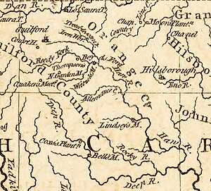
The Battle of Lindley's Mill (also known as the Battle of Cane Creek) took place in Orange County, North Carolina (now in Alamance County), on September 13, 1781, during the American Revolutionary War. The battle took its name from a mill that sat at the site of the battle on Cane Creek, which sat along a road connecting what was then the temporary state capital, Hillsborough, with Wilmington, North Carolina.
Cedarock Park Historic District
Historic farm in North Carolina, United States
Distance: Approx. 8576 meters
Latitude and longitude: 35.99055556,-79.44166667
The Cedarock Historical Farm, located at Cedarock Park in Alamance County, North Carolina, provides an example of life on a farm in North Carolina during the 19th Century. Populated with farm animals, antique and replica farm equipment, and a farmhouse, the Historical Farm provides a fun, education stop while visiting Cedarock Park. The historic district encompasses nine contributing buildings, one contributing site, and one contributing structure.
Snow Camp Outdoor Theatre
Outdoor theater and repertory theater company in Snow Camp, North Carolina
Distance: Approx. 3291 meters
Latitude and longitude: 35.8852,-79.4361
The Snow Camp Theatre is semi-professional theatre company in Snow Camp, an unincorporated community in southern Alamance County, North Carolina that brings the voices of the past into the hearts and minds of a modern audience from around the world by producing engaging historical dramas that inspire and entertain. Its two key plays over the years have been Pathway to Freedom (1994) by Mark Sumner. and The Sword of Peace (1973) by William Hardy.
Mount Hermon, Alamance County, North Carolina
Unincorporated community in North Carolina, United States
Distance: Approx. 7894 meters
Latitude and longitude: 35.98388889,-79.41277778
Mount Hermon is an unincorporated community in Alamance County, North Carolina, United States. The community is centered between North Carolina Highway 87, and North Carolina Highway 49, in south-central Alamance County.
Cedarock Park
Historic farm in North Carolina, United States
Distance: Approx. 9030 meters
Latitude and longitude: 35.99482222,-79.44004167
Cedarock Park is a 500-acre (2.0 km2) nature preserve, historic farm, and passive-use park located near Bellemont in Alamance County, North Carolina. The park opened in 1975 with Ronald Dean Coleman being the Parks Director at the time in the county. He envisioned a natural area a few miles from town where anyone could come and explore some of the most beautiful property Alamance County has to offer.

Three College Observatory
Observatory
Distance: Approx. 3960 meters
Latitude and longitude: 35.9449,-79.4068
Three College Observatory (TCO) is an astronomical observatory owned and operated by The University of North Carolina at Greensboro (UNCG), North Carolina Agricultural and Technical State University (N.C. A&T), and Guilford College (GC). Built in 1979, it is located 10 kilometers (6 mi) south of Graham, North Carolina (USA), in the Cane Creek Mountains. The observatory, designed by W. Edward Jenkins, was funded with a $250,000 grant, however, it would cost $1.5 million to replace it today.
A. L. Spoon House
Historic house in North Carolina, United States
Distance: Approx. 8305 meters
Latitude and longitude: 35.91527778,-79.52111111
A. L. Spoon House is a historic home located near Snow Camp, Alamance County, North Carolina. The house consists of a two-story, hall-and-parlor plan log house, with a timber frame side wing added about 1850. Also on the property is a contributing a double-pen log barn.
Snow Camp Mutual Telephone Exchange Building
United States historic place
Distance: Approx. 2821 meters
Latitude and longitude: 35.88888889,-79.43055556
Snow Camp Mutual Telephone Exchange Building is a historic telephone exchange building located at Snow Camp, Alamance County, North Carolina. It was built in 1915, and is a small, square, vernacular, two-story frame structure. It has a pyramidal roof and rests on a stone foundation.
Whitehead-Fogleman Farm
Historic house in North Carolina, United States
Distance: Approx. 9285 meters
Latitude and longitude: 35.83361111,-79.45555556
Whitehead-Fogleman Farm is a historic home and farm located near Crutchfield Crossroads, Chatham County, North Carolina. The main house was built about 1838, and is a two-story, Federal style frame dwelling. Also on the property are the contributing saddle-notch log corn crib, a square-notch log and board-and-batten well house, a large V-notch log barn, and a one-room board-and-batten kitchen.
Weather in this IP's area
clear sky
-9 Celsius
-9 Celsius
-9 Celsius
-8 Celsius
1036 hPa
54 %
1036 hPa
1011 hPa
10000 meters

