104.145.77.90 - IP Lookup: Free IP Address Lookup, Postal Code Lookup, IP Location Lookup, IP ASN, Public IP
Country:
Region:
City:
Location:
Time Zone:
Postal Code:
IP information under different IP Channel
ip-api
Country
Region
City
ASN
Time Zone
ISP
Blacklist
Proxy
Latitude
Longitude
Postal
Route
Luminati
Country
Region
il
City
mahomet
ASN
Time Zone
America/Chicago
ISP
PAVLOVMEDIA
Latitude
Longitude
Postal
IPinfo
Country
Region
City
ASN
Time Zone
ISP
Blacklist
Proxy
Latitude
Longitude
Postal
Route
IP2Location
104.145.77.90Country
Region
illinois
City
mahomet
Time Zone
America/Chicago
ISP
Language
User-Agent
Latitude
Longitude
Postal
db-ip
Country
Region
City
ASN
Time Zone
ISP
Blacklist
Proxy
Latitude
Longitude
Postal
Route
ipdata
Country
Region
City
ASN
Time Zone
ISP
Blacklist
Proxy
Latitude
Longitude
Postal
Route
Popular places and events near this IP address

Lake of the Woods, Illinois
Census-designated place in Illinois, United States
Distance: Approx. 2238 meters
Latitude and longitude: 40.20194444,-88.36694444
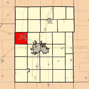
Lake of the Woods is a census-designated place in Champaign County, Illinois, United States. The population was 2,403 at the 2020 census. Lake of the Woods is located in Mahomet Township and mostly surrounded by the northeast part of the village of Mahomet.

Mahomet, Illinois
Village in Illinois, United States
Distance: Approx. 2029 meters
Latitude and longitude: 40.18666667,-88.37555556
Mahomet () is a village in Champaign County, Illinois, United States, along the Sangamon River. The population was 9,434 at the 2020 census. Mahomet is located approximately 10 miles (16 km) northwest of Champaign at the junction of Interstate 74 and Illinois Route 47.
Mabery Gelvin Botanical Garden
Distance: Approx. 535 meters
Latitude and longitude: 40.2038,-88.3943
The Mabery Gelvin Botanical Garden (8 acres (3.2 ha)) is a botanical garden located within the Lake of the Woods Forest Preserve. It is located just off State Route 47, 1 mile (1.6 km) north of Interstate 74, in Mahomet, Illinois.

WQQB
Radio station in Rantoul, Illinois
Distance: Approx. 8458 meters
Latitude and longitude: 40.224,-88.299
WQQB (96.1 MHz) is a Top 40/CHR FM radio station licensed to Rantoul, Illinois and serving the Champaign/Urbana radio market. It is owned by SJ Broadcasting LLC, headed by Stevie Jay Khachaturian, with radio studios and offices on Boulder Drive in Urbana. WQQB calls itself "Q96.1 - All The Hits!" It airs two nationally syndicated shows on weekdays, "The Kidd Kraddick Morning Show" from KHKS Dallas and "Zach Sang and the Gang" on weekday evenings.

Hazen Bridge
Bridge in Mahomet, Illinois
Distance: Approx. 6032 meters
Latitude and longitude: 40.25277778,-88.38333333
The Hazen Bridge, also known as the Newcomb Bridge, is a steel bridge spanning the Sangamon River north of Mahomet in Champaign County, Illinois, in the United States. It was constructed at a location known as White's ford, a popular crossing location of that era because of its proximity to Mahomet and Shiloh Church. The bridge was built in 1893 by Seevers Manufacturing Company of Oskaloosa, Iowa for the bid of $4,985.
WEFT
Community radio station in Champaign, Illinois
Distance: Approx. 6689 meters
Latitude and longitude: 40.181,-88.318
WEFT (90.1 MHz) is a listener-supported community radio station in Champaign, Illinois, founded in 1981 and owned by Prairie Air, Inc., a not-for-profit corporation. WEFT typically broadcasts 24 hours per day and 7 days per week. It has a wide range of programming, including music from a range of genres, local and nationally produced public affairs programming, live music, spoken word, and more.

Mahomet Township, Champaign County, Illinois
Township in Illinois, United States
Distance: Approx. 1914 meters
Latitude and longitude: 40.18527778,-88.40638889
Mahomet Township is a township in Champaign County, Illinois, USA. As of the 2020 census, its population was 13,697 and it contained 5,391 housing units.

Newcomb Township, Champaign County, Illinois
Township in Illinois, United States
Distance: Approx. 8046 meters
Latitude and longitude: 40.27055556,-88.40722222
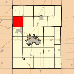
Newcomb Township is a township in Champaign County, Illinois, USA. As of the 2020 census, its population was 1,377 and it contained 526 housing units.
WGKC
Radio station in Mahomet, Illinois
Distance: Approx. 8458 meters
Latitude and longitude: 40.224,-88.299
WGKC (105.9 FM, "U.S. 105.9") is a country music radio station licensed to Mahomet, Illinois and broadcasting in the Champaign-Urbana, Illinois radio market.
Rising, Illinois
Unincorporated community in Illinois, United States
Distance: Approx. 6874 meters
Latitude and longitude: 40.15722222,-88.33361111
Rising is an unincorporated community in Champaign County, Illinois, United States. Rising is northwest of Champaign.

Lake of the Woods Forest Preserve
County park in Illinois, USA
Distance: Approx. 466 meters
Latitude and longitude: 40.203,-88.391
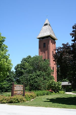
Lake of the Woods Forest Preserve is a county park of 900 acres (360 ha) in size, located adjacent to Lake of the Woods, Illinois, USA. It is operated by the Champaign County Forest Preserve District, a governmental agency of Champaign County, Illinois, and the forest preserve district has built their headquarters in the park.
Mahomet-Seymour High School
Public high school in Mahomet, Illinois, United States
Distance: Approx. 1518 meters
Latitude and longitude: 40.202392,-88.410324
Mahomet-Seymour High School, abbreviated MSHS, is a public high school in Mahomet, Illinois. It is a part of Mahomet-Seymour Community Unit School District 3.
Weather in this IP's area
overcast clouds
1 Celsius
-4 Celsius
0 Celsius
2 Celsius
1023 hPa
82 %
1023 hPa
995 hPa
10000 meters
7.15 m/s
9.83 m/s
323 degree
99 %