Country:
Region:
City:
Latitude and Longitude:
Time Zone:
Postal Code:
IP information under different IP Channel
ip-api
Country
Region
City
ASN
Time Zone
ISP
Blacklist
Proxy
Latitude
Longitude
Postal
Route
Luminati
Country
ASN
Time Zone
America/Chicago
ISP
AS62904
Latitude
Longitude
Postal
IPinfo
Country
Region
City
ASN
Time Zone
ISP
Blacklist
Proxy
Latitude
Longitude
Postal
Route
db-ip
Country
Region
City
ASN
Time Zone
ISP
Blacklist
Proxy
Latitude
Longitude
Postal
Route
ipdata
Country
Region
City
ASN
Time Zone
ISP
Blacklist
Proxy
Latitude
Longitude
Postal
Route
Popular places and events near this IP address
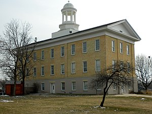
Elgin Academy (Elgin, Illinois)
United States historic place
Distance: Approx. 1721 meters
Latitude and longitude: 42.04138889,-88.27777778
Elgin Academy was an independent, coeducational, college-preparatory school in Elgin, Illinois, United States. Elgin Academy was notable for many accomplishments, such as its Scholastic Bowl and ACES teams.
Grand Victoria Casino Elgin
Distance: Approx. 1356 meters
Latitude and longitude: 42.031046,-88.280318
The Grand Victoria Casino Elgin is a riverboat casino in Elgin, Illinois, United States, located about 40 mi (64 km) west of Chicago. It is owned and operated by Caesars Entertainment.
Elgin High School (Illinois)
Public secondary school in Elgin, Illinois, United States
Distance: Approx. 1584 meters
Latitude and longitude: 42.0267,-88.2453
Elgin High School, or EHS, is a public four-year high school located in Elgin, Illinois, an American city 40 mi. (63.5 km) northwest of Chicago. It is part of Elgin Area School District U46, which also includes Bartlett High School, Larkin High School, South Elgin High School, and Streamwood High School.

National Street station
Commuter rail station in Elgin, Illinois
Distance: Approx. 1281 meters
Latitude and longitude: 42.0264,-88.2788
National Street is one of three stations on Metra's Milwaukee District West Line in Elgin, Illinois. The station is 36.0 miles (57.9 km) away from Chicago Union Station, the eastern terminus of the line. In Metra's zone-based fare system, National Street is in zone 4.
Elgin Historic District
Historic district in Illinois, United States
Distance: Approx. 1133 meters
Latitude and longitude: 42.03638889,-88.27444444
The Elgin Historic District is a set of 697 buildings in Elgin, Illinois. Of these, 429 contribute to the district's historical integrity. The district is the oldest portion of the city, and contains mostly residences and churches.

First Universalist Church (Elgin, Illinois)
Historic church in Illinois, United States
Distance: Approx. 1498 meters
Latitude and longitude: 42.03611111,-88.28
The First Universalist Church in Elgin, Illinois was built in 1892. It was designed by George Hunter to resemble a pocket watch in Richardsonian Romanesque style. The church was listed on the National Register of Historic Places in 1980 and was subsequently included as a contributing property in the Elgin Historic District.

Gifford–Davidson House
Historic house in Illinois, United States
Distance: Approx. 1217 meters
Latitude and longitude: 42.03416667,-88.2775
The Gifford–Davidson House, also known as Stone Cottage, in Elgin, Illinois was built in 1850 and expanded in 1871. The Gifford–Davidson House is unusual due to its cobblestone construction and Second Empire style details. This design would have been more typical in James Gifford's original home of New York City.
Fire Barn 5 (Elgin, Illinois)
United States historic place
Distance: Approx. 653 meters
Latitude and longitude: 42.02555556,-88.26944444
Fire Barn 5 or Fire Station 5 is a historic building in Elgin, Illinois. It was the fifth official fire barn in Elgin, originally housing horses and a fire fighting carriage. Over the years, the carriage was replaced by automobiles.

Ora Pelton House
Historic house in Illinois, United States
Distance: Approx. 1622 meters
Latitude and longitude: 42.03027778,-88.28361111
The Ora Pelton House, or the Izzo-Pelton House, is a historic residence in Elgin, Illinois. The Stick-Eastlake residence is the only Victorian house remaining on South State Street, formerly a wealthy area. It was built for Ora Pelton, a physician and surgeon, by local architect Gilbert M. Turnbull.
Elgin National Watch Company Observatory
United States historic place
Distance: Approx. 772 meters
Latitude and longitude: 42.03,-88.27333333
The Elgin National Watch Company Observatory is a historic building in Elgin, in the U.S. state of Illinois. It was built in 1910 to serve the Elgin National Watch Company two blocks to the west. The two-story observatory provided data on time that was scientifically accurate to a tenth of a second.
Elgin District (United Methodist)
Distance: Approx. 1741 meters
Latitude and longitude: 42.0385,-88.2815
The Elgin District is a geographic area within the Northern Illinois Annual Conference of the United Methodist Church and is led by a District Superintendent. With its administrative offices located in Elgin, Illinois, the district encompasses both urban and rural congregations, large and small. The current superintendent is Rev.

Elgin Downtown Commercial District
United States historic place
Distance: Approx. 1793 meters
Latitude and longitude: 42.03666667,-88.28361111
The Elgin Downtown Commercial District is a historic district encompassing the commercial core of downtown Elgin, Illinois. The district includes 94 buildings, 76 of which are considered contributing buildings to its historic character. While development in downtown Elgin began in the 1830s, the oldest buildings in the district were built in the 1870s; most of the district's buildings were built in the late 19th and early 20th centuries, but its development continued through the 20th century.
Weather in this IP's area
clear sky
6 Celsius
5 Celsius
5 Celsius
8 Celsius
1024 hPa
85 %
1024 hPa
997 hPa
10000 meters
2.57 m/s
260 degree
06:35:03
16:38:42


