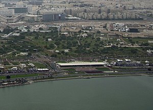
Country:
Region:
City:
Latitude and Longitude:
Time Zone:
Postal Code:
IP information under different IP Channel
ip-api
Country
Region
City
ASN
Time Zone
ISP
Blacklist
Proxy
Latitude
Longitude
Postal
Route
Luminati
Country
ASN
Time Zone
Asia/Qatar
ISP
Google Switzerland GmbH
Latitude
Longitude
Postal
IPinfo
Country
Region
City
ASN
Time Zone
ISP
Blacklist
Proxy
Latitude
Longitude
Postal
Route
db-ip
Country
Region
City
ASN
Time Zone
ISP
Blacklist
Proxy
Latitude
Longitude
Postal
Route
ipdata
Country
Region
City
ASN
Time Zone
ISP
Blacklist
Proxy
Latitude
Longitude
Postal
Route
Popular places and events near this IP address

Al Jasrah
District in Ad-Dawhah, Qatar
Distance: Approx. 328 meters
Latitude and longitude: 25.28611111,51.53416667
Al Jasrah (Arabic: الجسرة) is a district in Qatar, located in the municipality of Ad Dawhah. It hosts Souq Waqif, one of the largest souqs in Qatar. Other points of interest in the district include Souq Jaidah, the Souq Waqif Falcon Hospital, the Souq Waqif Horse Stables, Abdul Aziz Nasser Theatre, Waqif Art Centre, Al Koot Fort (also known as Doha Fort) and Doha Fort Museum.

Rumeilah (Doha)
District in Ad-Dawhah, Qatar
Distance: Approx. 329 meters
Latitude and longitude: 25.28333333,51.53333333
Rumeilah (Arabic: اَلرُّمَيْلَة, romanized: Ar Rumaylah; also spelled Rumaila) is a neighborhood of Doha, Qatar. It is divided into an eastern and western section. Zone 11, the eastern section, hosts roughly half of Al Bidda Park while Zone 21 contains most of Hamad Medical Corporation's facilities.

Doha
Capital and largest city of Qatar
Distance: Approx. 274 meters
Latitude and longitude: 25.28666667,51.53333333
Doha (Arabic: الدوحة, romanized: ad-Dawḥah [ædˈdæwħæ,-ˈdoː-]) is the capital city and main financial hub of Qatar. Located on the Persian Gulf coast in the east of the country, north of Al Wakrah and south of Al Khor and Lusail, it is home to most of the country's population. It is also Qatar's fastest growing city, with over 80% of the nation's population living in Doha or its surrounding suburbs, known collectively as the Doha Metropolitan Area.

Al Koot Fort
Fortress in Doha, Qatar
Distance: Approx. 134 meters
Latitude and longitude: 25.2866,51.5309
Al Koot Fort most commonly known as the Doha Fort, is a historical military fortress located in the heart of Doha, Qatar's capital city. It was built in 1927 by Sheikh Abdulla bin Qassim Al Thani, better known as Sheikh Abdullah bin Jassim Al Thani, who ruled Qatar from 1913 until 1949, after Sheikh Mohammed bin Jassim Al Thani, Sheikh Abdullah's brother, abdicated in favor of him. The fort was later converted into a museum.

Al Hilal (district)
District in Ad Dawhah, Qatar
Distance: Approx. 274 meters
Latitude and longitude: 25.28666667,51.53333333
Al Hilal (Arabic: الهلال) a is multipurpose district in central Doha. It is home to the Doha Mall, the city's first shopping centre. Prior to the 2010 census, Zone 41 comprised Al Hilal West, but the zone was later transferred to Nuaija.

Al Najada
District in Ad-Dawhah, Qatar
Distance: Approx. 251 meters
Latitude and longitude: 25.28333333,51.53
Al Najada (Arabic: النجادة, romanized: An-Najādah) is a Qatari district in the municipality of Doha. It is one of the oldest districts of Doha. Doha's rapid urbanization during the 1970s after it gained independence resulted in the gradual decline of Al Najada.

Msheireb Downtown Doha
Planned city in Doha, Qatar
Distance: Approx. 399 meters
Latitude and longitude: 25.28608333,51.52711111
Msheireb Downtown Doha is a planned city in Doha, Qatar being constructed in place of the current district of Mushayrib. It is promoted as being the world's first sustainable downtown regeneration project and one of the smartest cities on earth, strategically located in the heart of Doha. Initial construction began in January 2010.

Barahat Al Jufairi
District in Ad Dawhah, Qatar
Distance: Approx. 450 meters
Latitude and longitude: 25.282679,51.534312
Barahat Al Jufairi (Arabic: براحة الجفيري, romanized: Brāḥat al-Jufaīry) is a district named after the Al Jufairi tribe, a highly prominent family in Qatar. Barahat Al Jufairi is a city located in the municipality of Doha. Historically, it was used as a central marketplace.

Ad-Dawhah (municipality)
Municipality in Qatar
Distance: Approx. 274 meters
Latitude and longitude: 25.28666667,51.53333333
Ad-Dawhah (Arabic: الدوحة, ad-Dawḥa or ad-Dōḥa, [addawħa]) is one of the eight municipalities of Qatar. It is the most populous municipality with a population of 1,186,023 in 2020, and is the municipality of Qatar's capital city, Doha.
Zone 5, Qatar
Zone in Ad Dawhah, Qatar
Distance: Approx. 383 meters
Latitude and longitude: 25.283005,51.533734
Zone 5 is a zone of the municipality of Ad Dawhah in the state of Qatar. The main districts recorded in the 2015 population census were Al Najada, Barahat Al Jufairi, and Fereej Al Asmakh.

Fereej Al Asmakh
District in Ad-Dawhah, Qatar
Distance: Approx. 598 meters
Latitude and longitude: 25.280442,51.533298
Fereej Al Asmakh (Arabic: فريج الأصمخ, romanized: Farīj al-'Aṣmakh) is a Qatari district located in the municipality of Ad Dawhah. Administratively, it is part of Zone 5, along with Al Najada and Barahat Al Jufairi. It is one of the smaller and older districts of Doha.
Fereej Mohammed Bin Jasim
District in Ad Dawhah, Qatar
Distance: Approx. 437 meters
Latitude and longitude: 25.28555556,51.52666667
Fereej Mohammed Bin Jasim (Arabic: فريج محمد بن جاسم, romanized: Farīj Moḥammed Bin Jāsim) is a district in Qatar, located in the municipality of Ad Dawhah. It is bordered by Mushayrib, which it shares Zone 3 with. The district was first mentioned in the 1940s.
Weather in this IP's area
clear sky
30 Celsius
29 Celsius
29 Celsius
30 Celsius
1016 hPa
39 %
1016 hPa
1015 hPa
10000 meters
4.63 m/s
340 degree
05:51:55
16:45:42