103.99.111.94 - IP Lookup: Free IP Address Lookup, Postal Code Lookup, IP Location Lookup, IP ASN, Public IP
Country:
Region:
City:
Location:
Time Zone:
Postal Code:
ISP:
ASN:
language:
User-Agent:
Proxy IP:
Blacklist:
IP information under different IP Channel
ip-api
Country
Region
City
ASN
Time Zone
ISP
Blacklist
Proxy
Latitude
Longitude
Postal
Route
db-ip
Country
Region
City
ASN
Time Zone
ISP
Blacklist
Proxy
Latitude
Longitude
Postal
Route
IPinfo
Country
Region
City
ASN
Time Zone
ISP
Blacklist
Proxy
Latitude
Longitude
Postal
Route
IP2Location
103.99.111.94Country
Region
andhra pradesh
City
kavali
Time Zone
Asia/Kolkata
ISP
Language
User-Agent
Latitude
Longitude
Postal
ipdata
Country
Region
City
ASN
Time Zone
ISP
Blacklist
Proxy
Latitude
Longitude
Postal
Route
Popular places and events near this IP address

Eastern Coastal Plains
Coastal plain Eastern India
Distance: Approx. 9445 meters
Latitude and longitude: 15,80
The Eastern Coastal Plains is a stretch of landmass lying between the eastern part of the Deccan plateau and the Bay of Bengal in India. The plains stretch from the Mahanadi delta to Kaniyakumari at the southern tip of the Indian peninsula with the Eastern Ghats forming its rough western boundary. It is wider and leveled than the Western Coastal Plains and traverses the states of Odisha, Andhra Pradesh, and Tamil Nadu.

Kavali
Town in Andhra Pradesh, India
Distance: Approx. 1114 meters
Latitude and longitude: 14.913001,79.992921
Kavali is a town in Nellore district of Andhra Pradesh of India. It also serves as headquarters of Kavali mandal and Kavali revenue division.It is one of the few cities from Andhra Pradesh which were selected for Atal Mission for Rejuvenation and Urban Transformation (AMRUT) Scheme.
Jawahar Bharati College
Distance: Approx. 152 meters
Latitude and longitude: 14.91788,79.98258
Jawahar Bharati Degree College, established in 1951, is in the town of Kavali in Nellore district of the state of Andhra Pradesh, India. (14.91788°N 79.98258°E / 14.91788; 79.98258) Jawahar Bharati draws students from towns in Nellore district. The institute has an 'A grade' rating and 'Institute with potential for excellence' from NAAC peer committee (UGC, New Delhi).
Jaladanki
Village in Andhra Pradesh, India
Distance: Approx. 9831 meters
Latitude and longitude: 14.89972222,79.89361111
Jaladanki is a village in Nellore district of the Indian state of Andhra Pradesh. It is located in Jaladanki mandal of Kavali revenue division.

Kavali Assembly constituency
Constituency of the Andhra Pradesh Legislative Assembly, India
Distance: Approx. 1037 meters
Latitude and longitude: 14.91,79.99
Kavali Assembly constituency is a constituency in Nellore district of Andhra Pradesh that elects representatives to the Andhra Pradesh Legislative Assembly in India. It is one of the seven assembly segments of Nellore Lok Sabha constituency. Dagumati Venkata Krishna Reddy is the current MLA of the constituency, having won the 2024 Andhra Pradesh Legislative Assembly election from Telugu Desam Party.
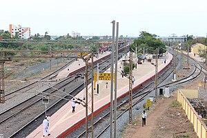
Kavali railway station
Railway station in Andhra Pradesh, India
Distance: Approx. 511 meters
Latitude and longitude: 14.92,79.98
Kavali railway station (station code: KVZ), located in the Indian state of Andhra Pradesh, serves Kavali in SPSR Nellore Dist. It is administered under Vijayawada railway division of South Central Railway zone.
Weather in this IP's area
overcast clouds
20 Celsius
20 Celsius
20 Celsius
20 Celsius
1009 hPa
90 %
1009 hPa
1007 hPa
10000 meters
2.14 m/s
2.24 m/s
207 degree
88 %
