103.97.86.247 - IP Lookup: Free IP Address Lookup, Postal Code Lookup, IP Location Lookup, IP ASN, Public IP
Country:
Region:
City:
Location:
Time Zone:
Postal Code:
IP information under different IP Channel
ip-api
Country
Region
City
ASN
Time Zone
ISP
Blacklist
Proxy
Latitude
Longitude
Postal
Route
Luminati
Country
Region
up
City
maharajganj
ASN
Time Zone
Asia/Kolkata
ISP
Net Sathi Networks Pvt. Ltd
Latitude
Longitude
Postal
IPinfo
Country
Region
City
ASN
Time Zone
ISP
Blacklist
Proxy
Latitude
Longitude
Postal
Route
IP2Location
103.97.86.247Country
Region
uttar pradesh
City
gorakhpur
Time Zone
Asia/Kolkata
ISP
Language
User-Agent
Latitude
Longitude
Postal
db-ip
Country
Region
City
ASN
Time Zone
ISP
Blacklist
Proxy
Latitude
Longitude
Postal
Route
ipdata
Country
Region
City
ASN
Time Zone
ISP
Blacklist
Proxy
Latitude
Longitude
Postal
Route
Popular places and events near this IP address

Gorakhpur
City in Uttar Pradesh, India
Distance: Approx. 3137 meters
Latitude and longitude: 26.7637152,83.4039116
Gorakhpur is a city in the Indian state of Uttar Pradesh, along the banks of the Rapti river in the Purvanchal region. It is situated 272 kilometres east of the state capital, Lucknow. It is the administrative headquarters of Gorakhpur district, North Eastern Railway Zone and Gorakhpur division.

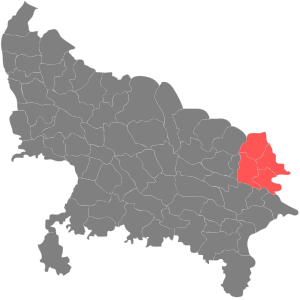
Gorakhpur division
Administrative division of Uttar Pradesh, India
Distance: Approx. 0 meters
Latitude and longitude: 26.755,83.3739
Gorakhpur division is one of the 18 administrative geographical units (i.e. division) of the northern Indian state of Uttar Pradesh. Gorakhpur city is the administrative headquarters of the division.

Gorakhpur Lok Sabha constituency
Constituency in Uttar Pradesh, India
Distance: Approx. 1694 meters
Latitude and longitude: 26.76,83.39
Gorakhpur is a Lok Sabha parliamentary constituency in Uttar Pradesh, India. The current member of Lok Sabha is Ravi Kishan, who has won the election as a BJP party candidate in 2024. This constituency is considered a stronghold of Gorakhnath Math, three of whose presiding monks have been elected from it multiple times.

Deen Dayal Upadhyay Gorakhpur University
University in Uttar Pradesh, India
Distance: Approx. 1030 meters
Latitude and longitude: 26.7481,83.3808
DDU Gorakhpur University (simply and formerly known as Gorakhpur University) is located in Gorakhpur, Uttar Pradesh. The University of Gorakhpur is a teaching and residential-cum-affiliating University. It has entered the league of top five state universities of the country by achieving NAAC Grade A++ rank.
Rohni River
River in Nepal, India
Distance: Approx. 4192 meters
Latitude and longitude: 26.75633333,83.33175
The Rohni (also known as Rohini or Rohin) is a river rise in the Chure or Sivalik Hills in Kapilvastu and Rupandehi Districts of Nepal's Lumbini Zone and flows south into Uttar Pradesh state, India. At Gorakhpur it becomes a left bank tributary of West Rapti River, which in turn joins the Ghaghara above Gaura Barhaj, then Ghaghara in turn joins the Ganges. According to an account in several Buddhist texts, Kapilavatthu (the town of the Sakyans) and Koli (the town of the Koliyans) were situated on either side of the Rohini river.

Ramgarh Tal Lake
Lake in Gorakhpur, Uttar Pradesh, India
Distance: Approx. 4888 meters
Latitude and longitude: 26.73333333,83.41666667
Ramgarh Tal is a lake located in Gorakhpur, Uttar Pradesh, India. In 1970, at its largest size, the lake covered an area of 723 hectares (1,790 acres) with a circumference of 18 kilometres (11 mi). Today, it covers about 678 hectares (1,680 acres).

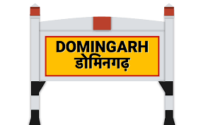
Domingarh railway station
Railway station in Uttar Pradesh, India
Distance: Approx. 3419 meters
Latitude and longitude: 26.7648,83.3413
Domingarh railway station is located in the city of Gorakhpur Surajkund in the Indian state of Uttar Pradesh. It was constructed in 1995. It serves the demand of local passengers on this route of North Eastern Railway.

Gorakhpur Urban Assembly constituency
Constituency of the Uttar Pradesh legislative assembly in India
Distance: Approx. 1694 meters
Latitude and longitude: 26.76,83.39
Gorakhpur Urban is a constituency of the Uttar Pradesh Legislative Assembly covering the city of Gorakhpur Urban in the Gorakhpur district of Uttar Pradesh, India. Gorakhpur Urban is one of five assembly constituencies in the Gorakhpur Lok Sabha constituency. Since 2008, this assembly constituency is numbered 322 amongst 403 constituencies.

All India Institute of Medical Sciences, Gorakhpur
Medical institute in India
Distance: Approx. 4660 meters
Latitude and longitude: 26.7465,83.4198
All India Institute of Medical Sciences, Gorakhpur better known as AIIMS Gorakhpur is a public medical university located in the Gorakhpur, Uttar Pradesh. It is one of the 20 operational AIIMS in India. It is one of the four "Phase-IV" All India Institutes of Medical Sciences (AIIMS) announced in July 2014.
Vir Bahadur Singh Planetarium, Gorakhpur
Distance: Approx. 3361 meters
Latitude and longitude: 26.7276,83.3881
Vir Bahadur Singh Planetarium (also spelled 'Veer' or 'Bir') is a tourist attraction in Gorakhpur, Uttar Pradesh, India. It has been run by the Council of Science & Technology, Uttar Pradesh since 21 December 2009. This planetarium runs three daily, 45-minute shows at 1pm, 3pm and 5pm.
Mahayogi Guru Gorakhnath AYUSH University
State University in India
Distance: Approx. 2169 meters
Latitude and longitude: 26.739393,83.360846
Mahayogi Guru Gorakhnath AYUSH University, Gorakhpur, formerly the State Ayush University, Uttar Pradesh, is an affiliating state university located in Gorakhpur. It was established through the Uttar Pradesh Act No. 6 of 2020, specializing in ayurveda, yoga, naturopathy, Unani, Siddha and homoeopathy (AYUSH).

Army Public School, Kunraghat, Gorakhpur
Indian army school in Gorakhpur, Uttar Pradesh, India
Distance: Approx. 4859 meters
Latitude and longitude: 26.7483,83.4222
Army Public School, Kunraghat, Gorakhpur is a school located in the Kunraghat area, in Gorakhpur, India. It is operated under Indian Army supervision under the aegis of the Army Welfare Education Society. The school was founded in 1954 by Neena Thapa, wife of Colonel Gopal Kushal Singh Thapa, then Commandant GRD, Kunraghat.
Weather in this IP's area
clear sky
11 Celsius
10 Celsius
11 Celsius
11 Celsius
1021 hPa
54 %
1021 hPa
1011 hPa
10000 meters
1.45 m/s
1.47 m/s
156 degree