103.94.25.222 - IP Lookup: Free IP Address Lookup, Postal Code Lookup, IP Location Lookup, IP ASN, Public IP
Country:
 Afghanistan
Region:
City:
Location:
Time Zone:
Postal Code:
ISP:
ASN:
language:
User-Agent:
Proxy IP:
Blacklist:
IP information under different IP Channel
ip-api
Country
Region
City
ASN
Time Zone
ISP
Blacklist
Proxy
Latitude
Longitude
Postal
Route
db-ip
Country
Region
City
ASN
Time Zone
ISP
Blacklist
Proxy
Latitude
Longitude
Postal
Route
IPinfo
Country
Region
City
ASN
Time Zone
ISP
Blacklist
Proxy
Latitude
Longitude
Postal
Route
IP2Location
103.94.25.222Country
afRegion
balkh
City
balkh
Time Zone
Asia/Kabul
ISP
Language
User-Agent
Latitude
Longitude
Postal
ipdata
Country
Region
City
ASN
Time Zone
ISP
Blacklist
Proxy
Latitude
Longitude
Postal
Route
Popular places and events near this IP address
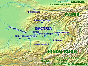
Bactria
Historical region in Central Asia
Distance: Approx. 242 meters
Latitude and longitude: 36.7581,66.8989
Bactria (; Bactrian: βαχλο, Bakhlo), or Bactriana, was an ancient Iranian civilization in Central Asia based in the area south of the Oxus River (modern Amu Darya) and north of the mountains of the Hindu Kush, an area within the north of modern Afghanistan. Bactria was strategically located south of Sogdia and the western part of the Pamir Mountains. The extensive mountain ranges acted as protective "walls" on three sides, with the Pamir on the north and the Hindu Kush on south forming a junction with the Karakoram range towards the east.
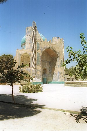
Balkh
Town in Balkh Province, in Persia ( today is in Afghanistan)
Distance: Approx. 199 meters
Latitude and longitude: 36.75805556,66.89805556
Balkh is a town in the Balkh Province of Afghanistan. It is located approximately 20 kilometres (12 mi) to the northwest of the provincial capital city Mazar-i-Sharif and approximately 74 kilometres (46 mi) to the south of the Amu Darya and the Afghanistan–Uzbekistan border. In 2021–2022, the National Statistics and Information Authority reported that the town had 138,594 residents.

Balkh Province
Province of Afghanistan
Distance: Approx. 9197 meters
Latitude and longitude: 36.75,67
Balkh (Dari and Pashto: بلخ, IPA: [balx]) is one of the 34 provinces of Afghanistan, located in the north of the country. It is divided into 15 districts and has a population of about 1,509,183, which is multi-ethnic and mostly a Persian-speaking society. The city of Mazar-i-Sharif is the capital and largest city of the province.

Charbolak District
District in Balkh, Afghanistan
Distance: Approx. 2804 meters
Latitude and longitude: 36.77305556,66.87361111
Chārbōlak (or Chahar Bolak or Char Bolak) (Dari: چاربولک) district (pop: 66,300) is located in the western part of Balkh Province. Its capital is the village of Charbolak, 40 km northwest of Mazari Sharif. The majority of the population is Pashtun.
Chehel Gazi
Place in Balkh Province, Afghanistan
Distance: Approx. 8924 meters
Latitude and longitude: 36.73,66.99166667
Chehel Gazi is a village in Balkh Province in northern Afghanistan.
Kushkak, Afghanistan
Place in Balkh Province, Afghanistan
Distance: Approx. 6461 meters
Latitude and longitude: 36.69861111,66.90388889
Kushkak is a village in Balkh Province in northern Afghanistan.
Orgun
Place in Balkh Province, Afghanistan
Distance: Approx. 8371 meters
Latitude and longitude: 36.80305556,66.97083333
Orgun is a village in Balkh Province in northern Afghanistan.
Tozhna-i-Nasiri
Place in Balkh Province, Afghanistan
Distance: Approx. 3386 meters
Latitude and longitude: 36.78444444,66.8825
Tozhna-i-Nasiri is a village in Balkh Province in northern Afghanistan.
Vazirabad, Afghanistan
Place in Balkh Province, Afghanistan
Distance: Approx. 9723 meters
Latitude and longitude: 36.83333333,66.84555556
Vazirabad is a village in Balkh Province in northern Afghanistan.
Balkh District
District in Balkh, Afghanistan
Distance: Approx. 3779 meters
Latitude and longitude: 36.7883,66.8827
Balkh District (Persian: بلخ) is a district in Balkh province, Afghanistan.
Weather in this IP's area
overcast clouds
8 Celsius
5 Celsius
8 Celsius
8 Celsius
1017 hPa
43 %
1017 hPa
971 hPa
10000 meters
3.89 m/s
5.78 m/s
86 degree
100 %