103.94.248.122 - IP Lookup: Free IP Address Lookup, Postal Code Lookup, IP Location Lookup, IP ASN, Public IP
Country:
Region:
City:
Location:
Time Zone:
Postal Code:
IP information under different IP Channel
ip-api
Country
Region
City
ASN
Time Zone
ISP
Blacklist
Proxy
Latitude
Longitude
Postal
Route
Luminati
Country
ASN
Time Zone
Asia/Jakarta
Latitude
Longitude
Postal
IPinfo
Country
Region
City
ASN
Time Zone
ISP
Blacklist
Proxy
Latitude
Longitude
Postal
Route
IP2Location
103.94.248.122Country
Region
papua
City
jayapura
Time Zone
Asia/Jayapura
ISP
Language
User-Agent
Latitude
Longitude
Postal
db-ip
Country
Region
City
ASN
Time Zone
ISP
Blacklist
Proxy
Latitude
Longitude
Postal
Route
ipdata
Country
Region
City
ASN
Time Zone
ISP
Blacklist
Proxy
Latitude
Longitude
Postal
Route
Popular places and events near this IP address

Papua (province)
Province of Indonesia
Distance: Approx. 1854 meters
Latitude and longitude: -2.53333333,140.71666667
Papua is a province of Indonesia, comprising the northern coast of Western New Guinea together with island groups in Cenderawasih Bay to the west. It roughly follows the borders of Papuan customary region of Tabi Saireri. It is bordered by nation of Papua New Guinea to the east, the Pacific Ocean to the north, Cenderawasih Bay to the west, and the provinces of Central Papua and Highland Papua to the south.

Jayapura
Capital and largest city of Papua, Indonesia
Distance: Approx. 1891 meters
Latitude and longitude: -2.533,140.717
Jayapura (formerly Hollandia) is the capital and largest city of the Indonesian province of Papua. It is situated on the northern coast of New Guinea island and covers an area of 940.0 km2 (362.9 sq mi). The city borders the Pacific Ocean and Yos Sudarso Bay to the north, the country of Papua New Guinea to the east, Keerom Regency to the south, and Jayapura Regency to the west.
Mandala Stadium
Stadium in Papua, Indonesia
Distance: Approx. 2644 meters
Latitude and longitude: -2.53055556,140.72361111
Mandala Stadium is a multi-purpose stadium in Jayapura, Papua, Indonesia. Founded in 1950 as Dock V Field, It is currently used mostly for football matches. It is the home stadium of one of the biggest and successful Liga 1 Indonesia team, Persipura Jayapura.

Yos Sudarso Bay
Bay in South Asia
Distance: Approx. 7870 meters
Latitude and longitude: -2.58333333,140.75
Yos Sudarso Bay (Indonesian: Teluk Yos Sudarso), known as Humboldt Bay from 1827 to 1968, is a small bay on the north coast of New Guinea, about 50 kilometers west of the border between Indonesia's province of Papua and the country of Papua New Guinea. The Indonesian provincial capital Jayapura is situated on the bay.
Cenderawasih University
Public university in Jayapura, Papua, Indonesia
Distance: Approx. 8786 meters
Latitude and longitude: -2.6085,140.676
Cenderawasih University (Indonesian: Universitas Cenderawasih) is a university in Jayapura, Papua province, Indonesia. The university is the leading educational institution in the province. The university has faculties in economics, law, teacher training and education, medical, engineering, and social and political science.

Battle of Hollandia
1944 battle between American and Japanese forces during World War II
Distance: Approx. 1891 meters
Latitude and longitude: -2.533,140.717
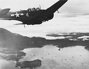
The Battle of Hollandia (code-named Operation Reckless) was an engagement between Allies of World War II and Japanese forces during World War II. The majority of the Allied force was provided by the United States, with the bulk of two United States Army infantry divisions being committed on the ground. Air and naval support consisted largely of U.S. assets, although Australia also provided air support during preliminary operations and a naval bombardment force. The battle took place between 22 April and 6 June 1944 and formed part of the New Guinea campaign.
Roman Catholic Diocese of Jayapura
Roman Catholic diocese in Papua, Indonesia
Distance: Approx. 2620 meters
Latitude and longitude: -2.51666667,140.71666667
The Roman Catholic Diocese of Jayapura (Latin: Iayapuraen(sis)) is a diocese located in the city of Jayapura in the ecclesiastical province of Merauke in Indonesia.

Youtefa Bridge
Bridge in Jayapura, Indonesia
Distance: Approx. 7027 meters
Latitude and longitude: -2.595,140.71333333
Youtefa Bridge (previously Holtekamp Bridge) is a steel arch type bridge over Youtefa Bay, Jayapura, Papua, Indonesia that connects Holtekamp in Muara Tami District with Hamadi in Jayapura Selatan District. The bridge cut the distance and travel time from Jayapura city center to Muara Tami District as well as Skouw State Border Post at Indonesia–Papua New Guinea border.

Naval Base Hollandia
World War 2 base in New Guinea
Distance: Approx. 1197 meters
Latitude and longitude: -2.541432,140.707047
Naval Base Hollandia was a United States Navy base built during World War II at Humboldt Bay, near the city of Hollandia (now Jayapura) in New Guinea. The base was built by the US Navy Seabees during the Battle of Hollandia, starting on May 9, 1944. Later Naval Base Hollandia became a supply base to support the invasion of the Philippines that started on October 20, 1944.
Weather in this IP's area
overcast clouds
24 Celsius
24 Celsius
24 Celsius
24 Celsius
1011 hPa
91 %
1011 hPa
991 hPa
10000 meters
1.82 m/s
1.98 m/s
191 degree
100 %