103.93.63.0 - IP Lookup: Free IP Address Lookup, Postal Code Lookup, IP Location Lookup, IP ASN, Public IP
Country:
Region:
City:
Location:
Time Zone:
Postal Code:
IP information under different IP Channel
ip-api
Country
Region
City
ASN
Time Zone
ISP
Blacklist
Proxy
Latitude
Longitude
Postal
Route
Luminati
Country
ASN
Time Zone
Asia/Tokyo
ISP
SHONAN CABLE NETWORK
Latitude
Longitude
Postal
IPinfo
Country
Region
City
ASN
Time Zone
ISP
Blacklist
Proxy
Latitude
Longitude
Postal
Route
IP2Location
103.93.63.0Country
Region
kanagawa
City
hiratsuka
Time Zone
Asia/Tokyo
ISP
Language
User-Agent
Latitude
Longitude
Postal
db-ip
Country
Region
City
ASN
Time Zone
ISP
Blacklist
Proxy
Latitude
Longitude
Postal
Route
ipdata
Country
Region
City
ASN
Time Zone
ISP
Blacklist
Proxy
Latitude
Longitude
Postal
Route
Popular places and events near this IP address

Hiratsuka
Special city in Kantō, Japan
Distance: Approx. 37 meters
Latitude and longitude: 35.31666667,139.35
Hiratsuka (平塚市, Hiratsuka-shi) is a city in Kanagawa Prefecture, Japan. As of 1 April 2021, the city had an estimated population of 257,316 and a population density of 3800 persons per km². The total area of the city is 67.88 square kilometres (26.21 sq mi).
Ōiso
Town in Kantō, Japan
Distance: Approx. 3508 meters
Latitude and longitude: 35.30861111,139.31277778
Ōiso (大磯町, Ōiso-machi) is a town located in Kanagawa Prefecture, Japan. As of 1 January 2023, the town had an estimated population of 31,262 and a population density of 1820 persons per km². The total area of the town is 17.18 square kilometres (6.63 sq mi).

Hiratsuka Station
Railway station in Hiratsuka, Kanagawa Prefecture, Japan
Distance: Approx. 1213 meters
Latitude and longitude: 35.32788889,139.35058333
Hiratsuka Station (平塚駅, Hiratsuka-eki) is a passenger railway station located in the city of Hiratsuka, Kanagawa Prefecture, Japan, operated by East Japan Railway Company (JR East).

Ōiso Station
Railway station in Ōiso, Kanagawa Prefecture, Japan
Distance: Approx. 3377 meters
Latitude and longitude: 35.31122222,139.3135
Ōiso Station (大磯駅, Ōiso-eki) is a passenger railway station located in the town of Ōiso, Kanagawa Prefecture, Japan, operated by the East Japan Railway Company (JR East).

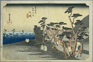
Ōiso-juku
Eighth of the 53 stations of the Tōkaidō in Japan
Distance: Approx. 3282 meters
Latitude and longitude: 35.30907,139.3152
Ōiso-juku (大磯宿, Ōiso-juku) was the eighth of the fifty-three stations (shukuba) of the Tōkaidō. It is located in the present-day town of Ōiso, located in Naka District, Kanagawa Prefecture, Japan.

Sagami River
River in Kanagawa and Yamanashi, Japan
Distance: Approx. 1760 meters
Latitude and longitude: 35.315168,139.36925
The Sagami River (相模川, Sagamigawa) is a river in Kanagawa and Yamanashi Prefectures on the island of Honshū, Japan. The upper reaches of the river in Yamanashi prefecture are also sometimes known as the Katsura River (桂川, Katsuragawa), and the portion near the river mouth as the Banyu River (馬入川, Banyugawa). The river overall was sometimes referred to as the Ayu River (鮎川, Ayugawa) from the sweetfish (ayu) which were once abundant in its waters.

Hiratsuka Navy Ammunitions Arsenal
Distance: Approx. 2149 meters
Latitude and longitude: 35.33611111,139.35333333
The Hiratsuka Naval Ammunitions Arsenal (平塚海軍火薬廠, Hiratsuka Kaigun Kayaku Shō) was the principal manufacturer of gunpowder, explosives, ammunition and artillery shells for the Imperial Japanese Navy. It was located in the town of Ōno (now part of the city of Hiratsuka), Kanagawa Prefecture, Japan.
Nissan Shatai
Japanese automobile contract manufacturer
Distance: Approx. 2310 meters
Latitude and longitude: 35.3371378,139.3561455
Nissan Shatai Co., Ltd. is a Japanese automobile contract manufacturer for Nissan that is headquartered in Hiratsuka, Kanagawa. Its direct history began in 1949.

Elizabeth Saunders Home
Orphanage school in Japan
Distance: Approx. 3375 meters
Latitude and longitude: 35.30888889,139.31419444
Elizabeth Saunders Home (エリザベス・サンダースホーム) is a Christian orphanage located in the town of Oiso in Kanagawa Prefecture, Japan.
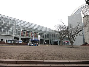
Hiratsuka Museum of Art
Building in Kanagawa Prefecture, Japan
Distance: Approx. 2357 meters
Latitude and longitude: 35.338079,139.347595
The Hiratsuka Museum of Art (平塚市美術館, Hiratsuka-shi bijutsukan) opened in 1991 in Hiratsuka, Kanagawa Prefecture, Japan. The collection of approximately twelve thousand objects has a particular focus on the Shōnan area.
Tokkei Security Hiratsuka General Gymnasium
Distance: Approx. 2918 meters
Latitude and longitude: 35.34152778,139.33866667
Tokkei Security Hiratsuka General Gymnasium is an arena in Hiratsuka, Kanagawa, Japan. This is an anime spot based on Slam Dunk (manga).

Shigitatsu-an
Distance: Approx. 3377 meters
Latitude and longitude: 35.31122222,139.3135
Shigitatsu-an (Japanese: 鴫立庵) is a haikai dojo (Japanese: 俳諧道場) in Ōiso, Kanagawa, Japan, where people learn haiku poetry from the master there or from each other. It is one of the three important such dojo, the other two being Rakushi-sha (落柿舎) in Sagano, Kyoto, and Mumei-an (無名庵) in Ōtsu, Shiga. Shigitasu-an was built in 1664 by Sōsetsu (崇雪) as a humble hut on the rivulet, Shigitatsu-sawa, Ōiso, where the 12th century waka poet, monk Saigyō, was said to write one of his most famous poems which was later included in the Shin Kokin Wakashū: In 1694, Michikaze Ōyodo (大淀三千風) became the master at Shigitatsu-an.
Weather in this IP's area
overcast clouds
10 Celsius
8 Celsius
9 Celsius
11 Celsius
1020 hPa
37 %
1020 hPa
1019 hPa
10000 meters
2.62 m/s
3.04 m/s
136 degree
98 %


