Country:
Region:
City:
Latitude and Longitude:
Time Zone:
Postal Code:
IP information under different IP Channel
ip-api
Country
Region
City
ASN
Time Zone
ISP
Blacklist
Proxy
Latitude
Longitude
Postal
Route
Luminati
Country
ASN
Time Zone
Asia/Kolkata
ISP
Sash Broadband Private Limited
Latitude
Longitude
Postal
IPinfo
Country
Region
City
ASN
Time Zone
ISP
Blacklist
Proxy
Latitude
Longitude
Postal
Route
db-ip
Country
Region
City
ASN
Time Zone
ISP
Blacklist
Proxy
Latitude
Longitude
Postal
Route
ipdata
Country
Region
City
ASN
Time Zone
ISP
Blacklist
Proxy
Latitude
Longitude
Postal
Route
Popular places and events near this IP address

Porur
Neighborhood in Chennai, India
Distance: Approx. 609 meters
Latitude and longitude: 13.0382,80.1565
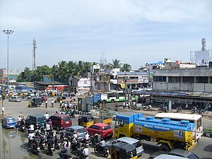
Porur (Tamil: [poːɾuːɾ]) is a neighbourhood of Chennai, India. It is situated in the Maduravoyal taluk of Chennai district in the southern part of the city. Since 2011, it has been a part of the Chennai Corporation and included in zone number 11.

Sri Ramachandra Institute of Higher Education and Research
Private medical institution in Chennai, India
Distance: Approx. 1406 meters
Latitude and longitude: 13.0395,80.1427
Sri Ramachandra Institute of Higher Education and Research (SRIHER), formerly Sri Ramachandra University and Sri Ramachandra Medical College and Research Institute, is a private institute located in Porur, Chennai, India. SRIHER consists of nine constituent colleges and faculties with more than 6,000 students. SRIHER was founded by Sri Ramachandra Education & Health Trust on September 11, 1985, by N. P. V. Ramasamy Udayar.
Karambakkam
Neighbourhood in Chennai, Tamil Nadu, India
Distance: Approx. 1343 meters
Latitude and longitude: 13.04277778,80.16166667
Karambakkam is a census town in Chennai district in the Indian state of Tamil Nadu. Recently buildings along Arcot road located at Karambakkam were demolished to provide space for the Chennai metro project.
Iyyapanthangal
Neighbourhood of Chennai, India
Distance: Approx. 2111 meters
Latitude and longitude: 13.03796,80.13513
Iyyappanthangal is a neighborhood to the west of Chennai, Tamilnadu, India. It comes under Mangadu Municipality of Chennai Metropolitan Area (CMA), governed by CMDA. It is located 20 kilometres (12 mi) away from Fort St George on the Mount-Poonamallee Road. The nearest railway stations are at Guindy (Chennai South Line) about 11 kilometres (6.8 mi) away and Avadi (Chennai West Line) about 12 kilometres (7.5 mi) away.
Mugalivakkam
Neighbourhood in Kanchipuram District, Tamil Nadu, India
Distance: Approx. 1587 meters
Latitude and longitude: 13.021,80.1614
Mugalivakkam is a neighbourhood of Chennai. It is located in Sriperumbudur taluk of Kanchipuram district, in Tamil Nadu. It is situated 16 km south-west of Chennai on the Mount-Poonamallee Road.
Alapakkam
Neighbourhood in Chennai, Tamil Nadu, India
Distance: Approx. 2266 meters
Latitude and longitude: 13.049,80.1673
Alapakkam (Tamil: [aːlappaːkkam]) is a neighbourhood in western part of Central Chennai. It belongs to Central Chennai Revenue Division of Chennai district. It is surrounded by Porur, Valasaravakkam and Maduravoyal.

Porur Lake
Lake in south-west Chennai, India
Distance: Approx. 378 meters
Latitude and longitude: 13.034223,80.15065
Porur Lake is located on the fringes of the Porur neighbourhood in south-west Chennai and is a primary water resource for the residents of Chennai. It is a temporary catchment area connected with Chembarambakkam Lake. It is spread over 200 acres with a capacity of 46 million cubic feet (mcft).
Moulivakkam
Neighbourhood in Kancheepuram, Tamil Nadu, India
Distance: Approx. 1683 meters
Latitude and longitude: 13.0215,80.1443
Moulivakkam is a neighbourhood of Chennai. It is situated 18 km south-west of Chennai on the Arcot Road. It comes under Mangadu municipality and is bounded by Porur on the north, Kolappakkam on the south, Mugalivakkam on the east and Manapakkam on the south-east directions.
Sri Ramachandra Medical Centre
Hospital in Tamil Nadu , India
Distance: Approx. 1136 meters
Latitude and longitude: 13.037814,80.144607
Sri Ramachandra Medical Centre (SRMC) is a tertiary care multi-specialty university hospital in Chennai, India. With over 1,500 beds, 114 ICU beds, 25 operating rooms, and a campus spread over 175 acres (71 ha), SRMC is one of the largest private health care facilities in South Asia. It is located in the suburb of Porur.
2014 Chennai building collapse
Incident of building collapse
Distance: Approx. 1728 meters
Latitude and longitude: 13.02137778,80.14379722
On 28 June 2014, an eleven-storey apartment block collapsed while under construction at Moulivakkam in the suburb of Chennai, Tamil Nadu, India. The cause was determined to be a lightning strike to exposed metal at the top, which was conducted through the building and to ground via reinforcement bars embedded in the concrete, which led to failure of support columns and subsequent collapse of the structure. The collapse killed 61 people, mostly construction workers who were trapped in the debris.
Adayalampattu
Locality in India
Distance: Approx. 2257 meters
Latitude and longitude: 13.05194444,80.14583333
Adayalampattu is a locality in the Thiruvallur district of Tamil Nadu, India, situated within the Poonamallee Tehsil. It is a suburban neighbourhood, part of the Chennai metropolitan area. It is known for its residential properties and is in proximity to other areas like Vanagaram and Porur.
Porur Ramanatheswarar Temple
Hindu temple in Chennai, India
Distance: Approx. 308 meters
Latitude and longitude: 13.03083333,80.15527778
Porur Ramanatheswarar Temple is a Hindu temple dedicated to Shiva, located in the neighbourhood of Porur in Chennai, India. The temple was built in the 8th century CE during the Chola period. The temple is one of the nine Navagraha temples of the Tondai Mandalam and is known as the Guru sthala (lit.
Weather in this IP's area
mist
29 Celsius
35 Celsius
29 Celsius
30 Celsius
1013 hPa
77 %
1013 hPa
1011 hPa
5000 meters
5.14 m/s
20 degree
40 %
06:04:44
17:41:18