Country:
Region:
City:
Latitude and Longitude:
Time Zone:
Postal Code:
IP information under different IP Channel
ip-api
Country
Region
City
ASN
Time Zone
ISP
Blacklist
Proxy
Latitude
Longitude
Postal
Route
Luminati
Country
Region
sa
ASN
Time Zone
Australia/Adelaide
ISP
Caznet
Latitude
Longitude
Postal
IPinfo
Country
Region
City
ASN
Time Zone
ISP
Blacklist
Proxy
Latitude
Longitude
Postal
Route
db-ip
Country
Region
City
ASN
Time Zone
ISP
Blacklist
Proxy
Latitude
Longitude
Postal
Route
ipdata
Country
Region
City
ASN
Time Zone
ISP
Blacklist
Proxy
Latitude
Longitude
Postal
Route
Popular places and events near this IP address

Keswick railway station, Adelaide
Former railway station in Adelaide, South Australia
Distance: Approx. 986 meters
Latitude and longitude: -34.9413786,138.5827999
Keswick railway station was a station on the Adelaide-Wolseley line and served by Adelaide Metro Belair, Noarlunga and Tonsley line services. It was located in the inner western Adelaide suburb of Keswick, 3.8 kilometres from Adelaide station.

Adelaide Parklands Terminal
Railway station in Adelaide, South Australia
Distance: Approx. 889 meters
Latitude and longitude: -34.93805556,138.58111111
Adelaide Parklands Terminal, formerly known as Keswick Terminal, is the interstate passenger railway station in Adelaide, South Australia. It is the only station in the world where passengers can board trains on both north–south and east–west transcontinental routes. The terminal is north of the suburb of Keswick, 3 kilometres (1.9 miles) by road south-west of the city centre, and adjoins the south-western sector of the West Parklands.
Keswick, South Australia
Suburb of Adelaide, South Australia
Distance: Approx. 973 meters
Latitude and longitude: -34.93333333,138.56666667
Keswick() is an inner south-western suburb of Adelaide, adjacent to the park lands, and located in the City of West Torrens. The suburb is home to the Keswick Barracks, the headquarters of the Royal District Nursing Service, the Keswick Cricket Club and Richmond Primary School. The Adelaide Parklands Terminal for interstate passenger trains, formerly known as Keswick Terminal, was within the boundary of the suburb until 1987 when, inclusive of adjacent business sites and covering a total area of 56.6 hectares (140 acres), it was declared a suburb in its own right.

Ashford, South Australia
Suburb of Adelaide, South Australia
Distance: Approx. 920 meters
Latitude and longitude: -34.949,138.574
Ashford is an inner southwestern suburb of Adelaide, in the City of West Torrens. It is triangular in shape and bordered by South Road (west), Anzac Highway (southeast) and Everard Avenue (north). Two of the main features of the suburb are Ashford Hospital and Ashford Special School.

Mile End South, South Australia
Suburb of Adelaide, South Australia
Distance: Approx. 336 meters
Latitude and longitude: -34.938,138.571
Mile End South, a suburb of Adelaide, South Australia, is in City of West Torrens. The name, denoting an area south of Mile End, was in use as early as 1913, but was only formally adopted by the state's nomenclature committee in 1944.

Richmond Oval (South Australia)
Australian rules football oval
Distance: Approx. 529 meters
Latitude and longitude: -34.93722222,138.56833333
Richmond Oval (also known as Hisense Stadium due to naming rights) is an Australian rules football oval in Richmond, a western suburb of Adelaide, South Australia. It has been the home of South Australian National Football League (SANFL) club West Adelaide for training since 1956 and home games since 1958.
Apollo Stadium
Former multi-purpose hall in Richmond, Australia
Distance: Approx. 668 meters
Latitude and longitude: -34.93916667,138.565
Apollo Stadium (officially called the Apollo Entertainment Centre) was a multi-purpose indoor arena located at 41 Kingston Avenue, Richmond, South Australia, just 5 minutes from the Adelaide city centre. The stadium had an original seating capacity of 4,000 until the early 1980s when the bench seats were replaced by individual plastic seats giving a reduced seating capacity of 3,000 and an overall capacity of just 3,500. Opened in 1969, the stadium was named for the Apollo Moon landing of the same year.
Ashford Hospital, Adelaide
Hospital in South Australia, Australia
Distance: Approx. 992 meters
Latitude and longitude: -34.9487,138.57726389
Ashford Hospital is a 239-bed private, not-for-profit hospital on the Anzac Highway in the suburb of Ashford, five kilometers from the CBD. It provides acute (including emergency) and maternity care.

4th Military District (Australia)
Military district of Australia
Distance: Approx. 1071 meters
Latitude and longitude: -34.94609,138.58189
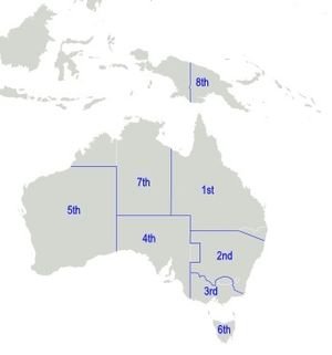
The 4th Military District was an administrative district of the Australian Army. During the Second World War, the 4th Military District covered all of South Australia, with its headquarters at Adelaide. Around the start of the Second World War, the 4th Military District became part of Southern Command, along with the 3rd and 6th Military Districts in Victoria and Tasmania.

Adelaide Showground railway station
Railway station in Adelaide, South Australia
Distance: Approx. 986 meters
Latitude and longitude: -34.9413786,138.5827999
Adelaide Showground railway station is located on the Belair, Flinders and Seaford lines, and is located in the inner western Adelaide suburb of Keswick. It is four kilometres from Adelaide station, and replaced Keswick station and the temporary Showground Central station.

Headquarters Building, Keswick Barracks
Heritage-listed military building in Adelaide, South Australia
Distance: Approx. 1002 meters
Latitude and longitude: -34.9438,138.5824
Headquarters Building (Building 32) is a heritage-listed office building at Keswick Barracks, Anzac Highway, Keswick, South Australia, Australia. It was added to the Australian Commonwealth Heritage List on 22 June 2004 and the former Register of the National Estate on 28 September 1982.
Keswick Bridge
Bridge in Keswick Terminal and Wayville
Distance: Approx. 928 meters
Latitude and longitude: -34.943685,138.581594
The Keswick Bridge carries the Anzac Highway over the Adelaide-Wolseley railway line in Adelaide, Australia.
Weather in this IP's area
scattered clouds
18 Celsius
17 Celsius
16 Celsius
19 Celsius
1024 hPa
53 %
1024 hPa
1021 hPa
10000 meters
5.66 m/s
220 degree
40 %
06:00:09
20:01:53