103.90.208.81 - IP Lookup: Free IP Address Lookup, Postal Code Lookup, IP Location Lookup, IP ASN, Public IP
Country:
Region:
City:
Location:
Time Zone:
Postal Code:
IP information under different IP Channel
ip-api
Country
Region
City
ASN
Time Zone
ISP
Blacklist
Proxy
Latitude
Longitude
Postal
Route
Luminati
Country
Region
nsw
City
sydney
ASN
Time Zone
Australia/Sydney
ISP
Australian Academic and Research Network AARNet
Latitude
Longitude
Postal
IPinfo
Country
Region
City
ASN
Time Zone
ISP
Blacklist
Proxy
Latitude
Longitude
Postal
Route
IP2Location
103.90.208.81Country
Region
new south wales
City
hurstville
Time Zone
Australia/Sydney
ISP
Language
User-Agent
Latitude
Longitude
Postal
db-ip
Country
Region
City
ASN
Time Zone
ISP
Blacklist
Proxy
Latitude
Longitude
Postal
Route
ipdata
Country
Region
City
ASN
Time Zone
ISP
Blacklist
Proxy
Latitude
Longitude
Postal
Route
Popular places and events near this IP address
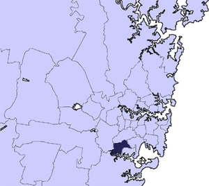
Hurstville, New South Wales
Suburb of Sydney, New South Wales, Australia
Distance: Approx. 404 meters
Latitude and longitude: -33.96811,151.10408
Hurstville is a suburb in Southern Sydney, New South Wales, Australia. It is 16 km (9.9 mi) south of the Sydney CBD and is part of the St George area. Hurstville is the administrative centre of the local government area of the Georges River Council.

Hurstville railway station
Railway station in Sydney, New South Wales, Australia
Distance: Approx. 222 meters
Latitude and longitude: -33.967259,151.102368
Hurstville railway station is located on the Illawarra line, serving the Sydney suburb of Hurstville. It is served by Sydney Trains' T4 Eastern Suburbs & Illawarra Line services and NSW TrainLink's South Coast Line services.

City of Hurstville
Former local government area in New South Wales, Australia
Distance: Approx. 12 meters
Latitude and longitude: -33.96666667,151.1
The City of Hurstville was a local government area in the St George and southern region of Sydney, New South Wales, Australia. The city seat of Hurstville is located 17 kilometres (11 mi) south–west of Sydney and west of Botany Bay. Hurstville was incorporated as a municipality in 1887, declared a city in 1988, and abolished in 2016, forming with Kogarah City Council the new Georges River Council.
Penshurst, New South Wales
Suburb of Sydney, New South Wales, Australia
Distance: Approx. 485 meters
Latitude and longitude: -33.96555556,151.095
Penshurst () is a suburb in southern Sydney, in the state of New South Wales, Australia. Penshurst is located 17 kilometres south of the Sydney central business district and is part of the St George area. Penshurst features low to medium-density housing.
Danebank
School in Australia
Distance: Approx. 538 meters
Latitude and longitude: -33.9622,151.1025
Danebank, officially Danebank An Anglican School for Girls, is an independent Anglican early learning, primary and secondary day school for girls, located in Hurstville, a southern suburb of Sydney, Australia. It is a member school of the Anglican Schools Corporation. Established in 1933 by Edith Roseby Ball, Danebank has a non-selective enrolment policy and currently caters for approximately 930 students from Preschool to Year 12.

Hurstville Oval
Sports ground in Sydney, Australia
Distance: Approx. 618 meters
Latitude and longitude: -33.9611,151.0992
Hurstville Oval is a multi-use sporting ground, located in the suburb of Hurstville, in Sydney's southern suburbs. Since its opening, it has held various sports at the venue – including Cricket, Rugby League, Cycling and Football. The oval also has a velodrome in the grounds, between the field and the stands.
Sydney Anglican Schools Corporation
School in Hurstville, New South Wales, Australia
Distance: Approx. 318 meters
Latitude and longitude: -33.96472222,151.0975
The Anglican Schools Corporation (TASC) is an independent, co-educational, school system established by the Anglican Church Diocese of Sydney headquartered in Hurstville, New South Wales, Australia. The number of schools in The Anglican Schools Corporation group has increased from five in 1995 to twenty in 2016. The initial objective was to establish one new school per year.

Hurstville Central
Shopping mall in New South Wales, Australia
Distance: Approx. 268 meters
Latitude and longitude: -33.967328,151.102867
Hurstville Central (originally named Hurstville Super Centre) is a shopping centre in the suburb of Hurstville in the St George area of Sydney and is located above Hurstville railway station and features a Coles supermarket and around 39 speciality stores.

Westfield Hurstville
Shopping mall in New South Wales, Australia
Distance: Approx. 465 meters
Latitude and longitude: -33.9661,151.1051
Westfield Hurstville is a shopping centre in the suburb of Hurstville in the St George area of Sydney, Australia.

West Maling
Historic site in New South Wales, Australia
Distance: Approx. 528 meters
Latitude and longitude: -33.9662,151.0944
West Maling is a heritage-listed former residence and now ecclesiastical centre and administration building located at 663-665 King Georges Road, Penshurst, Georges River Council, New South Wales, Australia. Its design is attributed to Richard Norman Shaw who is likely to have influenced its design, and built by Charles Halstead the supervising architect. It is also known as West Maling (Revival Life Centre) and Weigall House.

Penshurst Reservoirs
Historic site in New South Wales, Australia
Distance: Approx. 787 meters
Latitude and longitude: -33.9671,151.0916
The Penshurst Reservoirs are heritage-listed reservoirs located at Laycock Road, Penshurst in the Georges River Council local government area of New South Wales, Australia. They were designed and built during 1895 by the NSW Public Works Department. The reservoirs are also known as WS87 & R88, Penshurst Elevated Steel Reservoir No 2 and Penshurst Elevated Concrete Reservoir No 3.

St George County Council
Former electricity supply utility, in New South Wales, Australia
Distance: Approx. 337 meters
Latitude and longitude: -33.9675,151.10358333
St George County Council was a publicly owned electricity supply utility in the St George area of southern Sydney, Australia. It supplied electricity to consumers in the Kogarah, Hurstville, Rockdale and Bexley Municipalities (Bexley merged with Rockdale in 1949). It existed, from December 1920, until 1980 when its operations and assets, and those of Mackellar Country Council and Brisbane Water County Council, were merged into the existing Sydney County Council.
Weather in this IP's area
few clouds
21 Celsius
21 Celsius
20 Celsius
23 Celsius
1010 hPa
66 %
1010 hPa
1004 hPa
10000 meters
5.66 m/s
120 degree
20 %

