103.89.158.22 - IP Lookup: Free IP Address Lookup, Postal Code Lookup, IP Location Lookup, IP ASN, Public IP
Country:
Region:
City:
Location:
Time Zone:
Postal Code:
ISP:
ASN:
language:
User-Agent:
Proxy IP:
Blacklist:
IP information under different IP Channel
ip-api
Country
Region
City
ASN
Time Zone
ISP
Blacklist
Proxy
Latitude
Longitude
Postal
Route
db-ip
Country
Region
City
ASN
Time Zone
ISP
Blacklist
Proxy
Latitude
Longitude
Postal
Route
IPinfo
Country
Region
City
ASN
Time Zone
ISP
Blacklist
Proxy
Latitude
Longitude
Postal
Route
IP2Location
103.89.158.22Country
Region
gandaki
City
chame
Time Zone
Asia/Kathmandu
ISP
Language
User-Agent
Latitude
Longitude
Postal
ipdata
Country
Region
City
ASN
Time Zone
ISP
Blacklist
Proxy
Latitude
Longitude
Postal
Route
Popular places and events near this IP address

Manang District, Nepal
District in Gandaki Pradesh, Nepal
Distance: Approx. 1013 meters
Latitude and longitude: 28.55194444,84.24083333
Manang District (Nepali: मनाङ जिल्ला , in Gandaki Province, is one of the seventy-seven districts of Nepal. The district, with Chame as its district headquarters, covers an area of 2,246 km2 (867 sq mi) and in 2011 had a population of 6,538. The Thorung La pass, at 5,415 meters above sea level, connects the district with Mustang district by providing a route between the towns of Manang and Muktinath.
Lekhnath
Former Municipality in Gandaki Province, Nepal
Distance: Approx. 7786 meters
Latitude and longitude: 28.5,84.2
Lekhnath (Nepali: लेखनाथ नगरपालिका) was a municipality in Kaski District in the Gandaki Province of northern-central Nepal, about 180 km west of Kathmandu. It has now been merged into Pokhara sub-metropolitan city to form Pokhara metropolis. Pokhara Valley was politically divided between Pokhara city and Lekhnath which occupied the eastern half of the valley.

Chame Rural Municipality
Municipality in Gandaki Zone, Nepal
Distance: Approx. 1013 meters
Latitude and longitude: 28.55194444,84.24083333
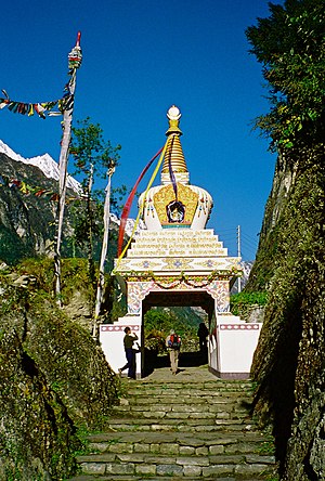
Chame (Nepali: चाँमे) is the headquarters of Manang District in the Gandaki Zone of northern Nepal. Chame village is located in Ward no. 2 of Chame village development committee, about 230 km from Kathmandu.

Bagarchhap
Village development committee in Gandaki Zone, Nepal
Distance: Approx. 8836 meters
Latitude and longitude: 28.53333333,84.33833333
Bagarchhap is a village development committee in Manang District in the Gandaki Zone of northern Nepal. At the time of the 1991 Nepal census it had a population of 534 people living in 116 individual households. On 10 November 1995 most of Bagarchap (around 80%) was destroyed by a landslide, which killed 11 villagers and 9 trekkers.
Tachi Bagarchhap
Village development committee in Gandaki Zone, Nepal
Distance: Approx. 6267 meters
Latitude and longitude: 28.59,84.3
Tachi Bagarchhap is a village development committee in Manang District in the Gandaki Zone of northern Nepal. At the time of the 2011 Nepal census it had a population of 544.
Rainas
Municipality in Gandaki, Nepal
Distance: Approx. 8681 meters
Latitude and longitude: 28.48,84.28
Rainas (Nepali: राइनास) is a municipality of Lamjung District in Gandaki Province of central Nepal. The municipality was declared on 19 September 2015 by merging the existing six VDCs of Eastern Lamjung, Tarkughat, Dhamilikuwa, Chakratirtha, Bhalayakharka, Pyarjung and Mohoriyakot having a total of 73 square km area. The center of this municipality has been established in Tinpiple of Chakratirth VDC. Rainas has a total population of 18,527 and population density of 254 person/km2 according to 2011 Nepal census.

Paungda Danda
Mountain
Distance: Approx. 4818 meters
Latitude and longitude: 28.58611111,84.21833333
Paungda Danda is a Himalayan mountain located in Manang District, Western Region, Nepal. The mountain is not significantly prominent, and is a subsidiary peak to the southeast of Pisang Peak. Paungda Danda is notable for its western rock face that rises dramatically 1,700 m (5,600 ft) above the Marshyangdi River.
Kajin Sara Lake
Lake in Manang district, Nepal
Distance: Approx. 6347 meters
Latitude and longitude: 28.49686111,84.25616667
Kajin Sara is a lake in the Manang district of Nepal.
Weather in this IP's area
clear sky
2 Celsius
-3 Celsius
2 Celsius
2 Celsius
1025 hPa
27 %
1025 hPa
598 hPa
10000 meters
5.62 m/s
4.71 m/s
349 degree
1 %