Country:
Region:
City:
Latitude and Longitude:
Time Zone:
Postal Code:
IP information under different IP Channel
ip-api
Country
Region
City
ASN
Time Zone
ISP
Blacklist
Proxy
Latitude
Longitude
Postal
Route
Luminati
Country
ASN
Time Zone
Asia/Dhaka
ISP
Sorob IT LTD
Latitude
Longitude
Postal
IPinfo
Country
Region
City
ASN
Time Zone
ISP
Blacklist
Proxy
Latitude
Longitude
Postal
Route
db-ip
Country
Region
City
ASN
Time Zone
ISP
Blacklist
Proxy
Latitude
Longitude
Postal
Route
ipdata
Country
Region
City
ASN
Time Zone
ISP
Blacklist
Proxy
Latitude
Longitude
Postal
Route
Popular places and events near this IP address

Mohakhali
Major neighbourhood of Dhaka
Distance: Approx. 885 meters
Latitude and longitude: 23.777264,90.403492
Mohakhali (Bengali: মহাখালী) is a neighborhood of Dhaka city, the capital of Bangladesh. Mohakhali is one of the busiest places in Dhaka city. Mohakhali is bounded by Banani in the north and Tejgoan area in the south while Gulshan and Niketan is in the east and Mohakhali DOHS to the west.

Ahsanullah University of Science and Technology
University in Dhaka, Bangladesh
Distance: Approx. 831 meters
Latitude and longitude: 23.76361111,90.40694444
Ahsanullah University of Science and Technology (Bengali: আহ্ছানউল্লা বিজ্ঞান ও প্রযুক্তি বিশ্ববিদ্যালয়), commonly known as AUST, is a private (science and technology) university in Bangladesh. It was founded by the Dhaka Ahsania Mission in 1995. Dhaka Ahsania Mission is a non-profit voluntary organization in Bangladesh.
Southeast University (Bangladesh)
Private University in Dhaka, Bangladesh
Distance: Approx. 419 meters
Latitude and longitude: 23.7692668,90.4049922
Southeast University (Bengali: সাউথইস্ট বিশ্ববিদ্যালয়) is a private university in Tejgaon, Dhaka, Bangladesh. The university was established in 2002. SEU ranked 10th among Top Private universities in Dhaka Tribune's Private University Ranking 2019.

National Institute of Cancer Research and Hospital
Healthcare organization and hospital in Dhaka, Bangladesh
Distance: Approx. 826 meters
Latitude and longitude: 23.7783,90.4093
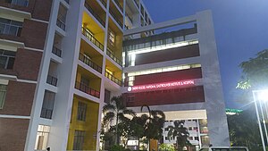
National Institute of Cancer Research & Hospital (NICRH) (Bengali: জাতীয় ক্যান্সার গবেষণা ইনস্টিটিউট ও হাসপাতাল) is dedicated to cancer patient management, education and research. This is the only tertiary level center of the country engaged in multidisciplinary cancer patient management. It started its activity in a tin-shade building of Dhaka Medical College and Hospital in 1982, soon it is shifted to the present location at Mohakhali in 1986.

National Institute of Diseases of the Chest and Hospital
Research institute in Dhaka, Bangladesh
Distance: Approx. 746 meters
Latitude and longitude: 23.7776,90.409
National Institute of Diseases of the Chest and Hospital (NIDCH) (Bengali: জাতীয় বক্ষব্যাধি ইনস্টিটিউট ও হাসপাতাল) is a state supported research institute and hospital in Bangladesh. It was established in 1955 as TB Hospital. In 1962 it was upgraded as National Chest Diseases Institute.

Mohakhali Inter District Bus Terminal
Bus Station in Mohakhali
Distance: Approx. 782 meters
Latitude and longitude: 23.77295278,90.40136111
Mohakhali Inter District Bus Terminal or Mohakhali Bus Terminal is one of three main inter-city bus stations in Dhaka, opened in 1984. Located in the Mohakhali neighbourhood, it primarily serves destinations in northern Bangladesh, including Tangail, Mymensingh, Netrokona, Jamalpur, Sherpur, Kishoreganj and Bogura. Renovations to the terminal were completed in 2005.

National Institute of Ear, Nose and Throat (Bangladesh)
Hospital in Tejgaon, Bangladesh
Distance: Approx. 907 meters
Latitude and longitude: 23.7633,90.4055
The National Institute of ENT (Ear, Nose and Throat) is a specialized hospital and training center in ear, nose and throat (Otorhinolaryngology) diseases located in Tejgaon, Dhaka, Bangladesh.

Tejgaon Industrial Area Thana
Thana in Dhaka North City Corporation, Bangladesh
Distance: Approx. 810 meters
Latitude and longitude: 23.76418,90.40566
Tejgaon Industrial Area Thana is a Thana of Dhaka District in the Division of Dhaka, Bangladesh that was formed in 2006.
Shanta Pinnacle
A 40-floor skyscraper in Dhaka, Bangladesh
Distance: Approx. 139 meters
Latitude and longitude: 23.7703,90.4075
Shanta Pinnacle (Bengali: শান্তা পিন্যাকেল) is a 152.3 m (500 ft) 40-floor commercial skyscraper in Tejgaon, Dhaka, which is currently under construction. Upon completion, The Pinnacle is set to be the second tallest building in the city, and its first 40-floor building. The tower was approved for construction in September 2018, and is scheduled to be completed by December 2026.

Niketan
Upscale Residential neighbourhood in Dhaka
Distance: Approx. 531 meters
Latitude and longitude: 23.774594,90.412003
Niketan or Niketon (Bengali: নিকেতন, romanised: Niketon) also known as Niketan Residential Area, Gulshan or Niketan Housing Society is an upscale residential neighbourhood in Dhaka, Bangladesh. Niketan is also a part of Gulshan Thana and Ward No. 20 of Dhaka North City Corporation.

Shahid Dr. Fazle Rabbi Park
Park in Dhaka, Bangladesh
Distance: Approx. 730 meters
Latitude and longitude: 23.773702,90.415174
Shahid Dr. Fazle Rabbi Park (Bengali: শহীদ ডা. ফজলে রাব্বি পার্ক) or in short Fazle Rabbi Park, is an urban park located in the Gulshan-1, Niketan area of Dhaka, Bangladesh.

National Gastroliver Institute & Hospital
Hospital in Dhaka, Bangladesh
Distance: Approx. 661 meters
Latitude and longitude: 23.776237,90.411543
National Gastroliver Institute & Hospital (Bengali: জাতীয় গ্যাস্ট্রোলিভার ইনস্টিটিউট ও হাসপাতাল) is a state supported research institute and hospital for Gastrointestinal diseases of the Digestive System, Liver, and Pancreas located at Mohakhali, Dhaka, Bangladesh. Previously it was called Sheikh Russel National Gastroliver Institute & Hospital.
Weather in this IP's area
haze
30 Celsius
32 Celsius
30 Celsius
30 Celsius
1015 hPa
58 %
1015 hPa
1014 hPa
4000 meters
1.54 m/s
340 degree
40 %
06:06:39
17:17:14