103.83.32.10 - IP Lookup: Free IP Address Lookup, Postal Code Lookup, IP Location Lookup, IP ASN, Public IP
Country:
Region:
City:
Location:
Time Zone:
Postal Code:
ISP:
ASN:
language:
User-Agent:
Proxy IP:
Blacklist:
IP information under different IP Channel
ip-api
Country
Region
City
ASN
Time Zone
ISP
Blacklist
Proxy
Latitude
Longitude
Postal
Route
db-ip
Country
Region
City
ASN
Time Zone
ISP
Blacklist
Proxy
Latitude
Longitude
Postal
Route
IPinfo
Country
Region
City
ASN
Time Zone
ISP
Blacklist
Proxy
Latitude
Longitude
Postal
Route
IP2Location
103.83.32.10Country
Region
milne bay
City
waigani
Time Zone
Pacific/Port_Moresby
ISP
Language
User-Agent
Latitude
Longitude
Postal
ipdata
Country
Region
City
ASN
Time Zone
ISP
Blacklist
Proxy
Latitude
Longitude
Postal
Route
Popular places and events near this IP address
Gurney Airport
Airport in Milne Bay, Papua New Guinea
Distance: Approx. 9476 meters
Latitude and longitude: -10.31138889,150.33361111
Gurney Airport (IATA: GUR, ICAO: AYGN) is an airport serving Alotau in the Milne Bay Province of Papua New Guinea (PNG). The airport is a single runway general aviation facility. In December 2008, the PNG Minister for Transport and Civil Aviation, Don Polye announced that the aviation company SkyAirWorld had been granted permission to operate direct flights from Cairns, Australia to Gurney.

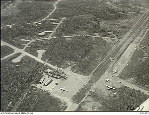
No. 2 Strip Milne Bay
World War 2 base in Papua New Guinea
Distance: Approx. 1852 meters
Latitude and longitude: -10.316667,150.25
No. 2 Strip Milne Bay, (Waigani Airfield), was an aerodrome under construction near Waigani village, Milne Bay, Papua New Guinea during World War II as part of Naval Base Milne Bay. Works at the aerodrome were discontinued due to the site being unsuitable for an aerodrome due to drainage problems.
Huhu Rural LLG
Local-level government in Papua New Guinea
Distance: Approx. 4747 meters
Latitude and longitude: -10.365,150.279
Huhu Rural LLG is a local-level government (LLG) of Milne Bay Province, Papua New Guinea.
Weather in this IP's area
overcast clouds
25 Celsius
26 Celsius
25 Celsius
25 Celsius
1007 hPa
97 %
1007 hPa
969 hPa
10000 meters
1.08 m/s
2.53 m/s
358 degree
100 %
