103.82.97.166 - IP Lookup: Free IP Address Lookup, Postal Code Lookup, IP Location Lookup, IP ASN, Public IP
Country:
Region:
City:
Location:
Time Zone:
Postal Code:
IP information under different IP Channel
ip-api
Country
Region
City
ASN
Time Zone
ISP
Blacklist
Proxy
Latitude
Longitude
Postal
Route
Luminati
Country
Region
mh
City
nanded
ASN
Time Zone
Asia/Kolkata
ISP
Nyak Technologies And Teleservices Pvt Ltd
Latitude
Longitude
Postal
IPinfo
Country
Region
City
ASN
Time Zone
ISP
Blacklist
Proxy
Latitude
Longitude
Postal
Route
IP2Location
103.82.97.166Country
Region
madhya pradesh
City
jabalpur
Time Zone
Asia/Kolkata
ISP
Language
User-Agent
Latitude
Longitude
Postal
db-ip
Country
Region
City
ASN
Time Zone
ISP
Blacklist
Proxy
Latitude
Longitude
Postal
Route
ipdata
Country
Region
City
ASN
Time Zone
ISP
Blacklist
Proxy
Latitude
Longitude
Postal
Route
Popular places and events near this IP address

Jabalpur
City in Madhya Pradesh, India
Distance: Approx. 1716 meters
Latitude and longitude: 23.16666667,79.93333333
Jabalpur, formerly Jubbulpore, is a city situated on the banks of Narmada River in the state of Madhya Pradesh, India. It is the 3rd-largest urban agglomeration of the state and the 38th-largest of the country. Jabalpur is the administrative headquarters of the Jabalpur district and the Jabalpur division.
Madhya Pradesh High Court
Subnational high court in India
Distance: Approx. 1377 meters
Latitude and longitude: 23.16055556,79.93861111
The Madhya Pradesh High Court is the High Court of the state of Madhya Pradesh which is located in Jabalpur. It was established as the Nagpur High Court on 2 January 1936 by Letters Patent dated 2 January 1936, issued under Section 108 the Government of India Act, 1935. This Letters Patent continued in force even after the adoption of the constitution of India on 26 January 1950 by virtue of Articles 225 & 372 thereof.

Jabalpur division
Distance: Approx. 1376 meters
Latitude and longitude: 23.1606,79.9386
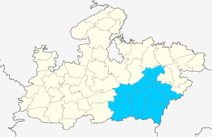
Jabalpur Division is an administrative geographical unit of Madhya Pradesh state of India. Jabalpur is the administrative headquarters of the division. As of 2023, the division consists of districts of Balaghat, Chhindwara, Jabalpur, Katni, Mandla, Narsinghpur, Dindori, Seoni and Pandhurna.

Jabalpur district
District of Madhya Pradesh in India
Distance: Approx. 1294 meters
Latitude and longitude: 23.16,79.94
Jabalpur district (Hindi pronunciation: [d͡ʒəbəlpʊɾ]) is a district of Madhya Pradesh state in central India. The city of Jabalpur is the administrative headquarters of the district. The area of the district is 5,198 km2 with population of 2,463,289 (2011 census).
Jabalpur Lok Sabha constituency
Lok Sabha constituency in Madhya Pradesh
Distance: Approx. 779 meters
Latitude and longitude: 23.16,79.95
Jabalpur is one of the 29 Lok Sabha constituencies in Madhya Pradesh state in central India. This constituency covers the entire Jabalpur district.
Roman Catholic Diocese of Jabalpur
Roman Catholic diocese in Madhya Pradesh, India
Distance: Approx. 1608 meters
Latitude and longitude: 23.1529,79.9535
The Roman Catholic Diocese of Jabalpur (Latin: Iabalpuren(sis)) is a diocese located in the city of Jabalpur in the ecclesiastical province of Bhopal in India.

Jabalpur Junction railway station
Railway station at Jabalpur, Madhya Pradesh, India
Distance: Approx. 274 meters
Latitude and longitude: 23.16472222,79.95111111
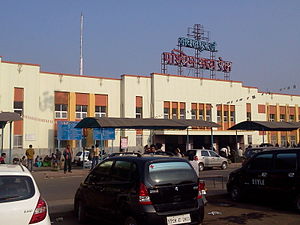
Jabalpur Junction railway station (Station Code: JBP), is an A1 category railway station of Jabalpur City in the Indian state of Madhya Pradesh. Jabalpur is the zonal and divisional headquarters of West Central Railway. It is located on the Mumbai-Prayagraj-Kolkata line.
Rani Durgawati Museum
Museum in Madhya Pradesh, India
Distance: Approx. 1707 meters
Latitude and longitude: 23.163,79.934
Rani Durgawati Museum is a museum in Jabalpur city in Madhya Pradesh state of India. It was established in 1976. It houses a fine collection of sculptures, inscriptions and prehistoric relics.

St. Aloysius Senior Secondary School
Private school in Jabalpur, Madhya Pradesh, India
Distance: Approx. 1469 meters
Latitude and longitude: 23.1541471,79.9533422
St. Aloysius Senior Secondary School is a co-ed catholic school located in the city of Jabalpur, Madhya Pradesh, India. It is affiliated to Central Board of Secondary Education.

Hitkarini Sabha
Indian non-profit organization
Distance: Approx. 1651 meters
Latitude and longitude: 23.166,79.934
Hitkarini Sabha (Hindi: हितकारिणी सभा) is a historic, educational, non-profit organization located in the city of Jabalpur, Madhya Pradesh, India. It is runs some of the oldest academic institutions in the region. It was founded in 1868 by Raj Balwant Rao Kher, Diwan Biharilal Khajanchi and Shri Ambika Charan Banerjee.
Garrison Ground
Distance: Approx. 1336 meters
Latitude and longitude: 23.155,79.95
Garrison Ground is a multi purpose stadium in Jabalpur, Madhya Pradesh. The ground is mainly used for organizing matches of football, cricket and other sports. The stadium has hosted three first-class matches in 1953 when Madhya Pradesh cricket team played against Holkar cricket team.
Jabalpur railway division
Railway division of India
Distance: Approx. 274 meters
Latitude and longitude: 23.16472222,79.95111111
Jabalpur railway division is one of the three railway divisions under West Central Railway zone (WCR) of Indian Railways. This railway division was formed on 1 April 1952 and its headquarters are located at Jabalpur city in the state of Madhya Pradesh of India. It has 107 railway stations under its jurisdiction.
Weather in this IP's area
clear sky
16 Celsius
15 Celsius
16 Celsius
16 Celsius
1019 hPa
61 %
1019 hPa
971 hPa
10000 meters
2.39 m/s
2.47 m/s
72 degree