Country:
Region:
City:
Latitude and Longitude:
Time Zone:
Postal Code:
IP information under different IP Channel
ip-api
Country
Region
City
ASN
Time Zone
ISP
Blacklist
Proxy
Latitude
Longitude
Postal
Route
Luminati
Country
ASN
Time Zone
Asia/Karachi
ISP
Vision telecom Private limited
Latitude
Longitude
Postal
IPinfo
Country
Region
City
ASN
Time Zone
ISP
Blacklist
Proxy
Latitude
Longitude
Postal
Route
db-ip
Country
Region
City
ASN
Time Zone
ISP
Blacklist
Proxy
Latitude
Longitude
Postal
Route
ipdata
Country
Region
City
ASN
Time Zone
ISP
Blacklist
Proxy
Latitude
Longitude
Postal
Route
Popular places and events near this IP address

Gaddafi Stadium
Cricket ground in Lahore, Pakistan
Distance: Approx. 1950 meters
Latitude and longitude: 31.51333333,74.33333333
Gaddafi Stadium (Punjabi, Urdu: قذافی اسٹیڈیم, romanized: Qaẕẕāfī Isṭeḍiyam), previously known as Lahore Stadium, is a cricket stadium in Lahore, Punjab, Pakistan, owned by the Pakistan Cricket Board (PCB). With a capacity of 27,000, it is the fourth largest cricket stadium of Pakistan. It is the home ground of Lahore Qalandars in the Pakistan Super League.

Pakistan Awami Tehreek
Political party in Pakistan
Distance: Approx. 2186 meters
Latitude and longitude: 31.482925,74.3088682
The Pakistan Awami Tehreek commonly known as PAT (Urdu: پاکستان عوامی تحريک) (Pakistan People's Movement) is a political party in Pakistan, founded by Muhammad Tahir-ul-Qadri, took part in general elections in 1990 and 2002.

Punjab Stadium
Distance: Approx. 1658 meters
Latitude and longitude: 31.51083333,74.33194444
The Punjab Stadium is a football stadium in Lahore, Pakistan. It was nicknamed the "Ian Rush Stadium" after the Liverpool striker visited Pakistan to promote grassroots football in the country.
National Hockey Stadium, Lahore
Distance: Approx. 1893 meters
Latitude and longitude: 31.51111111,74.335
National Hockey Stadium is a purpose-built field hockey stadium in Lahore, Pakistan. Located inside the Nishtar Park Sports Complex, it is the biggest terrace field hockey stadium in the world, having a capacity of 45,000 spectators. The offices of Sports Board Punjab and Pakistan Hockey Federation are also located in the stadium compound.
University of Health Sciences, Lahore
Public university in Lahore, Pakistan
Distance: Approx. 1178 meters
Latitude and longitude: 31.5068,74.3098
The University of Health Sciences, Lahore (Punjabi: یونیورسٹی صحتی علوم لہور; Urdu: جامعہ طبی علوم لاہور), commonly referred to as UHS Lahore, is a graduate, affiliating public university located in Lahore, Punjab, Pakistan.
2009 attack on the Sri Lanka national cricket team
Attack on cricket team in Pakistan by terrorists
Distance: Approx. 2270 meters
Latitude and longitude: 31.51055556,74.34027778
The 2009 attack on the Sri Lanka national cricket team occurred on 3 March 2009, when a bus carrying Sri Lankan cricketers, part of a larger convoy, was fired upon by 12 gunmen near Gaddafi Stadium in Lahore, Pakistan. The cricketers were on their way to play the third day of the second Test against the Pakistani cricket team. Six members of the Sri Lanka national cricket team were wounded and six Pakistani policemen and two civilians were killed.
Ace Institute of Health Sciences
Distance: Approx. 1361 meters
Latitude and longitude: 31.4894,74.3131
Ace Institute of Health Sciences (AIHS) is a medical sciences institution in Pakistan. The institute is located in Lahore, and was established in 1999 as the first independent professional health sciences institute in the private sector. The institute consists of five academic departments, an Intermediate college, a tertiary level diagnostic laboratory service, a PCR center, a dental center, and a physiotherapy center.
Abdus Salam School of Mathematical Sciences
University in Lahore, Punjab, Pakistan
Distance: Approx. 1497 meters
Latitude and longitude: 31.513142,74.314912
The Abdus Salam School of Mathematical Sciences (AS-SMS), (درس گاہ عبدالسلام برائے علوم ریاضی) is an autonomous institute affiliated with the Government College University Lahore, Pakistan. The school is named after the theoretical physicist and Nobel Laureate Abdus Salam.

Shaikh Zayed Hospital
Hospital in Lahore, Pakistan
Distance: Approx. 1372 meters
Latitude and longitude: 31.5082,74.3085
Shaikh Zayed Hospital, Lahore (Urdu: شیخ زید ہسپتال لاہور) is a tertiary care Hospital located in Lahore, Punjab, Pakistan. It is attached with Shaikh Khalifa Bin Zayed Al-Nahyan Medical and Dental College as a teaching hospital and is part of Shaikh Zayed Medical Complex Lahore.

Kalma Underpass
Road junction
Distance: Approx. 1220 meters
Latitude and longitude: 31.504382,74.331527
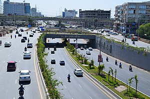
Kalma Underpass (Urdu: کلمہ زیرگذر) is an underpass where east-west Main Boulevard Garden Town and Main Boulevard Gulberg join under north-south Ferozepur Road, connecting two southern suburbs of Lahore, Pakistan.
Quaid e Azam International Cycling Velodrome
Distance: Approx. 1631 meters
Latitude and longitude: 31.511966,74.330002
The Quaid e Azam International Cycling Velodrome is a velodrome in Lahore, Pakistan; it is the only velodrome in Pakistan and was constructed in 1954, though plans exist to build a velodrome in Peshawar. However, its condition had deteriorated to the point that by 2011, Pakistan's Senate Standing Committee on Sports had become concerned about its continuing suitability.
United Christian Hospital, Lahore
Hospital in Lahore, Pakistan
Distance: Approx. 2201 meters
Latitude and longitude: 31.509009,74.340419
United Christian Hospital (UCH) (Urdu: یونائیٹڈ کرسچن ہسپتال) is a 250-bed non-profit hospital located in Lahore, Pakistan. It is affiliated with the Church of Pakistan.
Weather in this IP's area
smoke
24 Celsius
24 Celsius
24 Celsius
24 Celsius
1014 hPa
69 %
1014 hPa
989 hPa
1000 meters
06:24:34
17:08:26