103.79.223.235 - IP Lookup: Free IP Address Lookup, Postal Code Lookup, IP Location Lookup, IP ASN, Public IP
Country:
 India
IndiaRegion:
City:
Location:
Time Zone:
Postal Code:
ISP:
ASN:
language:
User-Agent:
Proxy IP:
Blacklist:
IP information under different IP Channel
ip-api
Country
Region
City
ASN
Time Zone
ISP
Blacklist
Proxy
Latitude
Longitude
Postal
Route
db-ip
Country
Region
City
ASN
Time Zone
ISP
Blacklist
Proxy
Latitude
Longitude
Postal
Route
IPinfo
Country
Region
City
ASN
Time Zone
ISP
Blacklist
Proxy
Latitude
Longitude
Postal
Route
IP2Location
103.79.223.235Country
inRegion
kerala
City
attingal
Time Zone
Asia/Kolkata
ISP
Language
User-Agent
Latitude
Longitude
Postal
ipdata
Country
Region
City
ASN
Time Zone
ISP
Blacklist
Proxy
Latitude
Longitude
Postal
Route
Popular places and events near this IP address

Attingal
Town in Kerala, India
Distance: Approx. 517 meters
Latitude and longitude: 8.68,76.83
Attingal is a municipal town in Thiruvananthapuram metropolitan area in Thiruvananthapuram district of Kerala state, India. It was the location of the Attingal kingdom, under Travancore. It is the headquarters of Chirayinkeezhu Taluk, and the important government institutions of the taluk such as the Taluk office, court complex, office of the deputy superintendent of Police, civil station, and treasuries are situated in Attingal.

Trivandrum International School
International school in Korani, Thiruvananthapuram, Kerala, India
Distance: Approx. 2974 meters
Latitude and longitude: 8.6571,76.8386
Trivandrum International School is a co-educational international school situated in Thiruvananthapuram, Kerala, India. It is situated 6 km from Attingal Town, 20 km from Varkala Town, 23 km from Thiruvananthapuram City and 40 km from Kollam City. The school offers the International Baccalaureate, International General Certificate of Secondary Education and is accredited by the Cambridge International Examinations and the Council for the Indian School Certificate Examinations.
Azhoor
Panchayat in Kerala, India
Distance: Approx. 3978 meters
Latitude and longitude: 8.648,76.8277
Azhoor is a town and suburb of Thiruvananthapuram metropolitan area of Thiruvananthapuram district in the state of Kerala, India.
Edakkode
Village in Kerala, India
Distance: Approx. 2428 meters
Latitude and longitude: 8.6654,76.8459
Edakkode is a village in Thiruvananthapuram district in the state of Kerala, India.
Mudakkal
Village in Kerala, India
Distance: Approx. 3444 meters
Latitude and longitude: 8.7011,76.8589
Elamba-Mudakkal is a village in Thiruvananthapuram district in the state of Kerala, India.
Koonthalloor
Village in Kerala, India
Distance: Approx. 4481 meters
Latitude and longitude: 8.6714,76.7944
Kizhuvalam-Koonthalloor is a village in Thiruvananthapuram district in the state of Kerala, India.

Avanavancherry
Village in Kerala, India
Distance: Approx. 687 meters
Latitude and longitude: 8.6884035,76.8368179
Avanavancherry is a village in Thiruvananthapuram district in the state of Kerala, India. Avanavanchery is located near Attingal in Thiruvananthapuram District of Kerala. This residential area is situated between Moonnu mukku and Valakkad on Attingal – Venjaramoodu Road.

Chirayinkeezhu
Taluk in Kerala, India
Distance: Approx. 2366 meters
Latitude and longitude: 8.7,76.82
Chirayinkeezhu is a town in Thiruvananthapuram district in the Indian state of Kerala. It was also hometown of famous Malayalam Film actor Prem Nazir. It is the seat of Chirayinkeezhu taluk.
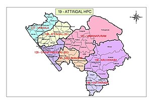
Attingal Lok Sabha constituency
Lok Sabha Constituency in Kerala
Distance: Approx. 517 meters
Latitude and longitude: 8.68,76.83
Attingal Lok Sabha constituency (Malayalam: ആറ്റിങ്ങല് ലോക്സഭാ നിയോജകമണ്ഡലം) is one of the 20 Lok Sabha constituencies in Kerala state in southern India. This constituency came into existence in 2008 following the delimitation of the parliamentary constituencies based on the recommendation of the Delimitation Commission of India constituted in 2002.
Avanavanchery Sri Indilayappan Temple
Hindu temple in Kerala, India
Distance: Approx. 1119 meters
Latitude and longitude: 8.69330556,76.83430556
Avanavanchery Sri Indilayappan Temple (Malayalam: അവനവഞ്ചേരി ശ്രീ ഇണ്ടിളയപ്പൻ ക്ഷേത്രം) is a popular Hindu temple in Attingal of Thiruvananthapuram district, Kerala. The temple is dedicated to Lord Indilayappan and is one of the oldest temples in the state of Kerala. Lord Indilayappan is worshipped by devotees for getting good health, courage and better life prospects.
Chirayinkeezhu taluk
Taluk in Kerala, India
Distance: Approx. 2366 meters
Latitude and longitude: 8.7,76.82
Chirayinkeezhu Taluk is a Taluk (tehsil) in Thiruvananthapuram district in the Indian state of Kerala. It is shares border with Varkala Taluk in North and with Thiruvananthapuram Taluk in South. It comprises 12 panchayats and Attingal Municipality.

Attingal Assembly constituency
Constituency of the Kerala legislative assembly in India
Distance: Approx. 2670 meters
Latitude and longitude: 8.69,76.81
Attingal State assembly constituency is one of the 140 state legislative assembly constituencies at the state Kerala in southern India. It is also one of the 7 state legislative assembly constituencies included in the Attingal Lok Sabha constituency. As of the 2021 assembly elections, the current MLA is O S Ambika of CPI(M).
Weather in this IP's area
overcast clouds
26 Celsius
26 Celsius
26 Celsius
26 Celsius
1012 hPa
76 %
1012 hPa
1009 hPa
10000 meters
1.76 m/s
1.83 m/s
39 degree
100 %