Country:
 Hong Kong (China)
Region:
City:
Latitude and Longitude:
Time Zone:
Postal Code:
IP information under different IP Channel
ip-api
Country
Region
City
ASN
Time Zone
ISP
Blacklist
Proxy
Latitude
Longitude
Postal
Route
IPinfo
Country
Region
City
ASN
Time Zone
ISP
Blacklist
Proxy
Latitude
Longitude
Postal
Route
MaxMind
Country
Region
City
ASN
Time Zone
ISP
Blacklist
Proxy
Latitude
Longitude
Postal
Route
Luminati
Country
 CA
CAASN
Time Zone
America/Toronto
ISP
ADCDATA.COM
Latitude
Longitude
Postal
db-ip
Country
Region
City
ASN
Time Zone
ISP
Blacklist
Proxy
Latitude
Longitude
Postal
Route
ipdata
Country
Region
City
ASN
Time Zone
ISP
Blacklist
Proxy
Latitude
Longitude
Postal
Route
Popular places and events near this IP address
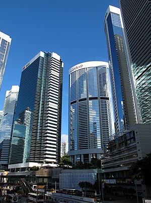
Pacific Place (Hong Kong)
Building complex in Admiralty, Hong Kong
Distance: Approx. 245 meters
Latitude and longitude: 22.27726944,114.16493056
Pacific Place is a complex of office towers and hotels and a shopping centre situated at 88 Queensway, Admiralty, Hong Kong. The latest phase, Three Pacific Place, is located at 1 Queen's Road East, Wan Chai. The four-level shopping centre is home to over 160 shops and boutiques and one major department store.
Wellington Barracks, Hong Kong
Military barracks in Admiralty, Hong Kong
Distance: Approx. 301 meters
Latitude and longitude: 22.278,114.166
Wellington Barracks (Chinese: 威靈頓兵房) was a military barracks located to the east of Garden Road in Admiralty, Hong Kong. One of many military complexes constructed by the British Army in the area, the land was returned to the Hong Kong government in the 1970s and gradually reverted to civilian use. As a result, the barracks was closed at the end of that decade, demolished in the mid-1980s and replaced with Harcourt Garden.

Harcourt Garden
Park in Admiralty, Hong Kong
Distance: Approx. 393 meters
Latitude and longitude: 22.27878,114.16663
Harcourt Garden (Chinese: 夏慤花園; Jyutping: haa6 kok3 faa1 jyun4) is a small urban park in Admiralty, Hong Kong, constructed in the mid-1990s. To the east of the park is the Hong Kong Police Headquarters while to the west is Admiralty bus station. Like the adjacent Harcourt Road, the park is named for Admiral Cecil Harcourt, de facto governor of Hong Kong from September 1945 to June 1946.
St. Francis' Canossian College
Distance: Approx. 324 meters
Latitude and longitude: 22.2748,114.1691
St. Francis' Canossian College (abbr: SFCC; Chinese: 嘉諾撒聖方濟各書院; Jyutping: gaa1 nok6 saat3 sing3 fong1 zai3 gok3 syu1 jyun2; demonym: Franciscan) was founded on 7 May 1869 as the second school established by the Italian Canossian Daughters of Charity in Hong Kong. The wall painting of four Guardian Angels playing instruments is the school's mascot.
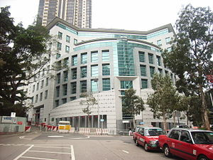
Consulate General of the United Kingdom, Hong Kong
British Consulate General serving Hong Kong
Distance: Approx. 149 meters
Latitude and longitude: 22.27618056,114.16491667
The British Consulate General Hong Kong (BCGHK), located at 1 Supreme Court Road, Admiralty, Hong Kong Island, is one of the largest British consulates general in the world and is bigger than many British embassies and high commissions. It is responsible for maintaining British ties with Hong Kong and Macau. Together with the Consulate General of the United States of America, Hong Kong and Macau; the Consulate General of Malaysia; and the Consulate General of the Republic of Indonesia, the British consulate general is among the few consulates general in Hong Kong to be housed in its own building.
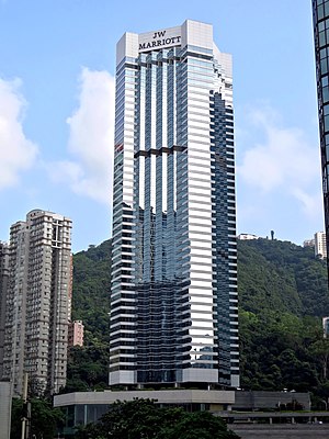
JW Marriott Hotel Hong Kong
Hotel in Hong Kong, China
Distance: Approx. 284 meters
Latitude and longitude: 22.27781,114.16549
The JW Marriott Hotel Hong Kong is a hotel of JW Marriott Hotels. It is located in the Admiralty area of Hong Kong, on the border of Wan Chai and Central, on Hong Kong Island. The hotel opened on 27 February 1989 in the Pacific Place complex.

Royal Naval Hospital (Hong Kong)
Former hospital in Hong Kong Island, Hong Kong
Distance: Approx. 345 meters
Latitude and longitude: 22.2784,114.1661
Royal Naval Hospital (Hong Kong) was the Royal Navy's medical facility in the colony. The RNH began in 1841 in a matshed on the site of the Wellington Barracks on Hong Kong Island. In early 1841, Hong Kong was occupied for the first time by British.

Starstreet Precinct
Distance: Approx. 263 meters
Latitude and longitude: 22.276632,114.168109
The Starstreet Precinct (Chinese: 星街社區) is a neighborhood in Wan Chai, Hong Kong, centred on Three Pacific Place and comprising mainly Star Street (星街), Moon Street (月街), Sun Street (日街), St. Francis Street (聖佛蘭士街), St. Francis Yard (進教圍), and Wing Fung Street (永豐街).

Queensway Government Offices
Building in Admiralty, Hong Kong
Distance: Approx. 351 meters
Latitude and longitude: 22.27777778,114.16388889
The Queensway Government Office Building, in short form QGO, is a skyscraper located in the Admiralty district of Hong Kong near Admiralty station. The tower rises 56 floors and 199 metres (653 ft) in height. The building was completed in 1985.

Admiralty (East) Public Transport Interchange
Distance: Approx. 371 meters
Latitude and longitude: 22.27861111,114.16555556
The Admiralty (East) Public Transport Interchange (Chinese: 金鐘(東)公共運輸交匯處) is a major bus terminus located in Admiralty, Central and Western District, Hong Kong. Located above Admiralty Station of the MTR, the terminus hosts bus routes to most destinations in the Southern District west of Deep Water Bay, so the usage is relatively high. The interchange has different names named by different bus companies.

Nam Koo Terrace
House in Wan Chai, Hong Kong
Distance: Approx. 394 meters
Latitude and longitude: 22.2749,114.1698
Nam Koo Terrace is a Grade I Historic Building located at No. 55 Ship Street, Wan Chai, Hong Kong, popularly known as "The Wan Chai Haunted House". The building is currently owned by Hopewell Holdings, a large property development company based in Hong Kong.
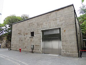
Asia Society Hong Kong Centre
Distance: Approx. 94 meters
Latitude and longitude: 22.27586,114.16532
The Asia Society Hong Kong Centre is one of the global centers of the New York City based Asia Society. Located in Admiralty, in the business district of Hong Kong, it was dedicated on February 9, 2012. The centre is situated on the site of a former British military explosives magazine and includes several restored military buildings The project was designed by architects Tod Williams and Billie Tsien.
Weather in this IP's area
overcast clouds
31 Celsius
37 Celsius
30 Celsius
31 Celsius
1005 hPa
72 %
1005 hPa
994 hPa
10000 meters
4.92 m/s
80 degree
100 %
06:11:15
18:23:09