103.78.14.230 - IP Lookup: Free IP Address Lookup, Postal Code Lookup, IP Location Lookup, IP ASN, Public IP
Country:
Region:
City:
Location:
Time Zone:
Postal Code:
IP information under different IP Channel
ip-api
Country
Region
City
ASN
Time Zone
ISP
Blacklist
Proxy
Latitude
Longitude
Postal
Route
Luminati
Country
Region
up
City
prayagraj
ASN
Time Zone
Asia/Kolkata
ISP
Green Tech Net Com Pvt Ltd
Latitude
Longitude
Postal
IPinfo
Country
Region
City
ASN
Time Zone
ISP
Blacklist
Proxy
Latitude
Longitude
Postal
Route
IP2Location
103.78.14.230Country
Region
uttar pradesh
City
allahabad
Time Zone
Asia/Kolkata
ISP
Language
User-Agent
Latitude
Longitude
Postal
db-ip
Country
Region
City
ASN
Time Zone
ISP
Blacklist
Proxy
Latitude
Longitude
Postal
Route
ipdata
Country
Region
City
ASN
Time Zone
ISP
Blacklist
Proxy
Latitude
Longitude
Postal
Route
Popular places and events near this IP address

United Provinces of Agra and Oudh
Province in British India
Distance: Approx. 11 meters
Latitude and longitude: 25.45,81.85
The United Provinces of Agra and Oudh was a province of India under the British Raj, which existed from 22 March 1902 to 1937; the official name was shortened by the Government of India Act 1935 to United Provinces (UP), by which the province had been commonly known, and by which name it was also a province of independent India until 1950. It corresponded approximately to the present-day Indian states of Uttar Pradesh (UP) and Uttarakhand. Allahabad served as the administrative headquarters and the capital of the province.

Prayagraj division
Administrative division of Uttar Pradesh, India
Distance: Approx. 11 meters
Latitude and longitude: 25.45,81.85
Prayagraj division, formerly known as Allahabad division, is one of the 18 administrative geographical units (i.e. division) of the northern Indian state of Uttar Pradesh, with the city of Prayagraj being the administrative divisional headquarters. In 2000, when Uttar Pradesh was reorganised by forming Uttaranchal out of its northern areas, Allahabad division and the district was majorly reorganised too.

Prayagraj district
District of Uttar Pradesh in India
Distance: Approx. 11 meters
Latitude and longitude: 25.45,81.85
Prayagraj district, formerly known as Allahabad district, is the most populous district in the Indian state of Uttar Pradesh. Prayagraj city is the district headquarters of this district. The District is divided into blocks within tehsils.

North-Western Provinces
Administrative region of British India (1836–1902)
Distance: Approx. 11 meters
Latitude and longitude: 25.45,81.85
The North-Western Provinces was an administrative region in British India. The North-Western Provinces were established in 1836, through merging the administrative divisions of the Ceded and Conquered Provinces. In 1858, the Nawab-ruled kingdom of Oudh was annexed and merged with the North-Western Provinces to form the renamed North-Western Provinces and Oudh.

Motilal Nehru Medical College
Medical school in Prayagraj, Uttar Pradesh, India
Distance: Approx. 188 meters
Latitude and longitude: 25.45030556,81.85186111
Moti Lal Nehru Medical College (MLNMC) is a government medical college and hospital in Prayagraj, Uttar Pradesh, India. It was founded in memory of Motilal Nehru, who was the father of Jawaharlal Nehru. It is affiliated to Atal Bihari Vajpayee Medical University.
St Joseph's College, Prayagraj
Private school in Prayagraj, Uttar Pradesh, India
Distance: Approx. 806 meters
Latitude and longitude: 25.4559,81.8452
St. Joseph's College, abbreviated to SJC, established in 1884, is a prominent CISCE-affiliated elite school in Prayagraj, Uttar Pradesh, India, with high rankings both in the state and in India. It is affiliated with the Council for the Indian School Certificate Examinations.
Georgetown, Prayagraj
Neighbourhood of Prayagraj
Distance: Approx. 11 meters
Latitude and longitude: 25.45,81.85
George Town is an upper-class neighbourhood locality in Prayagraj, India. Built in 1901, it is a residential area in the central part of the city mainly occupied by the white collar workers. It also houses a large number of hospitals and clinics.

Chandra Shekhar Azad Park
Park in Prayagraj, Uttar Pradesh, India
Distance: Approx. 465 meters
Latitude and longitude: 25.45388889,81.84805556
Chandra Shekhar Azad Park (also known by its former name Alfred Park, and Company Bagh during the Company Raj) is a public park in Prayagraj, Uttar Pradesh, India. Built in 1870 to mark Prince Alfred's visit to the city, with an area of 133 acres, it is the biggest park in Prayagraj. It was renamed by the Uttar Pradesh Government after revolutionary Chandra Shekhar Azad, who sacrificed his life here during the Indian independence movement in 1931.
Manda (zamindari)
Zamindari estate in British India
Distance: Approx. 11 meters
Latitude and longitude: 25.45,81.85
Manda was a zamindari, with lands located near Allahabad (now known as Prayagraj), Uttar Pradesh, in northern India.

Allahabad Museum
National Museum in Prayagraj, India
Distance: Approx. 675 meters
Latitude and longitude: 25.4551,81.8462
The Allahabad Museum is a national-level museum in Prayagraj, Uttar Pradesh. Established in 1931, it is known for its rich collection and unique objects of art, and is funded by Ministry of Culture. Moreover, it is a premier research centre for archaeologists, historians and academicians and carries out extensive research activities and publications in archaeology, art and literature.

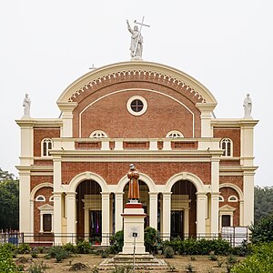
St. Joseph's Cathedral, Prayagraj
Church in Uttar Pradesh , India
Distance: Approx. 998 meters
Latitude and longitude: 25.4575,81.8444
St. Joseph's Cathedral is the cathedral of the Roman Catholic Diocese of Prayagraj, in Prayagraj (formerly Allahabad), in the state of Uttar Pradesh in North India. Built in 1879, the cathedral represents a fine example of Italian architecture.
State Unani Medical College Allahabad
Distance: Approx. 188 meters
Latitude and longitude: 25.45030556,81.85186111
State Unani Medical College (SUMC) is a government medical college in Prayagraj, Uttar Pradesh, India. In the institution, all students selected through NEET (UG) get admission into BUMS course, and intake capacity of the students is 60 students per year.
Weather in this IP's area
clear sky
19 Celsius
19 Celsius
19 Celsius
19 Celsius
1020 hPa
55 %
1020 hPa
1009 hPa
10000 meters
3.84 m/s
4.63 m/s
267 degree