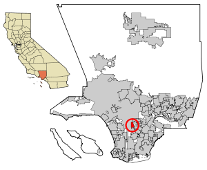
Country:
 USA
USARegion:
City:
Latitude and Longitude:
Time Zone:
Postal Code:
IP information under different IP Channel
ip-api
Country
Region
City
ASN
Time Zone
ISP
Blacklist
Proxy
Latitude
Longitude
Postal
Route
IPinfo
Country
Region
City
ASN
Time Zone
ISP
Blacklist
Proxy
Latitude
Longitude
Postal
Route
MaxMind
Country
Region
City
ASN
Time Zone
ISP
Blacklist
Proxy
Latitude
Longitude
Postal
Route
Luminati
Country
USRegion
ca
City
losangeles
ASN
Time Zone
America/Los_Angeles
ISP
LeaseWeb Netherlands B.V.
Latitude
Longitude
Postal
db-ip
Country
Region
City
ASN
Time Zone
ISP
Blacklist
Proxy
Latitude
Longitude
Postal
Route
ipdata
Country
Region
City
ASN
Time Zone
ISP
Blacklist
Proxy
Latitude
Longitude
Postal
Route
Popular places and events near this IP address

Florence-Graham, California
Census-designated place in Huntington Park, California
Distance: Approx. 334 meters
Latitude and longitude: 33.96944444,-118.24388889
Florence-Graham (Also known as Florence-Firestone) is a census-designated place in Los Angeles County, California. The population was 61,983 at the 2020 census, down from 63,387 at the 2010 census. The census area includes separate communities of Florence, Firestone Park, and Graham.

Walnut Park, California
Census-designated place in Huntington Park, California
Distance: Approx. 1708 meters
Latitude and longitude: 33.96888889,-118.22388889
Walnut Park is a census-designated place (CDP) in Los Angeles County, California, United States, adjacent to Florence-Graham, Huntington Park and South Gate. The population was 15,966 at the 2010 census, down from 16,180 at the 2000 census.

Firestone station
Los Angeles Metro Rail station
Distance: Approx. 1352 meters
Latitude and longitude: 33.9599,-118.2432
Firestone station is an elevated light rail station on the A Line of the Los Angeles Metro Rail system. The station is located between Graham Avenue and the Union Pacific freight railroad's Wilmington Subdivision (the historic route of the Pacific Electric Railway), and elevated over the intersection of Firestone Boulevard, after which the station is named, in the unincorporated Los Angeles County community of Firestone Park.

Florence station (Los Angeles Metro)
Los Angeles Metro Rail station
Distance: Approx. 325 meters
Latitude and longitude: 33.9748,-118.243
Florence station is an at-grade light rail station on the A Line of the Los Angeles Metro Rail system. The station is located alongside the Union Pacific freight railroad's Wilmington Subdivision (the historic route of the Pacific Electric Railway), at its intersection with Florence Avenue, after which the station is named, in the unincorporated Los Angeles County neighborhood of Florence.

Slauson station (A Line)
Light rail station in Los Angeles, California
Distance: Approx. 1796 meters
Latitude and longitude: 33.9881,-118.2433
Slauson station is an elevated light rail station on the A Line of the Los Angeles Metro Rail system. The station is located within the historic right-of-way of the Pacific Electric Railway and elevated over the intersection of Slauson Avenue, after which the station is named, in the unincorporated Los Angeles County community of Florence. The station is on a long viaduct that carries the A Line over the Union Pacific freight railroad's Wilmington Subdivision and its junction with the La Habra Subdivision.
Florence, California
Unincorporated community in California, United States
Distance: Approx. 622 meters
Latitude and longitude: 33.97444444,-118.24805556
Florence is an unincorporated community in California. It is often considered part of South Los Angeles. It is serviced by area code 323 and has a ZIP Code of 90001.

Long Beach Boulevard (California)
Street in Los Angeles
Distance: Approx. 1698 meters
Latitude and longitude: 33.9658,-118.2252
Long Beach Boulevard is a north–south thoroughfare in Los Angeles County.
Mary Bethune Park
Distance: Approx. 1678 meters
Latitude and longitude: 33.984,-118.253
Mary Bethune Park is a public park located in South Los Angeles, California. The park is located at 1244 East 61st Street, near the intersection of Central and Gage Avenues. It is managed by the County of Los Angeles Department of Parks and Recreation.

Florence, Los Angeles
Neighborhood of Los Angeles in California, United States
Distance: Approx. 625 meters
Latitude and longitude: 33.9746,-118.248
Florence is a neighborhood in Los Angeles, California. The neighborhood, part of the South Los Angeles region, is home to over 46,000 residents.
Diego Rivera Learning Complex
High school in California, US
Distance: Approx. 1751 meters
Latitude and longitude: 33.9833,-118.2552
The Diego Rivera Learning Complex (DRLC) is a high school in Florence-Graham, California, with a Los Angeles postal address. It is a part of the Los Angeles Unified School District. It was formerly known as South Region High School No.
Linda Esperanza Marquez High School
Public choice, magnet school in Huntington Park, California, United States
Distance: Approx. 1362 meters
Latitude and longitude: 33.98222222,-118.23388889
Linda Esperanza Marquez High School (or simply Marquez High School) is a public choice high school in Huntington Park, California that is part of the Los Angeles Unified School District. Marquez High School opened in 2013 as part of LA Unified's $19.5 billion New School Construction and Modernization Program. The school is a Choice site that offers the LIBRA Academy, The Huntington Park Institute of Applied Medicine, and the School of Social Justice.
Alliance Margaret M. Bloomfield High School
Charter school in Huntington Park, California
Distance: Approx. 1217 meters
Latitude and longitude: 33.9668,-118.2304
Alliance Margaret M. Bloomfield High School, located in Huntington Park, California, is a charter school that is part of the Alliance College-Ready Public Schools network in Los Angeles. It operates as a free public charter school authorized by the Los Angeles Unified School District. The school has an enrollment of approximately 574 students, with a student-teacher ratio of 23 to 1.
Weather in this IP's area
smoke
21 Celsius
20 Celsius
19 Celsius
23 Celsius
1017 hPa
43 %
1017 hPa
1012 hPa
10000 meters
4.12 m/s
250 degree
07:02:23
18:12:35