Country:
Region:
City:
Latitude and Longitude:
Time Zone:
Postal Code:
IP information under different IP Channel
ip-api
Country
Region
City
ASN
Time Zone
ISP
Blacklist
Proxy
Latitude
Longitude
Postal
Route
Luminati
Country
Region
sa
City
adelaide
ASN
Time Zone
Australia/Adelaide
ISP
Falcore Investments Pty Ltd
Latitude
Longitude
Postal
IPinfo
Country
Region
City
ASN
Time Zone
ISP
Blacklist
Proxy
Latitude
Longitude
Postal
Route
db-ip
Country
Region
City
ASN
Time Zone
ISP
Blacklist
Proxy
Latitude
Longitude
Postal
Route
ipdata
Country
Region
City
ASN
Time Zone
ISP
Blacklist
Proxy
Latitude
Longitude
Postal
Route
Popular places and events near this IP address
Adelaide College of Divinity
Theological college in South Australia
Distance: Approx. 1581 meters
Latitude and longitude: -34.931001,138.548599
Adelaide College of Divinity (ACD) was an accredited higher education provider offering diploma, associate and bachelor's degrees, graduate diplomas, master and doctoral degrees in ministry, it also was a Registered Training Organisation offering certificates and a diploma. The ACD offered qualifications in its own right in the vocational and higher education sectors and, except for the period 2011–2013, its teaching staff have formed the Department of Theology at Flinders University in the Faculties of Education, Humanities and Law. The ACD brought together the Adelaide Theological Library, from the collections of the three colleges which had merged for form ACD. The library has grown since the merger and in 2006 held over 60,000 volumes, including many dating back before 1850 and some to the 17th century.

Uniting College for Leadership and Theology
Distance: Approx. 1537 meters
Latitude and longitude: -34.930629,138.548391
The Uniting College for Leadership and Theology located at Brooklyn Park South Australia is a Uniting Church in Australia (UCA) theological college for the education and training of both lay people and those for specified ministries including the diaconate and youth workers. It is a member college of the University of Divinity. From 1930, staff of the Congregational Union of Australia's Parkin College and the Methodist Church of Australasia's Wesley Theological College lectured students of both institutions.
Flinders Park, South Australia
Suburb of Adelaide, South Australia
Distance: Approx. 1033 meters
Latitude and longitude: -34.908,138.546
Flinders Park is a western suburb of Adelaide, South Australia. It is located in the City of Charles Sturt.
Thebarton Senior College
Public, senior secondary school. school in Torrensville, Adelaide, South Australia, Australia
Distance: Approx. 1669 meters
Latitude and longitude: -34.917214,138.562773
Thebarton Senior College is a public senior secondary school located in Torrensville in Adelaide, South Australia. The school was established on the site in 1924 as Thebarton Boys Technical High School, with adult re-entry students accepted in 1988 and then formally becoming an adult re-entry college in 1990. From 2012, it is providing senior students with the opportunity of completing their South Australian Certificate of Education, either alone or in conjunction with a nationally accredited vocational certificate.

Lockleys, South Australia
Suburb of Adelaide, South Australia
Distance: Approx. 1507 meters
Latitude and longitude: -34.925,138.531
Lockleys is an inner western suburb of Adelaide, in the City of West Torrens. Australian Bureau of Statistics data from May 2021 revealed that Adelaide's western suburbs had the lowest unemployment rate in South Australia.
Brooklyn Park, South Australia
Suburb of Adelaide, South Australia
Distance: Approx. 1314 meters
Latitude and longitude: -34.929,138.544
Brooklyn Park is a western suburb of the South Australian capital of Adelaide. It is located immediately north-east of Adelaide Airport and the Australian Federal Police (AFP) base on Sir Donald Bradman Drive (the Boulevard of Honour ) . It is bound on the north by Henley Beach Road, on the east by Marion Road, and on the west by the Kooyonga Golf Club on May Terrace.

Mile End, South Australia
Suburb of Adelaide, South Australia
Distance: Approx. 1742 meters
Latitude and longitude: -34.92527778,138.56083333
Mile End is an inner western suburb of Adelaide, located in the City of West Torrens, around 2 kilometres from the Adelaide city centre. It has a census area population of 4,413 people (2011). Much of the suburb is residential, but there are small commercial areas along Henley Beach Road and South Road.
Kidman Park, South Australia
Suburb of Adelaide, South Australia
Distance: Approx. 1547 meters
Latitude and longitude: -34.914,138.528
Kidman Park is a western suburb of Adelaide, South Australia. It lies within the City of Charles Sturt council area.
Findon, South Australia
Suburb of Adelaide, South Australia
Distance: Approx. 1629 meters
Latitude and longitude: -34.906,138.533
Findon is a western suburb of Adelaide, South Australia. It is located in the City of Charles Sturt.

Underdale, South Australia
Suburb of Adelaide, South Australia
Distance: Approx. 506 meters
Latitude and longitude: -34.91666667,138.55
Underdale is a western suburb of South Australia's capital city Adelaide on Kaurna land. It sits between Henley Beach Road and the River Torrens. It is largely residential with a very small industrial section on the eastern side of Holbrook's Road near the river.
Underdale High School
Public secondary school in Adelaide, South Australia, Australia
Distance: Approx. 506 meters
Latitude and longitude: -34.91666667,138.55
Underdale High School is a medium-sized government secondary school, located in Underdale in the western suburbs of Adelaide.

Kooyonga Golf Club
Distance: Approx. 1595 meters
Latitude and longitude: -34.928,138.533
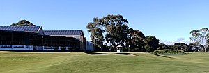
Kooyonga Golf Club is a private golf club in Australia, located in South Australia at Lockleys, a suburb west of Adelaide. Members entry is off May Terrace, Brooklyn Park. Work on the course started in 1922 and the first nine holes opened on 19 May 1923.
Weather in this IP's area
broken clouds
17 Celsius
16 Celsius
16 Celsius
18 Celsius
1024 hPa
56 %
1024 hPa
1022 hPa
10000 meters
5.14 m/s
210 degree
75 %
06:00:19
20:01:56
