Country:
 India
IndiaRegion:
City:
Latitude and Longitude:
Time Zone:
Postal Code:
IP information under different IP Channel
ip-api
Country
Region
City
ASN
Time Zone
ISP
Blacklist
Proxy
Latitude
Longitude
Postal
Route
IPinfo
Country
Region
City
ASN
Time Zone
ISP
Blacklist
Proxy
Latitude
Longitude
Postal
Route
MaxMind
Country
Region
City
ASN
Time Zone
ISP
Blacklist
Proxy
Latitude
Longitude
Postal
Route
Luminati
Country
INRegion
up
City
ghaziabad
ASN
Time Zone
Asia/Kolkata
ISP
Global Ra Net Services Pvt. Ltd.
Latitude
Longitude
Postal
db-ip
Country
Region
City
ASN
Time Zone
ISP
Blacklist
Proxy
Latitude
Longitude
Postal
Route
ipdata
Country
Region
City
ASN
Time Zone
ISP
Blacklist
Proxy
Latitude
Longitude
Postal
Route
Popular places and events near this IP address

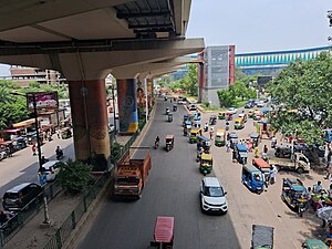
Ghaziabad
Metropolis City in Uttar Pradesh, India
Distance: Approx. 2762 meters
Latitude and longitude: 28.67,77.42
Ghaziabad (Hindustani: [ɣaːziːaːbaːd̪]) is a city in the Indian state of Uttar Pradesh and a part of Delhi NCR. It is the administrative headquarters of Ghaziabad district and is the largest city in Western Uttar Pradesh, with a population of 1,729,000. Ghaziabad Municipal Corporation is divided into 5 zones - City Zone, Kavi Nagar Zone, Vijay Nagar Zone, Mohan Nagar Zone and Vasundhara Zone. The Municipal Corporation comprises 100 wards.

Institute of Management Technology, Ghaziabad
Business Schools in India
Distance: Approx. 1041 meters
Latitude and longitude: 28.6743,77.4488
Institute of Management Technology, Ghaziabad abbreviated as IMT G, is a private business school with its main campus at Ghaziabad in the Indian state of Uttar Pradesh. It offers postgraduate diploma and executive education programmes in management. It also offers distance learning and collaborative programmes.
Ghaziabad district
District of Uttar Pradesh in India
Distance: Approx. 1419 meters
Latitude and longitude: 28.6667,77.4333
Ghaziabad district (pronounced [ɣaːziːaːˈbaːd̪ ˈzɪla]) is a largely suburban district of Uttar Pradesh state in northern India. It is also a core part of the National Capital Region. The city of Ghaziabad is the administrative headquarters of the district.

Ghaziabad Lok Sabha constituency
Constituency of the Indian parliament in Uttar Pradesh
Distance: Approx. 600 meters
Latitude and longitude: 28.66,77.45
Ghaziabad Lok Sabha constituency is one of the 80 Lok Sabha constituencies in Uttar Pradesh state in northern India. This constituency came into existence in 2008 as a part of the implementation of delimitation of parliamentary constituencies based on the recommendations of the Delimitation Commission of India constituted in 2002.
Academy of Scientific and Innovative Research
Institute based at Ghaziabad, Uttar Pradesh, India
Distance: Approx. 3092 meters
Latitude and longitude: 28.68804167,77.46538611
The Academy of Scientific and Innovative Research (AcSIR) is an Indian institute of national importance, headquartered at the CSIR-Human Resource Development Centre Campus, Ghaziabad, Uttar Pradesh. The institute was established for the purpose of granting doctoral and post-doctoral degrees. The establishment of the academy allowed for a centralised institution to manage this research and was enabled by legislation of the Lok Sabha in 2010.

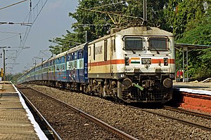
Ghaziabad Junction railway station
Railway Station in Uttar Pradesh, India
Distance: Approx. 2240 meters
Latitude and longitude: 28.6505,77.4318
Ghaziabad Junction railway station (station code: GZB) is on the Kanpur–Delhi section of Howrah–Delhi main line, Howrah–Gaya–Delhi line,New Delhi - Meerut - Saharanpur line and New Delhi–Bareilly–Lucknow line. It is located in Ghaziabad district in the Indian state of Uttar Pradesh. It serves Ghaziabad.
Pilkhuva (Ghaziabad)
Town in Uttar Pradesh, India
Distance: Approx. 2762 meters
Latitude and longitude: 28.67,77.42
Pilkhuva is a town in India in Ghaziabad, Uttar Pradesh, 50 kilometres from Delhi.
Jawaharlal Nehru Stadium (Ghaziabad)
Cricket ground
Distance: Approx. 1024 meters
Latitude and longitude: 28.65923,77.43954
The Jawaharlal Nehru Stadium is a multi-purpose stadium in Ghaziabad, Uttar Pradesh. The ground is mainly used for matches of football, and other sports. The stadium hosted six first-class matches in 1992 when Uttar Pradesh cricket team played against railways cricket team.

Shaheed Sthal metro station
Station in Ghaziabad, Uttar Pradesh, India
Distance: Approx. 3211 meters
Latitude and longitude: 28.67062081,77.41545281
Shaheed Sthal metro station, also known as New Bus Adda metro station, is the terminal metro station of the Red Line in the Delhi Metro. It is located in Ghaziabad, Uttar Pradesh. The metro station serves is closest to NH 58 bus station, which carries passengers from Meerut to New Delhi and is also close to Red Mall Cinepolis.

Sajwan Nagar
Place in Uttar Pradesh, India
Distance: Approx. 2762 meters
Latitude and longitude: 28.67,77.42
Sajwan Nagar is an old village in Ghaziabad known as Village Shahbad Urf Mitthepur is an old village in the Ghaziabad district of Uttar Pradesh, India. While it was established in 1989, Village Shahbad Urf Mitthepur Sajwan Nagar has been average developed. This village under Ward No-48.
Shahpur Bamheta
Distance: Approx. 3861 meters
Latitude and longitude: 28.65,77.48333333
Shahpur Bamheta is a former Estate of Yaduvanshi Ahirs in erstwhile Ghaziabad district, Uttar Pradesh, India. Adjacent to Delhi-Meerut Expressway & N.H. 91(G.T Road). It is located 6.8 km away from Ghaziabad Railway Station towards N.H. 91.
Electric Loco Shed, Ghaziabad
Loco shed in Uttar Pradesh, India
Distance: Approx. 2500 meters
Latitude and longitude: 28.646939,77.432491
Electric Loco Shed, Ghaziabad is a motive power depot performing locomotive maintenance and repair facility for electric locomotives of the Indian Railways, located at Ghaziabad Junction of the Northern Railway zone in Uttar Pradesh, India. It is one of the two electric locomotive sheds of the Northern Railway, the others being at Ludhiana (LDH) .
Weather in this IP's area
clear sky
26 Celsius
26 Celsius
26 Celsius
26 Celsius
1004 hPa
83 %
1004 hPa
979 hPa
10000 meters
1.4 m/s
1.79 m/s
124 degree
06:07:40
18:19:40