Country:
Region:
City:
Latitude and Longitude:
Time Zone:
Postal Code:
IP information under different IP Channel
ip-api
Country
Region
City
ASN
Time Zone
ISP
Blacklist
Proxy
Latitude
Longitude
Postal
Route
Luminati
Country
ASN
Time Zone
Asia/Tokyo
ISP
SoftBank Corp.
Latitude
Longitude
Postal
IPinfo
Country
Region
City
ASN
Time Zone
ISP
Blacklist
Proxy
Latitude
Longitude
Postal
Route
db-ip
Country
Region
City
ASN
Time Zone
ISP
Blacklist
Proxy
Latitude
Longitude
Postal
Route
ipdata
Country
Region
City
ASN
Time Zone
ISP
Blacklist
Proxy
Latitude
Longitude
Postal
Route
Popular places and events near this IP address
Warabi, Saitama
City in Kantō, Japan
Distance: Approx. 1250 meters
Latitude and longitude: 35.82558333,139.67972222
Warabi (蕨市, Warabi-shi) is a city located in Saitama Prefecture, Japan. As of 1 February 2024, the city had an estimated population of 75,614 in 41,025 households and a population density of 15,000 persons per km2. The total area of the city is 5.11 square kilometres (1.97 sq mi).

Warabi Station
Railway station in Warabi, Saitama Prefecture, Japan
Distance: Approx. 235 meters
Latitude and longitude: 35.82805556,139.69055556
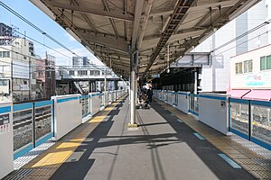
Warabi Station (蕨駅, Warabi-eki) is a passenger railway station located in the city of Warabi, Saitama, Japan, operated by East Japan Railway Company (JR East).

Minami-Urawa Station
Railway station in Saitama, Japan
Distance: Approx. 3014 meters
Latitude and longitude: 35.84777778,139.66916667
Minami-Urawa Station (南浦和駅, Minami-Urawa-eki) is a junction passenger railway station located in Minami-ku, Saitama, Saitama Prefecture, Japan, operated by East Japan Railway Company (JR East).

Warabi-shuku
Distance: Approx. 1311 meters
Latitude and longitude: 35.82506944,139.67921389
Warabi-shuku (蕨宿, Warabi-shuku) was the second of the sixty-nine stations of the Nakasendō highway connecting Edo with Kyoto during the Edo period. It was located in the present-day city of Warabi, Saitama Prefecture, Japan.

Nishi-Kawaguchi Station
Railway station in Kawaguchi, Saitama Prefecture, Japan
Distance: Approx. 1776 meters
Latitude and longitude: 35.81583333,139.70444444
Nishi-Kawaguchi Station (西川口駅, Nishi-Kawaguchi-eki) is a passenger railway station located] in the city of Kawaguchi, Saitama, Japan, operated by the East Japan Railway Company (JR East).
NHK Kawaguchi Transmitter
Distance: Approx. 2474 meters
Latitude and longitude: 35.827813,139.720377
The NHK Kawaguchi Transmitter was a medium-wave broadcasting station at Kawaguchi, Saitama, Japan, which was built in 1937. It used for transmissions on 590 kHz with a power of 150 kW, a T-antenna, which was spun between two 312.78-metre-tall guyed masts, which were 463 m apart and which were both insulated against ground. The masts of NHK Kawaguchi Transmitter were until erection of Tokyo Tower the tallest towers of Japan and belonged at time of completion to the tallest man-made structures of the world.
Kita-Toda Station
Railway station in Toda, Saitama Prefecture, Japan
Distance: Approx. 2954 meters
Latitude and longitude: 35.82745278,139.66030556
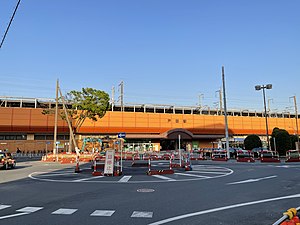
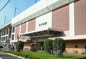
Kita-Toda Station (北戸田駅, Kita-Toda-eki) is a passenger railway station located in the city of Toda, Saitama, Japan, operated by the East Japan Railway Company (JR East).

Toda Station (Saitama)
Railway station in Toda, Saitama Prefecture, Japan
Distance: Approx. 2450 meters
Latitude and longitude: 35.81764167,139.66959722
Toda Station (戸田駅, Toda-eki) is a passenger railway station located in the city of Toda, Saitama, Japan, operated by the East Japan Railway Company (JR East).

Toda-Kōen Station
Railway station in Toda, Saitama Prefecture, Japan
Distance: Approx. 2681 meters
Latitude and longitude: 35.807982,139.678051
Toda-kōen Station (戸田公園駅, Toda-kōen-eki) is a passenger railway station located in the city of Toda, Saitama, Japan, operated by the East Japan Railway Company (JR East).

Minato stable
Stable (organization) of sumo wrestlers
Distance: Approx. 898 meters
Latitude and longitude: 35.8295,139.7029
Minato stable (湊部屋, Minato-beya) is a stable of sumo wrestlers, formerly part of the Tokitsukaze ichimon or group of stables. It was founded in 1982 by former komusubi Yutakayama, who branched off from Tokitsukaze stable. Minato-oyakata studied at the Tokyo University of Agriculture, and due to his interest in academia his stable was the first to introduce a library on its premises.
Saitama Prefectural Warabi High School
School in Japan
Distance: Approx. 1756 meters
Latitude and longitude: 35.83286111,139.67419444
Saitama Prefectural Warabi High School (埼玉県立蕨高等学校, Saitama Kenritsu Warabi Koutou Gakkou), often shortened to Warakou (蕨高) is a public high school, located in Warabi City, Saitama, Japan. The number of applicants increased, and both like 7.57 times as for the magnification of the entrance exam of the previous term of fiscal year 2006 and 2.34 times as for the latter half of the year entrance exam were the best every year in the public high school school infantry in the saitama prefecture.

Toda, Saitama
City in Kantō, Japan
Distance: Approx. 1845 meters
Latitude and longitude: 35.81761111,139.67791667
Toda (戸田市, Toda-shi) is a city located in Saitama Prefecture, Japan. As of 1 February 2021, the city had an estimated population of 140,902 in 66,765 households and a population density of 7700 persons per km2. The total area of the city is 18.19 square kilometres (7.02 sq mi).
Weather in this IP's area
overcast clouds
9 Celsius
9 Celsius
8 Celsius
11 Celsius
1022 hPa
43 %
1022 hPa
1021 hPa
10000 meters
1.34 m/s
3.13 m/s
11 degree
99 %
06:21:25
16:32:06


