Country:
 India
IndiaRegion:
City:
Latitude and Longitude:
Time Zone:
Postal Code:
IP information under different IP Channel
ip-api
Country
Region
City
ASN
Time Zone
ISP
Blacklist
Proxy
Latitude
Longitude
Postal
Route
IPinfo
Country
Region
City
ASN
Time Zone
ISP
Blacklist
Proxy
Latitude
Longitude
Postal
Route
MaxMind
Country
Region
City
ASN
Time Zone
ISP
Blacklist
Proxy
Latitude
Longitude
Postal
Route
Luminati
Country
INASN
Time Zone
Asia/Kolkata
ISP
INDINET SERVICE PRIVATE LIMITED
Latitude
Longitude
Postal
db-ip
Country
Region
City
ASN
Time Zone
ISP
Blacklist
Proxy
Latitude
Longitude
Postal
Route
ipdata
Country
Region
City
ASN
Time Zone
ISP
Blacklist
Proxy
Latitude
Longitude
Postal
Route
Popular places and events near this IP address

Dhanbad
Metropolis in Jharkhand, India
Distance: Approx. 241 meters
Latitude and longitude: 23.7998,86.4305
Dhanbad is the second-most populated city in the Indian state of Jharkhand after Jamshedpur. It ranks as the 39th largest city in India and is the 33rd largest million-plus urban agglomeration in India. Dhanbad shares its land borders with Paschim Bardhaman district and Purulia district of West Bengal and Bokaro, Giridih and Jamtara districts of Jharkhand.

Dhanbad district
District of Jharkhand in India
Distance: Approx. 1193 meters
Latitude and longitude: 23.79,86.43
Dhanbad district is one of the twenty-four districts of Jharkhand state, India, and Dhanbad is the administrative headquarters of this district. As of 2011, it is the second most populous district of Jharkhand (out of 24), after Ranchi. It also has the lowest sex ratio in Jharkhand, at 908.
Manaitand
Distance: Approx. 1778 meters
Latitude and longitude: 23.784655,86.429281
Manaitand is a locality within Dhanbad district, Jharkhand, India. It is a fully residential place surrounded by schools, colleges, markets with other commercial bodies. It is barely 2 kilometers (1.2 mi) from the Dhanbad railway station towards the Purana Bazar side.

Dhanbad Lok Sabha constituency
Constituency of the Indian parliament in Jharkhand
Distance: Approx. 1586 meters
Latitude and longitude: 23.81,86.44
Dhanbad Lok Sabha constituency is one of the 14 Lok Sabha (parliamentary) constituencies in Jharkhand state in eastern India. This constituency covers parts of Bokaro and Dhanbad districts.

Dhanbad Assembly constituency
Constituency of the Jharkhand legislative assembly in India
Distance: Approx. 1286 meters
Latitude and longitude: 23.808,86.438
Dhanbad Assembly constituency is an assembly constituency in the Indian state of Jharkhand.
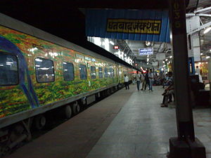
Dhanbad Junction railway station
Railway station in Jharkhand
Distance: Approx. 935 meters
Latitude and longitude: 23.7922,86.4283
Dhanbad Junction railway station, station code DHN, is a railway station of the Indian railway serving the city of Dhanbad, the headquarters of Dhanbad district in the Indian state of Jharkhand. It is the largest railway station in Jharkhand, handling over 100 trains and 100000+ passengers every day. Dhanbad is also the headquarters of the Dhanbad Rail Division of the East Central Railway zone.
Central Institute of Mining and Fuel Research
Distance: Approx. 1836 meters
Latitude and longitude: 23.81708611,86.42766389
CSIR-Central Institute of Mining and Fuel Research CSIR-CIMFR, previously known as Central Mining Research Institute and Central Fuel Research Institute, is based in Dhanbad, Jharkhand, India. It is a constituent laboratory of Council of Scientific & Industrial Research, an autonomous government body and India's largest research and development organisation. The establishment of CSIR-CIMFR was aimed to provide R&D inputs for the entire coal-energy chain from mining to consumption through integration of the core competencies of the two premier coal institutions of the country.
Dhanbad (community development block)
Community development block in Jharkhand, India
Distance: Approx. 1538 meters
Latitude and longitude: 23.80194444,86.44333333
Dhanbad is a community development block that forms an administrative division in Dhanbad Sadar subdivision of Dhanbad district, Jharkhand state, India.
De Nobili School, CMRI
Private primary and secondary school in Dhanbad, Jharkhand, India
Distance: Approx. 927 meters
Latitude and longitude: 23.80861111,86.42583333
De Nobili School, CMRI is a private Catholic primary and secondary school located in Dhanbad, Jharkhand, India. The school draws it name from its association with the former Central Mining Research Institute (CMRI) and has classes one through twelve. The school is run by the Society of Jesus.
Department of Management Studies, IIT (ISM) Dhanbad
Business school of IIT, Dhanbad, India
Distance: Approx. 1741 meters
Latitude and longitude: 23.812,86.44
The Department of Management Studies, IIT (ISM) Dhanbad is the business school of Indian Institute of Technology (Indian School of Mines), Dhanbad which was established in 1977. The Department admits students on the basis of Common Admission Test (CAT).
Guru Nanak College, Dhanbad
Distance: Approx. 1679 meters
Latitude and longitude: 23.7895859,86.4170381
Guru Nanak College, Dhanbad is an educational centre located in Dhanbad, Jharkhand, India, offering undergraduate, vocational, and add-on courses.
Dhanbad Sadar subdivision
Subdivision in Jharkhand, India
Distance: Approx. 241 meters
Latitude and longitude: 23.7998,86.4305
Dhanbad Sadar subdivision is an administrative subdivision of the Dhanbad district in the state of Jharkhand, India.
Weather in this IP's area
overcast clouds
27 Celsius
29 Celsius
27 Celsius
27 Celsius
1006 hPa
73 %
1006 hPa
980 hPa
10000 meters
1.58 m/s
1.78 m/s
258 degree
100 %
05:32:00
17:44:14