Country:
 Australia
Region:
City:
Latitude and Longitude:
Time Zone:
Postal Code:
IP information under different IP Channel
ip-api
Country
Region
City
ASN
Time Zone
ISP
Blacklist
Proxy
Latitude
Longitude
Postal
Route
IPinfo
Country
Region
City
ASN
Time Zone
ISP
Blacklist
Proxy
Latitude
Longitude
Postal
Route
MaxMind
Country
Region
City
ASN
Time Zone
ISP
Blacklist
Proxy
Latitude
Longitude
Postal
Route
Luminati
Country
AUASN
Time Zone
Australia/Sydney
ISP
TPG Telecom Limited
Latitude
Longitude
Postal
db-ip
Country
Region
City
ASN
Time Zone
ISP
Blacklist
Proxy
Latitude
Longitude
Postal
Route
ipdata
Country
Region
City
ASN
Time Zone
ISP
Blacklist
Proxy
Latitude
Longitude
Postal
Route
Popular places and events near this IP address

Glebe, New South Wales
Suburb of Sydney, New South Wales, Australia
Distance: Approx. 441 meters
Latitude and longitude: -33.87978,151.18541
Glebe is an inner-western suburb of Sydney in New South Wales. Glebe is located 3 kilometres (1.9 mi) southwest of the Sydney central business district and is part of the local government area of the City of Sydney, in the Inner West region. Glebe is surrounded by Blackwattle Bay and Rozelle Bay, inlets of Sydney Harbour, in the north.
Forest Lodge, New South Wales
Suburb of Sydney, New South Wales, Australia
Distance: Approx. 162 meters
Latitude and longitude: -33.88396,151.1815
Forest Lodge is a small, inner-city suburb of Sydney, in the state of New South Wales, Australia. Forest Lodge is located 4 kilometres south-west of the Sydney central business district and is part of the local government area of the City of Sydney.

Macleay Museum
Natural history museum in New South Wales, Australia
Distance: Approx. 521 meters
Latitude and longitude: -33.8852,151.1881
The Macleay Museum at The University of Sydney, was a natural history museum located on the University's Camperdown campus, in Sydney, New South Wales, Australia. The museum was dissolved in 2016 and upon opening of the Chau Chak Wing Museum in 2020, its collections were amalgamated into it. The Macleay Museum was added to the City of Sydney local government heritage list on 14 December 2012.

Coroner's Court of New South Wales
Distance: Approx. 543 meters
Latitude and longitude: -33.8811282,151.1883183
The Coroner's Court of New South Wales is the court in the Australian state of New South Wales where legal proceedings, in the form of an inquest or inquiry, are held and presided over by the State Coroner of New South Wales (or NSW State Coroner), a Deputy State Coroner of New South Wales, or another coroner of the state of New South Wales. Coroners must be magistrates in the state and sit in branches of the Local Court of New South Wales. They hold jurisdiction over the remains of a person and have the power to make findings in respect of the cause of death of a person or the cause of any fire in New South Wales.

Sancta Sophia College, University of Sydney
University residential college
Distance: Approx. 501 meters
Latitude and longitude: -33.88726389,151.18068056
Sancta Sophia College (colloquially as Sancta) is a residential college for undergraduate women and postgraduate men and women at the University of Sydney. The college has a Catholic foundation but admits students of all religions. Fiona Hastings has been the Principal of the College since 2018.
University Oval, Sydney
Sports ground in Sydney, Australia
Distance: Approx. 559 meters
Latitude and longitude: -33.88791,151.1851
University Oval is a cricket ground at the University of Sydney, in Sydney, Australia. The first recorded match on the ground was in 1898, when it was the venue for a game between the Australian Universities and A. E. Stoddart's XI. The ground has also hosted a Women's Test match between Australia and New Zealand.
University of Sydney School of Psychology
Distance: Approx. 569 meters
Latitude and longitude: -33.886249,151.187947
The School of Psychology is a constituent department of the Faculty of Science at the University of Sydney, Australia. It is the first established School of Psychology in Australia, and currently one of the largest and most prestigious. It is one of many components of the University of Sydney.
Centre for Research on Computer Supported Learning and Cognition
Distance: Approx. 575 meters
Latitude and longitude: -33.886977,151.187249
The Centre for Research on Computer Supported Learning and Cognition (abbreviated as CRLI) is an education research centre within the Faculty of Arts and Social Sciences of The University of Sydney that carries out research into the sciences and technologies of learning. Established on 1 January 2016, the Centre was formed through the amalgamation of the University's Computer Supported Learning and Cognition Centre (CoCo) and the Sciences and Technologies of Learning (STL) research network. The Centre is located in the Education Building (A35), adjacent to Manning Road, that houses the Sydney School of Education and Social Work on the University's Camperdown campus, New South Wales, Australia.

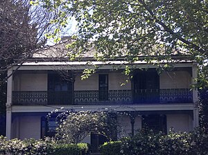
Reussdale
Historic site in New South Wales, Australia
Distance: Approx. 310 meters
Latitude and longitude: -33.8811,151.1852
Reussdale is a heritage-listed former private house and now function centre located at 160 Bridge Road in the inner western Sydney suburb of Glebe in the City of Sydney local government area of New South Wales, Australia. It was designed and built by Ferdinand Reuss from 1868 to 1870. It is also known as the former Presbyterian Manse.

Charles Perkins Centre
University of Sydney, an Australian medical research institute, clinic and education hub
Distance: Approx. 481 meters
Latitude and longitude: -33.8875,151.1835
The Charles Perkins Centre (CPC) is an Australian medical research institute, clinic and education hub that primarily focuses on diabetes, cardiovascular disease and obesity, as well as other related conditions. The centre is affiliated with the University of Sydney and is located within the Royal Prince Alfred Hospital health precinct at the Camperdown campus of the university in Sydney, New South Wales. The centre is named in honour of alumnus Charles Perkins, the first man of Aboriginal descent to graduate from an Australian university.

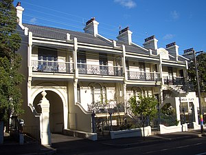
Glebe Town Hall
Government town hall in New South Wales, Australia
Distance: Approx. 201 meters
Latitude and longitude: -33.8825,151.185
The Glebe Town Hall is a landmark civic building in Glebe, a suburb of Sydney, Australia. It stands at 160 St Johns Road and was built in 1880 in the Victorian Italianate style by architect Ambrose Thornley. The Town Hall was the seat of The Glebe Municipal Council from 1880 to 1948 when it became a community centre and hall run by the City of Sydney.
Hereford House
Australian heritage-listed historic site
Distance: Approx. 436 meters
Latitude and longitude: -33.8793,151.1834
Hereford House is a heritage-listed historic site located in Hereford Street in the inner western Sydney suburb of Glebe in the City of Sydney local government area of New South Wales, Australia. It was built from 1870 to 1879. The property was owned by the NSW College of Nursing until it was sold to a private owner in 2001.
Weather in this IP's area
overcast clouds
14 Celsius
13 Celsius
12 Celsius
15 Celsius
1024 hPa
81 %
1024 hPa
1021 hPa
10000 meters
3.12 m/s
4.28 m/s
49 degree
100 %
06:20:09
19:04:08